Blog Article
Winter Whiplash: From Deep Freeze to Valentine's Storms
The historic freeze is ending, but a 'Spring Fake-Out' brings record heat and a messy Valentine's Day storm. Here is the cultural and weather breakdown.
From Frozen Pools to Valentine's Storms: The Great Winter Whiplash
Alright folks, pull up a chair because we need to talk about the absolute mood swing the atmosphere is having right now.
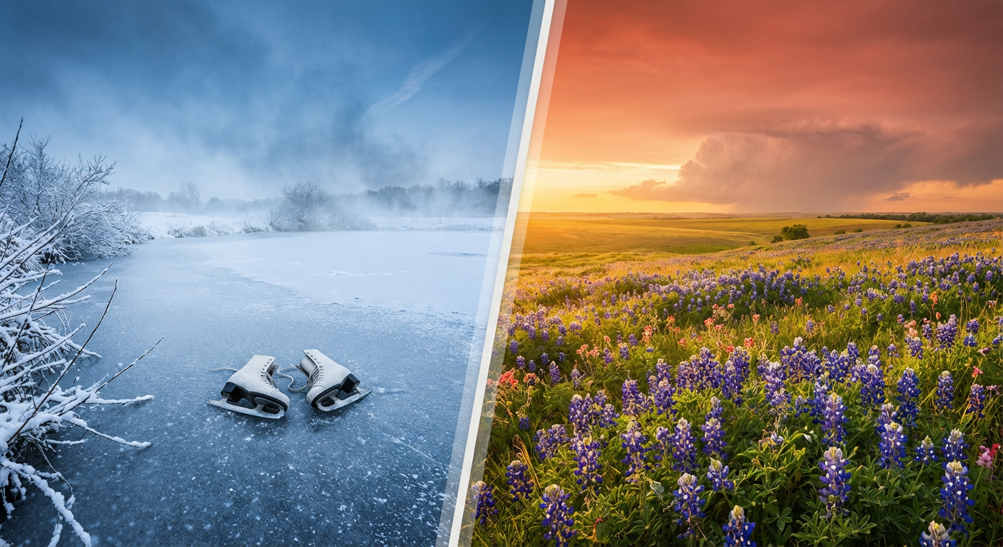
If you have been scrolling through your feed the last few days, you have seen the pictures. I'm talking about the viral shots of people ice skating on the Reflecting Pool in DC or those poor frozen iguanas down in Florida. We just wrapped up one of the most culturally defining cold snaps in recent memory. It was the kind of cold that dominates the group chat. But here is the thing. If you step outside in the Central Plains today or tomorrow, it feels like spring break.
We are in the middle of a massive "atmospheric whiplash" that is confusing nature just as much as it is confusing us. While folks in Utah are looking at dirt patches on ski slopes, the Texas Panhandle is about to hit temperatures near 80 degrees. That is 30 degrees above normal. It is not just a warm-up. It is a total pattern flip.
The "Spring Fake-Out" Explained
Get this. The jet stream has basically taken the Arctic air that froze the East Coast and shoved it back north, replacing it with a blowtorch of warm air from the Southwest.
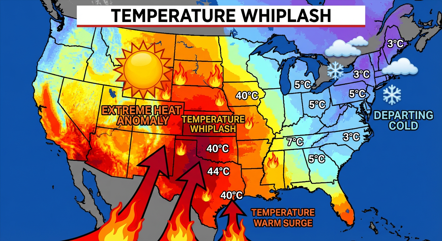
This is why we are seeing such extreme fire danger in places like Amarillo. The air is dry, the wind is howling, and the heat is record-breaking. But don't pack away the winter coats just yet. This warm air is actually fuel for the next big weather player.
Cupid vs. The Low Pressure System
I know a lot of y'all have plans for Saturday. It's Valentine's Day. You have reservations. You have outdoor events like that Winter Tequila Tasting in Chicago or seafood festivals down south.
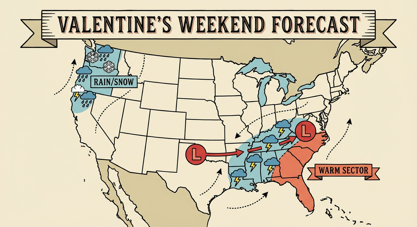
Here is the bad news. That massive warm-up is colliding with a new storm system ejecting out of the West. According to the latest data from the Weather Prediction Center, we are looking at a developing storm that is going to track from the Southern Plains right into the Tennessee Valley and the Southeast over the weekend.
Here is what you need to know for your Saturday plans:
- The South & Southeast: You are looking at a wet Valentine's Day. We have a signal for widespread showers and thunderstorms developing Saturday and moving east. If you have outdoor dinner reservations, move them inside.
- The East Coast: You get the warmth first, but the rain arrives late weekend. Enjoy the thaw while you can.
- The West: You aren't off the hook. A new frontal system is crashing into the Pacific Northwest and Northern California, bringing more rain and mountain snow.
The Cultural Angle: Winter Isn't Done
There is a lot of chatter online about a "Polar Vortex Split" happening around mid-February. I'm seeing the articles and the tweets. The science is real on this. We are seeing a warming event way up in the stratosphere that could disrupt the polar vortex again later this month.
So while we enjoy this 80-degree tease in the Plains and the thaw in the East, remember that 2026 is proving to be the year of extremes. We go from record cold to record warmth and likely back again.
The Bottom Line: Enjoy the break from the deep freeze, but keep an eye on that Saturday forecast if you are in the South or East. You don't want your date night ruined by a surprise thunderstorm. Stay safe out there, and I'll catch y'all in the next one!
https://ryanhallyall.com/blog/from-frozen-pools-to-valentines-storms-the-great-winter-whiplash