Blog Article
Severe Ice Storm Threatens South: Weekend Weather Update
A significant ice storm targets the South this weekend while a Clipper hits the Midwest. Plus, a recap of the historic solar storm.
From Northern Lights to Southern Ice: A Dangerous Setup
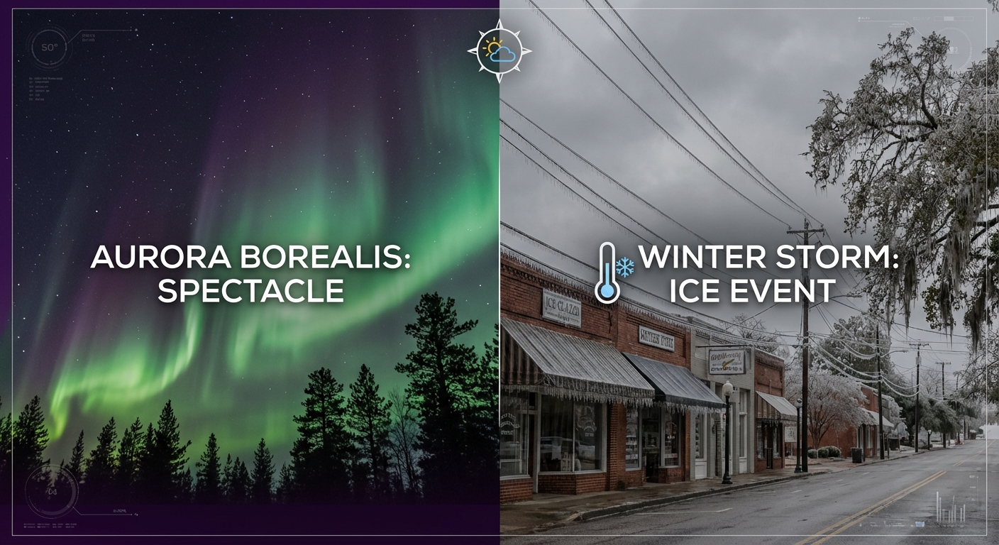
What is going on, y'all? I hope you had a chance to look up last night. We just lived through history with that S4 solar storm—the first one we've seen since 2003. Seeing the Northern Lights all the way down in Alabama and Louisiana is something you tell your grandkids about. But as amazing as that was, we have to bring our eyes back down to the ground because the weather map is lighting up in a different way, and honestly, it has me a little concerned.
The Midwest Clipper: Fast and Furious
First things first. We have a "Clipper" system diving out of the Dakotas today. This isn't a blockbuster storm, but it is going to be a nuisance. If you are in Iowa, Southern Wisconsin, Northern Illinois, or Michigan, you are on the clock.
Here is the thing. These systems move fast. We are talking a quick 1 to 3 inches of snow for most folks, but if you are near Lake Michigan, you could see up to 6 inches. The bigger issue might be the wind. We are looking at gusts of 35 to 45 mph. After that 100-car pileup we saw in Michigan yesterday, please take it slow. Visibility can drop to zero in a heartbeat when that wind kicks up fresh snow.
The Weekend Threat: An Icy Mess for the South
Alright, let's talk about the big story. We have been tracking this potential for a few days, and the data is starting to lock in on a solution that I really don't like.
Starting Friday, we have a classic setup for an ice storm across the South. We have that stubborn Arctic air mass that just won't quit (temps are 20-30 degrees below average), and we have moisture streaming up from the Gulf.
Here is the science part: When you have deep cold air at the surface, but a layer of warm air noses in just above it, the snow melts into rain, falls, and then freezes instantly when it hits the ground. That is freezing rain, and it is the worst-case scenario for power lines and trees.
Who Needs to Watch This?
- Friday: The bullseye is on Oklahoma and Texas. Central Texas, you are right on that transition line. If you are headed out to round up supplies, do it now.
- Saturday: The mess slides east into Arkansas, Tennessee, and Mississippi.
- Saturday Night & Sunday: It targets the Carolinas. I know a lot of y'all are planning to be in Charlotte for the Big Southern Classic Battle of the Bands on Saturday. You need to watch this forecast like a hawk. Getting there might be okay, but getting home could be a slip-and-slide.
The Deep Freeze Returns
Behind this storm, winter is reloading... again. We are looking at another blast of Arctic air plunging into the Northern Plains late week. We could see wind chills down to -50°F in the Dakotas. Even down in Florida, you aren't safe from the chill. If you're going to the Boca Raton Beer Wine and Spirits Fest this weekend, you might be drinking more stouts than slushies with those temps dropping.
Bottom Line
- Midwest: Watch for snow squalls and gusty winds today and tomorrow. Keep both hands on the wheel.
- The South: The risk for a significant ice storm from Texas to North Carolina is increasing for Friday and Saturday. This could be a power outage event.
- Travelers: If you have flights or road trips planned through Atlanta, Charlotte, or Dallas this weekend, have a backup plan.
- Stay Tuned: Ice forecasts are tricky and can change with just one degree of temperature difference. I'll keep watching the data and let you know what changes.
Stay safe out there, y'all!
https://ryanhallyall.com/blog/from-northern-lights-to-southern-ice-a-dangerous-setup