Blog Article
Severe Storms in the Dakotas & Incoming Solar Storm
Tracking an Enhanced Risk for severe storms in the Northern Plains, flash flooding in the Mid-South, and a G2 geomagnetic solar storm arriving Monday.

From Northern Plains Supercells to Solar Storms: What We Are Watching Today
As we talked about yesterday, that storm system out East caused a lot of headaches. We saw structural damage in Pennsylvania and some serious wind gusts across the Mid-Atlantic. Today, the eastern seaboard gets a breather. But the atmosphere never really rests, and our main severe weather focus is shifting to the Dakotas.
Big Hail and High Winds Up North
The Storm Prediction Center has an Enhanced Risk posted for parts of North Dakota and South Dakota. This includes Bismarck, Minot, and Dickinson. The setup here is classic for early June. We have a strong upper-level trough swinging through, and it is going to fire off some intense thunderstorms this afternoon and evening.
Minneapolis usually averages a high of 79 degrees for early June, but the warm sector pulling up into the Northern Plains is bringing plenty of heat and moisture to fuel these storms.
The main threats are going to be very large hail and damaging wind gusts. The data shows a 15 percent probability for severe hail, and there is a significant hatched area meaning we could see hailstones 2 inches in diameter or larger. That is hen-egg size, folks. If you park outside, today is the day to clean out the garage and get the cars under a roof.
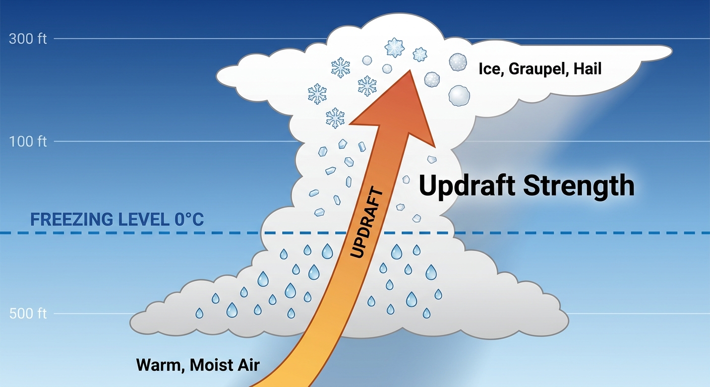
We are also looking at a 30 percent chance for damaging winds, with gusts potentially topping 75 mph. An isolated tornado or two is not out of the question, but wind and hail are the heavy hitters today.
Flash Flooding in the Mid-South
Down south, we are dealing with a completely different problem. The Weather Prediction Center has a Slight Risk for excessive rainfall across the Mid-Mississippi Valley, the Ozarks, and the western Tennessee Valley.
Steering winds aloft are pretty weak in this area. That means when thunderstorms form, they are going to crawl. Slow-moving storms dumping heavy rain over the same areas will lead to flash flooding. If you are traveling along the I-40 corridor or heading out to the Railbird Festival in Lexington today, pack the rain gear and leave early. Never drive your car through flooded roads.
Space Weather Incoming
Get this, y'all. The weather on Earth is not the only thing acting up. The Space Weather Prediction Center is tracking a coronal mass ejection that left the sun on June 6. That solar energy is expected to arrive by early to mid-day tomorrow.
When it hits, we are likely looking at G1 to G2 geomagnetic storming. That is a Minor to Moderate solar storm. It is not something to panic over, but it could cause some minor fluctuations in power grids and satellite operations. If we get lucky and the skies clear up, folks in the northern tier of the US might even catch a glimpse of the northern lights Monday night.
The Tropics Are Waking Up
I also want to give a quick update on the tropical side of things. The Eastern Pacific is getting busy. Tropical Depression Amanda is out there, but it is poorly organized and forecast to become a remnant low by late Sunday. It is not a threat to land.
However, we are watching two other disturbances off the coast of Mexico and Central America. Both have a High probability of developing into tropical depressions over the next couple of days. If you have vacation plans or interests down in southern Mexico or Costa Rica, keep an eye on the forecast. Heavy rainfall and flash flooding will be a big concern for those coastal areas regardless of whether these systems get a name.
Bottom Line
Alright folks, here is the bottom line. If you are in the Dakotas, have multiple ways to get weather warnings today. Those storms will be capable of breaking windows and denting cars. Down in the Mid-South, watch out for water covering the roadways. Have a plan, check your local forecast, and enjoy your Sunday.