Blog Article
Great Lakes Severe Storms & New England Icing Forecast
A surging warm front brings severe thunderstorms, large hail, and damaging winds to the Great Lakes today and tomorrow, plus freezing rain in New England.

Great Lakes Severe Threat Ramps Up While New England Braces for Ice
Alright y'all, yesterday we talked about that massive temperature whiplash across the Midwest. That warm front is officially surging north today, and it is bringing a whole lot of energy with it. We are trading those winter coats for severe weather awareness across a huge chunk of the country.
Tonight's Late-Night Threat
If you live in Wisconsin, specifically around Milwaukee, Madison, or Waukesha, you need to pay attention tonight. The Storm Prediction Center has a Slight Risk in place for late tonight into early Tuesday morning.
Here is the thing. These storms are going to fire up after a lot of folks are already asleep. The main threat is large hail, but gusty winds are absolutely on the table. Make sure your phone is not on silent. Have a weather radio plugged in and ready to go. A broader Marginal Risk stretches down into Chicago and Grand Rapids, so do not be surprised if some loud thunder wakes you up before your Tuesday morning commute.
Tuesday Brings the Main Event
By Tuesday, this whole system slides east. We are looking at a Slight Risk covering Detroit, Cleveland, Toledo, Fort Wayne, and all the way over to Buffalo.
This is a classic spring setup. A cold front is going to clash with an incredibly juicy airmass. We are seeing near-record moisture levels for late March. Because of that, these storms will dump a ton of rain very quickly. The Weather Prediction Center has a Marginal Risk for excessive rainfall posted for the lower Great Lakes.
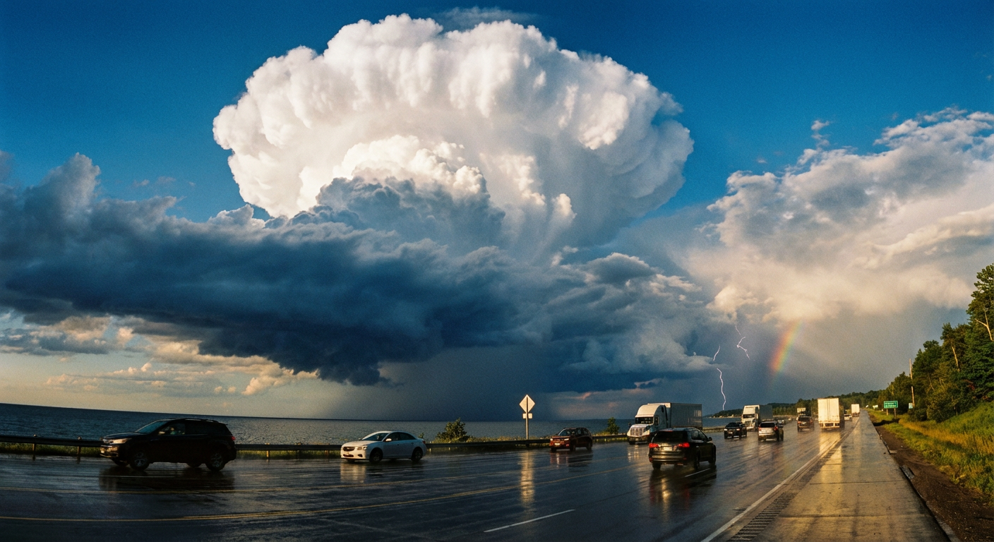
The main severe threats on Tuesday will be damaging wind gusts and large hail. The data also shows a 2 percent tornado risk in this zone. That is a low probability, but it is not zero. If you are driving on I-75 or I-80 tomorrow afternoon, be ready for rapidly changing visibility and slick roads.
Icing in New England
While the Great Lakes deal with thunderstorms, northern New England is looking at a completely different headache. The cold air is still firmly entrenched up there. As this surging moisture runs into that sub-freezing air, freezing rain is going to develop. If you have travel plans across Maine or upstate New York on Tuesday, expect some very slick roads and potential flight delays.
Looking Ahead to Wednesday
Get this. Once that system clears the East Coast, we do not get much of a break. By Wednesday, a new cold front stalls out across the Central and Southern Plains.
Dallas, Oklahoma City, Tulsa, and Kansas City are all in a Marginal Risk for severe storms. A normal high for Dallas right now is about 69 degrees. We are going to be well above that mark, and that extra heat is going to act like fuel for afternoon thunderstorms. Large hail and severe wind gusts will be the primary hazards to watch.
- Tonight: Wisconsin sees an overnight hail and wind threat.
- Tuesday: Damaging winds and heavy rain target Michigan, Ohio, Indiana, and New York.
- Wednesday: A new severe threat emerges for the Southern and Central Plains.
Bottom Line: If you are in the Great Lakes, secure your loose patio furniture and plan for a messy Tuesday commute. Have multiple ways to get warnings tonight, especially if you live in Wisconsin or northern Illinois.
https://ryanhallyall.com/blog/great-lakes-severe-threat-ramps-up-while-new-england-braces-for-ice