Blog Article
Weather Update Feb 2, 2026: Black Ice Risk & Clipper Systems
Groundhog Day weather update: Dangerous black ice threatens the East Coast commute, while a Clipper system targets the Ohio Valley. Florida stays cold tonight.
Groundhog Day Reality Check: Black Ice, Clippers, and the Refreeze
Alright folks, happy Groundhog Day. I know everyone is waiting to see if Punxsutawney Phil sees his shadow, but here is the thing: the weather map doesn't care much about a rodent's opinion today. Whether we get six more weeks of winter or an early spring, right now we are dealing with some very real, very dangerous cold.
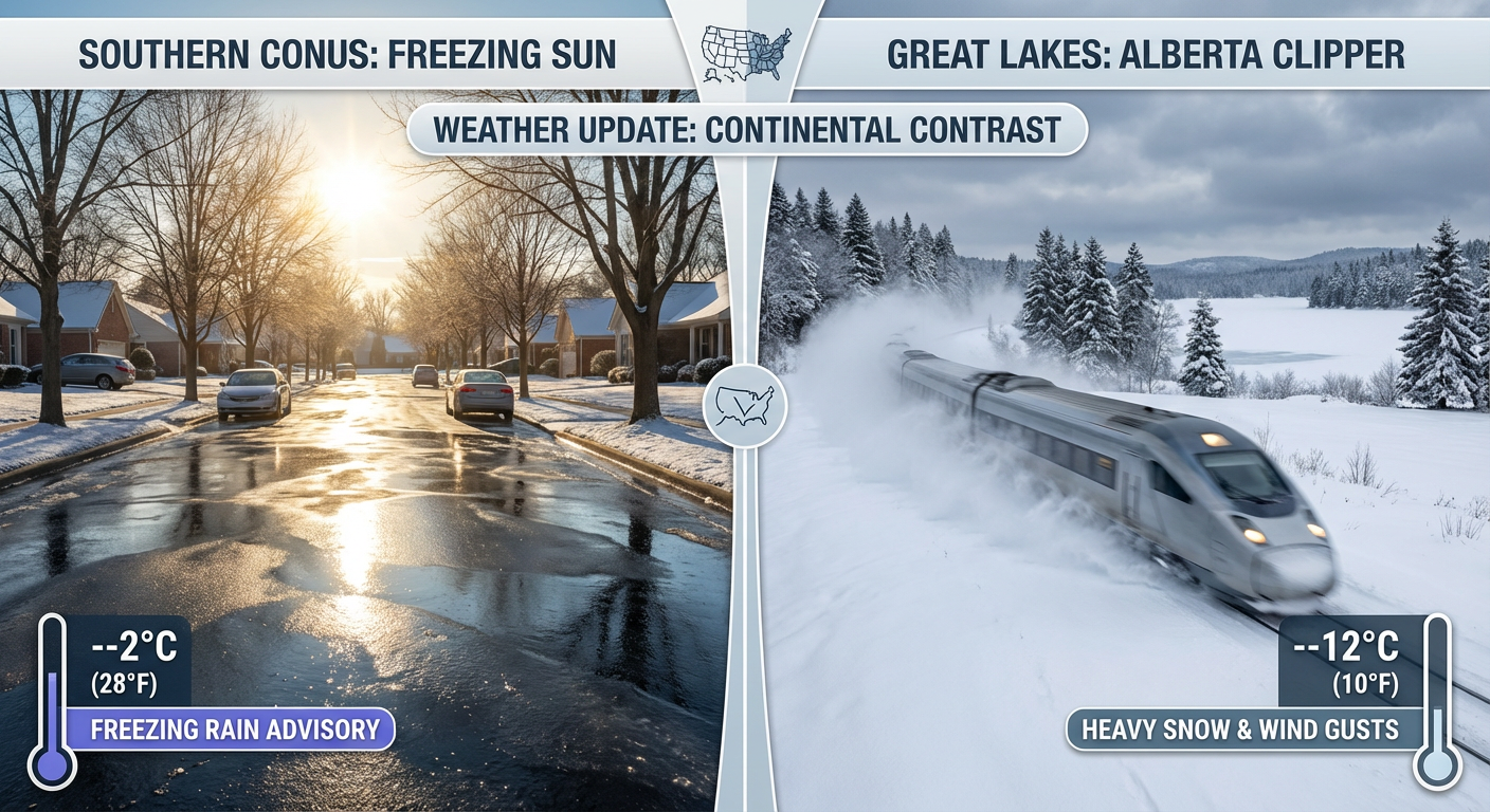
Yesterday was chaotic with that massive storm exiting the East Coast, and today we are dealing with the aftermath. Let's break down what you need to know to stay safe this week.
The Deceptive "Refreeze"
If you are in the Carolinas, Virginia, Tennessee, or even up into the Mid-Atlantic, do not let the sunshine fool you. We are seeing temperatures barely hovering above freezing in many spots, and melting is happening. But as soon as that sun goes down, all that slush and standing water is going to turn into a sheet of ice.
This is why we are seeing so many school closures from South Carolina to Maryland this morning. The "black ice" risk tonight into Tuesday morning is high. If you are commuting around Nashville, Richmond, or the D.C. metro area, you need to take it slow. The roads might look dry, but those bridges and overpasses will catch you off guard.
The "Clipper Train" is Boarding
While the East Coast is shivering, we are watching a new pattern set up for the Midwest and Great Lakes. We call this a "Clipper Train." These are fast-moving, moisture-starved systems that swoop down from Canada.
Here is what to expect:
- The Great Lakes: The lake effect snow machine is still cranking. Places east of Lake Ontario and Lake Erie are seeing snowfall rates that can bury a car in a few hours. Upstate New York, y'all are in the thick of it.
- Ohio Valley: A clipper system is diving down Tuesday. It's not a blockbuster storm, but it could drop a quick 1 to 3 inches of snow from Cincinnati over to the central Appalachians just in time for the Tuesday evening commute. That is enough to grease up the roads and cause headaches.
Florida: Still Chilly, But Help is Coming
I saw the trending searches for "Alerta por helada" down in Miami, and yeah, it is cold. We had freeze warnings covering almost the entire peninsula last night. For folks hitting the outdoor markets or getting ready for upcoming festivals like the Jupiter Seafood Festival later this month, you are probably wondering when you can ditch the parkas.
Good news: the Arctic high pressure is shifting. We have one more cold night tonight, especially for the Nature Coast and inland areas, but a gradual warm-up starts Tuesday. You'll be back to beach weather before you know it, but keep those plants covered one more night.
Pacific Northwest: The Rain Returns
Out West, it is a tale of two worlds. A massive ridge of high pressure is keeping things dry and stagnant for much of the interior West. In the valleys, watch out for dense fog and air quality issues because the air just isn't moving.
However, the Pacific Northwest is about to get active again. A new system is targeting Washington and Oregon starting late Tuesday into Wednesday. We are talking about steady rain for the I-5 corridor and more snow for the Cascades. If you are traveling through the passes, check conditions before you go.
Texas: Thunderstorms Return?
Down in Texas, the deep freeze is breaking, but moisture is surging back from the Gulf. By Tuesday, areas east of I-35 around Dallas and Waco could see scattered showers and even a few thunderstorms. It doesn't look severe right now, but there is enough cold air aloft that some small hail isn't out of the question. Keep an umbrella handy.
Bottom Line
- Watch Your Step: If it looks wet on the road in the East/South tonight, assume it is ice. The refreeze is the biggest danger right now.
- Commuter Alert: Light snow could impact the Tuesday evening drive in the Ohio Valley and West Virginia.
- Florida: One more freezing night inland before a slow warm-up begins.
- West Coast: Foggy valleys for now, but rain returns to the PNW mid-week.
Stay warm, drive safe, and don't take any chances on those icy roads, y'all!
https://ryanhallyall.com/blog/groundhog-day-reality-check-black-ice-clippers-and-the-refreeze