Blog Article
Severe Winds Hit East Coast While Gulf Coast Faces Floods
A stalled cold front brings a multi-day flood risk to Texas and the Gulf Coast, while the Mid-Atlantic braces for 60+ mph wind gusts and severe storms.
Gulf Coast Flood Threat Builds While the Mid-Atlantic Braces for Wind
Good morning, y'all. Yesterday we talked about that massive storm system tracking east. Well, it is finally knocking on the door of the Mid-Atlantic. But while the East Coast deals with the wind, we have a serious water problem building down south.
Here is the setup for today. The Storm Prediction Center has a Slight Risk for severe storms stretching from northern Georgia all the way up into southern New England. If you live in Washington, Baltimore, Philadelphia, or New York, you need to pay attention this afternoon.
We have a Level 3 out of 5 threat for damaging winds in this zone. That means gusts over 60 mph are highly possible. We also have a 2 percent chance for an isolated tornado, but the main hazard is absolutely straight-line wind.
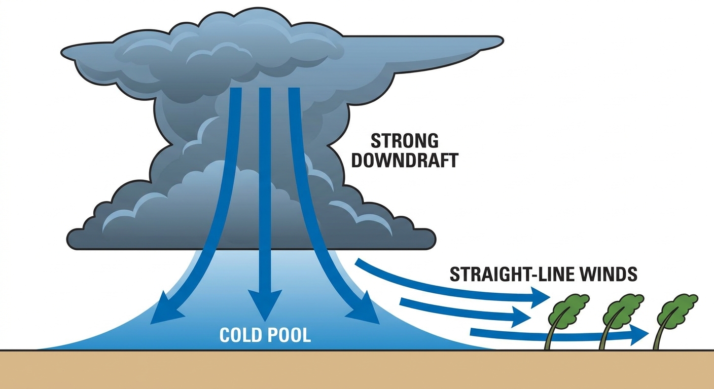
This timing is tough. Philadelphia is hosting the World Cup Fan Fest today. We also have the Padres playing the Orioles in Baltimore and the Mariners at the Nationals in DC. If you are heading out to the ballpark or the festival, keep a radar app handy. These storms will be moving fast, and those winds can knock down tree limbs and power lines in a hurry.
The Gulf Coast Water Hose
Now, let's look down south. A cold front is sinking into Texas and Arkansas, and it is going to hit the brakes. It is just going to stall out. At the same time, we have a massive surge of tropical moisture flowing up from the Gulf of Mexico.
The Weather Prediction Center has posted Slight Risks for excessive rainfall for the next three days across South Texas and the Lower Mississippi Valley. The atmosphere is holding over 2.5 inches of precipitable water. That is incredibly high for mid-June.
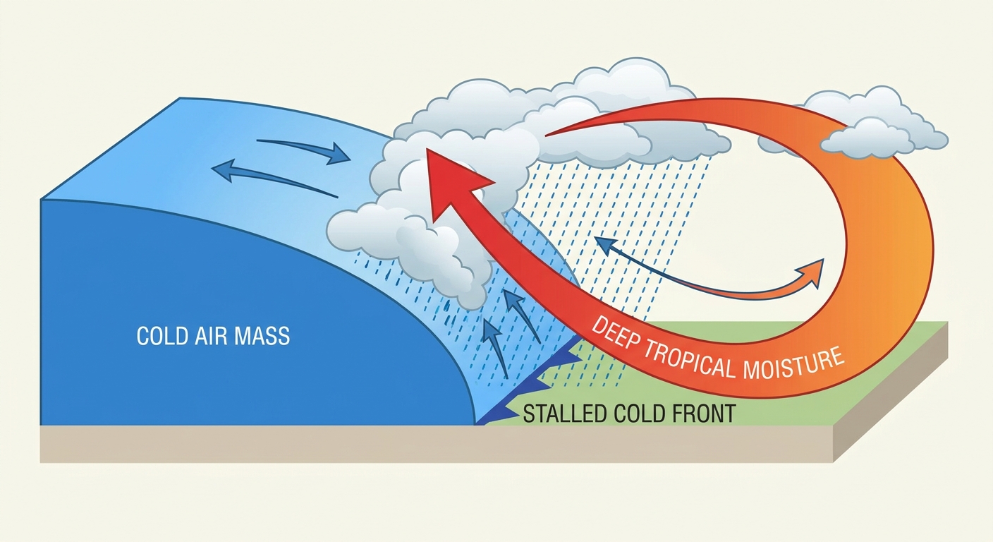
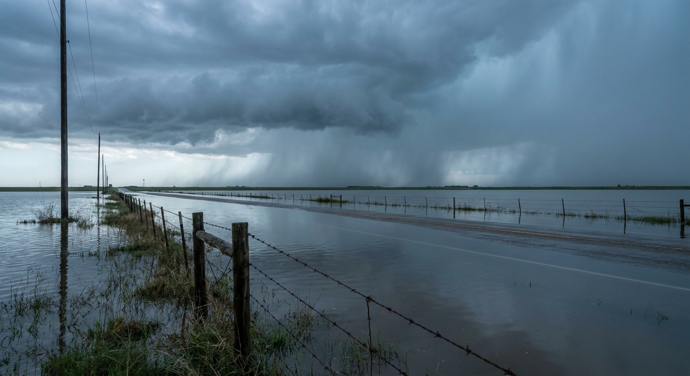
When storms fire up along that stalled front, they are going to dump water like a bucket. Expect rapid runoff and localized flash flooding, especially in urban areas. The ground can only take so much water at once.
A Quick Look at the Tropics and Space
Speaking of the Gulf, we are watching a broad area of low pressure off the eastern coast of Mexico. The National Hurricane Center gives it a low 20 percent chance of developing over the next week. It will eventually move inland and might emerge back over the water by Tuesday. Conditions are only marginally favorable for it to become a named storm, but it is adding to that moisture pipeline soaking Texas.
Just a quick note for our night sky watchers. We are expecting a G1 Minor geomagnetic storm today because a couple of coronal mass ejections arrived from the sun. It is a low-end event, but it is keeping the atmosphere active up top.
Key Things We Are Watching
- Radar trends on the I-95 corridor: We are watching for bowing line segments that indicate high wind gusts this afternoon and evening.
- Rainfall rates in South Texas and Louisiana: With that stalled front, training thunderstorms could drop several inches of rain in a very short time.
- High Plains wind: Tomorrow, we have a Marginal Risk for severe storms in eastern New Mexico and southeast Colorado. High-based storms could produce some strong outflow wind gusts.
Bottom Line
If you are on the East Coast today, secure your patio furniture and know where to go if a severe thunderstorm warning is issued. If you are down on the Gulf Coast or in South Texas, be ready for heavy rain through Tuesday. Never drive your car through a flooded roadway. Turn around, don't drown.
https://ryanhallyall.com/blog/gulf-coast-flood-threat-builds-while-the-mid-atlantic-braces-for-wind