Blog Article
South Texas Flash Flood Risk Builds This Weekend
WPC flags a Slight Risk of excessive rainfall for the Texas Hill Country and Rio Grande Valley Sunday into Monday, with 2-6 inch rain totals possible.

Gulf Moisture Takes Aim at the Texas Hill Country: Flood Risk Builds Sunday Into Monday
Alright y'all, today is a good news day for most of the country, and tomorrow is the day we need to talk about. The Weather Prediction Center has a Slight Risk of excessive rainfall posted for south-central and southern Texas from Sunday morning through Monday morning, and that's the headline act in an otherwise quiet pattern.
This one's worth your attention if you're anywhere from the Edwards Plateau down through the Rio Grande Valley, because the setup has the ingredients to produce some serious rain totals in a short window.
How We Got Here
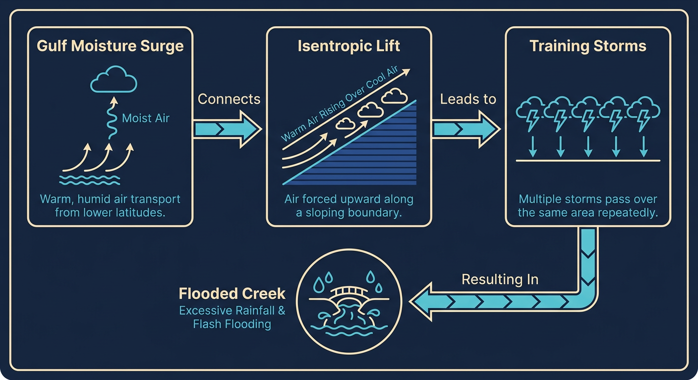
Here's the thing about this pattern. An upper-level trough has been grinding across the Southwest the last day or so, and it's about to amplify and close off as it drops into northern Mexico. That's going to kick southeast low-level flow into overdrive across South Texas, hauling Gulf moisture northward like a firehose.
Precipitable water values are forecast to climb to somewhere between 1.5 and 2.1 inches, which is a lot of moisture sitting in the atmospheric column over South Texas in November. Pair that with isentropic ascent (that's just a fancy way of saying air is being lifted smoothly up and over a wedge of cooler, denser air near the surface), upper-level divergence, and a shallow surface trough, and you've got a recipe for elevated thunderstorms that don't move much and don't let up.
Timeline and Who's Watching This Closest
Today, Saturday, the risk is just Marginal across south, central, and west Texas. That's a "keep an eye on it" level, not a "change your plans" level. The real upgrade comes Sunday.
- Today (Saturday): Marginal risk, mostly dry for the I-35 corridor and points west. Actually a nice day for a lot of the Plains.
- Sunday into Monday morning: This is the Slight Risk window. The heaviest rain targets the Edwards Plateau and Texas Hill Country, sliding south into Webb, Duval, and Zapata Counties, Laredo, Corpus Christi, the King Ranch area, and down into the Lower Rio Grande Valley.
- Monday into Tuesday: Risk drops back to Marginal as the pattern starts to break down and drier air filters in from the north.
Widespread totals of 2 to 3 inches look likely across that corridor, with localized 4 to 6 inch amounts possible where storms train over the same ground repeatedly. Isolated higher totals can't be ruled out near and east of Laredo. The San Antonio metro sits right on the edge of the heaviest activity, and this time of year San Antonio normally sees a high around 72 and a low around 50. Sunday's numbers won't be far off that temperature-wise, but the rain is the story here, not the thermometer.
Southeastern Arizona and southwestern New Mexico are also in line for heavy rain and some localized drainage flooding out of this same system, so don't sleep on that corner of the Southwest either.
If you're headed to the Texas Renaissance Festival in Todd Mission today, you're fine, that's well north and east of the Day 1 Marginal zone and today looks dry there. If you've got Sunday or Monday travel plans through San Antonio, Laredo, or Corpus Christi, that's when you want to build in extra time and have an alternate route in your back pocket, especially around low water crossings.
Elsewhere Around the Country
We're still watching a few other things on the board:
- Tropical Storm Pena strengthened a bit overnight in the Central Pacific, several hundred miles south-southeast of the Big Island. Winds are up to 52 mph and it's tracking west, away from Hawaii. No landfall is forecast and the closest approach to any land stays over 800 kilometers out. This is one to watch for folks with Pacific interests, but it's not a direct threat to the islands right now.
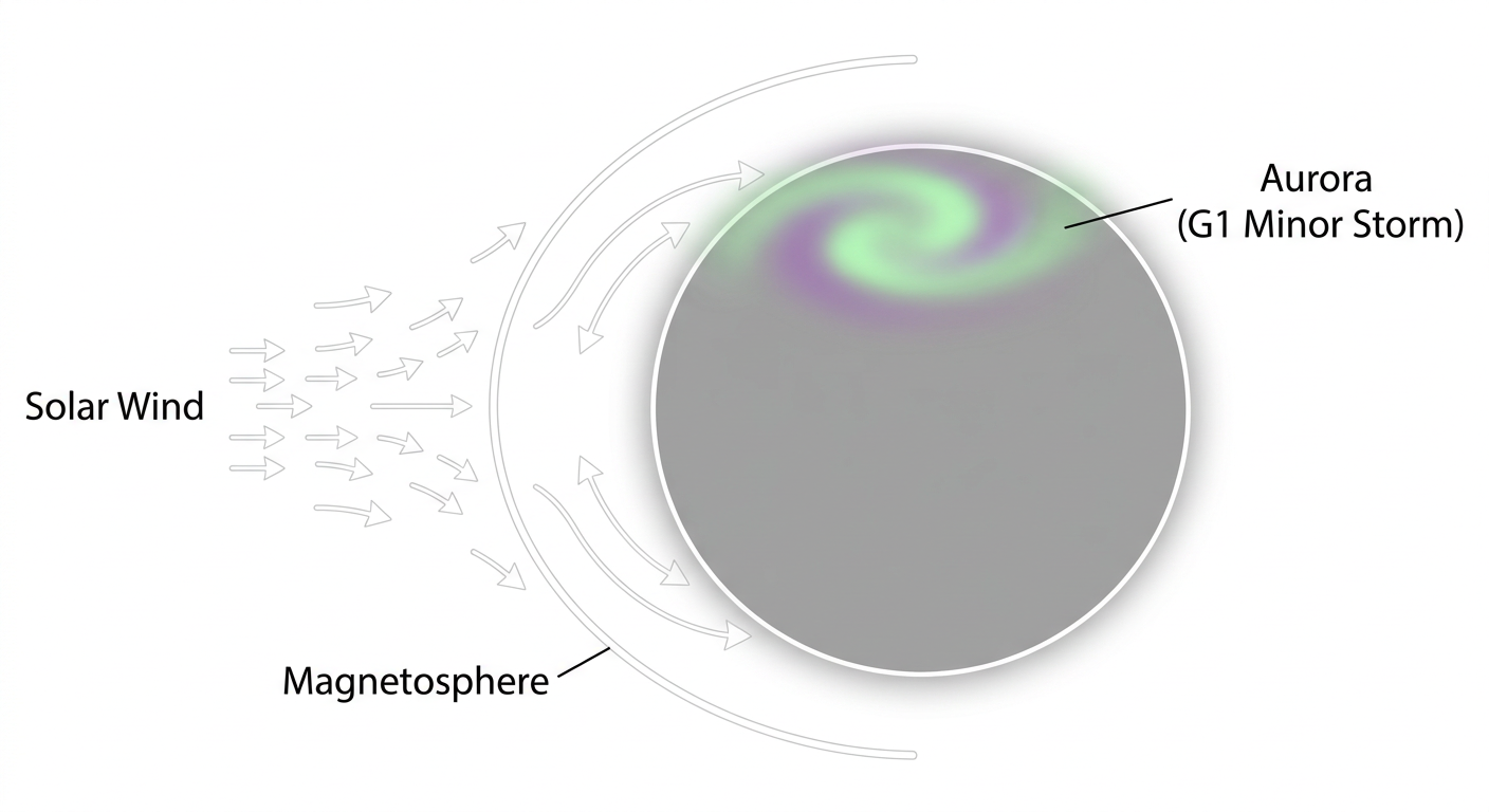
- Space weather: SWPC says the geomagnetic field is likely to reach G1 Minor storm levels tonight into Monday, with a chance of G2 Moderate, thanks to a coronal hole high-speed stream. If you're in the northern tier and skies clear out, it might be worth a look north after dark for aurora, though confidence on exact timing is only low to medium.
- Southern California fire weather: Weak to moderate Santa Ana winds are kicking up today across the San Gabriel, Santa Monica, and Santa Susana mountains, with gusts to 30-40 mph and relative humidity down to 15-20%. That's an elevated fire weather day, not red flag conditions, but it's dry and breezy enough to pay attention if you're in those foothill communities.
- Pacific Northwest and Northern Rockies: After yesterday's wild wind event (we're talking a 93 mph gust near Crystal Mountain and 77 mph near East Glacier Park, Montana), the extended outlook calls for repeated rounds of mountain snow through the period as Pacific systems keep rolling in. Snow levels should stay up in the higher terrain for now.
And a Reset After a Rough Week
This week gave us a little bit of everything. Norfolk, Virginia picked up 6.33 inches of rain Thursday night into Friday with flooded underpasses across Hampton Roads. New Bedford, Massachusetts dealt with cars stuck in street flooding into the overnight hours. And out West, the Pacific Northwest wind event and that Southeast Alaska 111 mph gust from earlier in the week remind you just how active this pattern has stayed. Today's quieter stretch across most of the country is a nice breather before attention shifts back to South Texas tomorrow.
Key Factors We're Watching
- Whether the upper trough closes off as forecast, which would support the heaviest, most persistent rain over the Hill Country and Rio Grande Valley
- How far east the training storm corridor sets up, since that determines whether San Antonio or areas closer to Laredo see the worst of it
- Precipitable water values actually reaching that 1.5 to 2.1 inch range, which would support efficient, heavy rain rates
- Any upgrade from WPC if model guidance trends wetter through Saturday night
Bottom Line
Today's a keeper for most of the country, especially the central High Plains and Panhandles where high pressure and clearing skies are making for a genuinely great day outside. But if your weekend plans run through San Antonio, the Hill Country, Laredo, or the Rio Grande Valley, Sunday into Monday is the window to watch. Have a way to check radar, know your low water crossings, and don't drive into flooded roadways. This is a Slight Risk, not a worst-case scenario, but Slight Risk days in Texas have produced serious flash flooding before, and the moisture available with this one is nothing to shrug off.