Blog Article
Gulf Disturbance and Enhanced Severe Risk: July 19-21 Outlook
A Gulf system tries to organize as SPC lines up Enhanced severe risks for the Upper Midwest Monday and Ohio Valley Tuesday. Here's the full breakdown.

Gulf System Trying to Organize While a Multi-Day Severe Weather Setup Builds Behind It
Alright y'all, let's get into it. There's a lot on the board this morning, so we're gonna work through it in order of what actually matters most.
The Gulf System: Slow, But Worth Watching
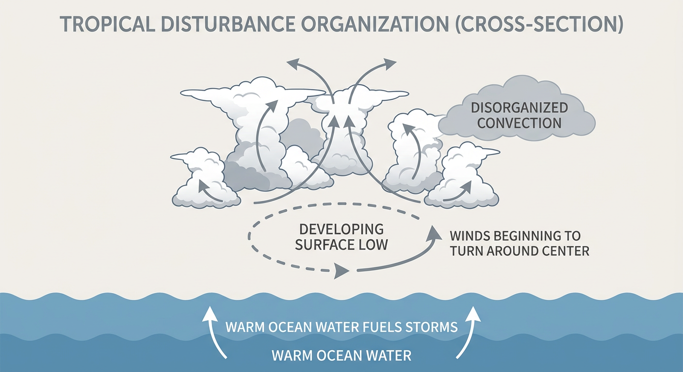
NHC is tracking Invest 91AL, an area of low pressure sitting over the northeastern Gulf near 27.8N/85.3W with max winds around 30 knots. The Tropical Weather Outlook gives it a medium risk, 40% chance of development in the next two days and 50% through seven days. That's not explosive, but it's also not nothing.
Here's the thing about this system. The shower and thunderstorm activity tied to it is still disorganized. NHC's language is measured on purpose, they're watching it slowly get better defined on satellite and surface data, but a well-defined center hasn't come together yet. Gradual development is the forecast, meaning even if this becomes a tropical depression, it's not going to happen overnight.
The bigger practical impact right now isn't wind, it's moisture. That Gulf system is pumping deep tropical moisture into the Southeast, and airports like RSW and SRQ down in Florida are already dealing with heavy rain and afternoon thunderstorm delays because of it. If you've got Gulf Coast or Florida travel plans this week, build in some slack.
We've also got Invest 97EP way out in the eastern Pacific near 11.1N/108.4W, but that one's far enough offshore that it's not a US land threat right now.
Severe Weather: Three Days, Three Different Regions
This is where I want you paying attention, because the pattern is shifting geographically day by day.
Today (Sunday): SPC has a Slight Risk stretched from north Georgia up through the Carolinas into southern Virginia, plus a separate Slight Risk area across the Dakotas into western Minnesota. Damaging winds are the main threat in both zones, with large hail possible out west. Atlanta sits right in that Slight Risk window today, and with the Rangers-Braves game this afternoon, folks headed to Truist Park should keep half an eye on the sky. Charlotte, Raleigh, and the Virginia Beach/Norfolk area are also in play. Population-wise, we're talking about roughly 23.7 million people under that Slight Risk.
Monday: This is the day that jumps out at me. SPC has upgraded far southeast Minnesota, northeast Iowa, northern Illinois, Wisconsin, and the Upper Peninsula of Michigan to an Enhanced Risk, Level 3. That's about 7.3 million people, including Milwaukee, Madison, Rockford, and Cedar Rapids. The wind probability is up to 30%, with a hatched area inside it where gusts could reach 75 mph or better. There's also a 5% tornado risk and hail up to 2 inches possible. A strong shortwave trough is the driver here, and the setup supports storms growing upscale into a bowing line Monday evening. If you're headed to EAA AirVenture Oshkosh, which kicks off Monday, that puts you right in the Slight Risk ring surrounding the Enhanced core. Worth checking conditions before you head to the flight line.
Tuesday: The severe threat shifts east into the Ohio Valley, with another Enhanced Risk centered on Lexington, Cincinnati, Pittsburgh, and Youngstown. A vigorous upper trough spreads across the region, and damaging wind gusts look like the headline hazard again as the system pushes into the Mid-Atlantic and Northeast that evening. New York, Philadelphia, DC, and Nashville all fall inside the broader Slight Risk shield that day.
What makes this stretch notable is the analog data. On this same date, July 19, 2023, an EF3 tornado injured 16 people in eastern North Carolina. Iowa saw two EF3 and two EF2 tornadoes on this date eight years back. And the Iowa-to-Illinois corridor we're watching Monday overlaps almost exactly with the corridor that produced 49 preliminary tornado reports on July 15, 2024. None of that means Monday repeats those numbers, but it tells you this time of year and this setup have a track record in this part of the country.
And this all comes on the heels of yesterday's outbreak. Pennsylvania, New York, New Jersey, Maryland, and Delaware got hit hard on July 18, with radar-indicated gusts of 70 to 80 mph, a 71 mph measured gust at Richmond International, and tornado reports near Summerville and McChesneytown, PA. Trees and power lines came down across a wide swath of the Mid-Atlantic and Northeast. This week's pattern has been relentless, and it isn't done yet.
Flooding Still a Concern Out West
WPC has a Slight Risk of excessive rainfall today from West Texas through the eastern Great Basin, plus another pocket in the Northeast and Mid-Atlantic. That monsoonal flow out west is producing high-efficiency rainfall, meaning storms are dropping a lot of water fast on already-saturated ground. This carries into Monday and Tuesday too, with the Slight Risk sliding into New Mexico and Arizona, then expanding toward the central Appalachians and Mid-Atlantic coast by Tuesday. Given the month we've had, with catastrophic flooding across the Texas Hill Country running practically nonstop since mid-July, any new heavy rain out that direction deserves respect even at a Slight Risk level.
Heat Keeps Its Grip on the Plains and Midwest
Outside the storm zones, the story today is heat. Heat indices are climbing into the 100s across the Plains and Midwest, and that's compounded by lingering wildfire smoke drifting in from Canada. The cleanest, most pleasant air in the country sits along the Washington and Oregon coast today. Everywhere else is getting squeezed between heat, humidity, haze, or storm risk.
Space Weather: Quiet, Nothing to See Here
Quick note for the space weather watchers. SWPC has the geomagnetic field holding at quiet levels through Tuesday, with only a slight chance of an M-class flare. No G1-or-stronger storms are expected in the 27-day outlook. Skip the aurora chasing this week.
What We're Watching
- Invest 91AL's development pace in the northeastern Gulf, and whether it organizes enough to earn a name
- Monday's Enhanced Risk across the Wisconsin/Iowa/Illinois corridor, especially timing of any morning convection that could shift where the worst storms set up
- Tuesday's Enhanced Risk sliding into the Ohio Valley and Mid-Atlantic
- Excessive rainfall risk continuing across the Southwest monsoon zone into a region still recovering from a brutal flood month
- Air quality and heat index values across the Plains and Midwest, where smoke and heat are stacking on top of each other
Bottom Line
If you're in Georgia, the Carolinas, or southern Virginia today, keep an eye on the sky this afternoon, especially if you're headed to an outdoor game or event. If your week takes you through Wisconsin, northern Illinois, or eastern Iowa on Monday, that Enhanced Risk is worth real planning, not just a passing glance, particularly if you're headed to Oshkosh for AirVenture. Tuesday shifts that same level of concern into the Ohio Valley and toward the Mid-Atlantic and Northeast. And if you're anywhere near the Gulf Coast or Florida this week, expect soggy, delay-prone travel even without a named storm. Nothing here is catastrophic yet, but it's a busy, multi-day setup that deserves your attention each morning, not just today's.