Blog Article
Winter Alert: Midwest Snow Today & Major Southern Ice Threat Weekend
A Clipper system hits the Midwest today while a dangerous ice storm targets the South from Texas to the Carolinas this weekend. Get the latest forecast.
Heads Up: Southern Ice Threat Increasing & Midwest Snow Alert
Alright folks, grab your coffee and let's chat. After a wild 24 hours that saw the Northern Lights dancing all the way down to the Gulf Coast and heavy lake effect snow burying parts of New York, the atmosphere isn't giving us much of a break. We have a lot of moving parts today, so let's break it down piece by piece.
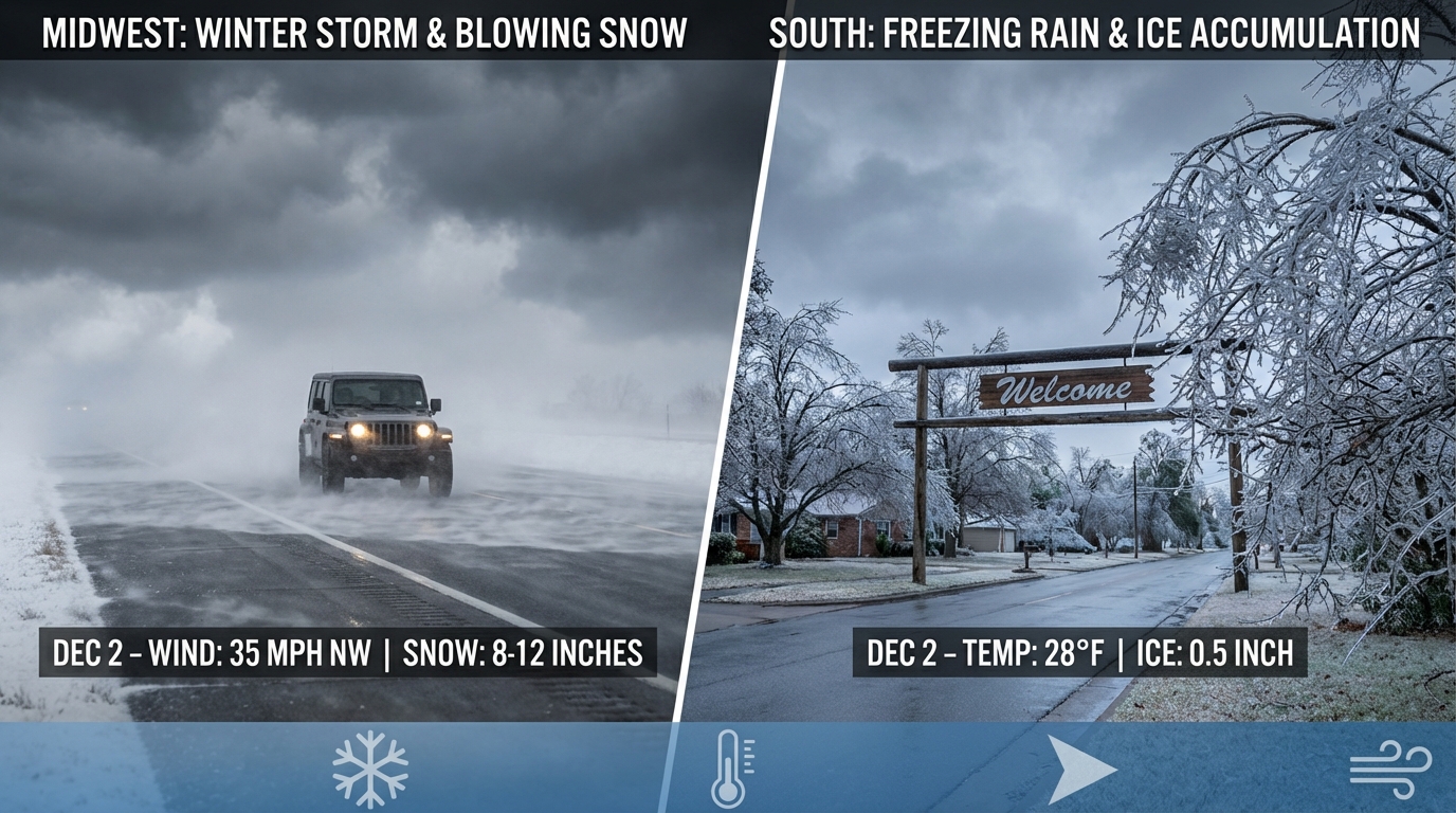
Here is the thing. We are tracking two main stories right now. One is happening today in the Midwest, and the other is a looming threat for the South this weekend that has me a little concerned about ice.
The Midwest Clipper: Fast but Tricky
First up, let's talk about what is happening right now. We have a "Clipper" system diving down from the Dakotas into the Great Lakes. Now, usually Clippers are quick hitters, but they can be sneaky. This one is bringing a swath of 1 to 3 inches of snow across parts of Iowa, Wisconsin, northern Illinois, and Michigan through Wednesday.
Get this, though. If you are near Lake Michigan—places like southwest Michigan or northern Indiana—lake enhancement could bump those totals up to 6 inches. The wind is also going to pick up, gusting 35 to 45 mph. That means blowing snow and reduced visibility. We saw that nasty pileup on I-196 yesterday, and we do not want a repeat of that. If you are commuting in Chicago, Grand Rapids, or Madison, please slow down. The roads might just look wet, but they could be slicker than they appear.
The Weekend Threat: Ice in the South
Now, I need everyone from Texas to the Carolinas to pay close attention. The data is starting to lock in on a significant winter storm developing Friday into the weekend.
We have Gulf moisture surging north, and it is going to run smack into that stubborn Arctic air sitting over the country. The result? A messy mix of snow, sleet, and freezing rain.
- The Danger Zone: Right now, the WPC is highlighting a corridor from Central Texas, through the Lower Mississippi Valley, and over into the Carolinas.
- Why Ice? We are looking at a "warm nose" setup. That means warm air aloft melts the snow into rain, but surface temps are still below freezing (thanks to that Arctic air). When that rain hits power lines, trees, and roads, it freezes instantly.
- Timing: This looks to start Friday in the Southern Plains (Oklahoma/Texas) and spread east into Tennessee and the Carolinas by Saturday and Sunday.
If you have plans for the Big Southern Classic Battle of the Bands in Charlotte on Saturday, you need to have a Plan B. Travel could get very difficult very quickly in that region.
The Deep Freeze Reloads
Behind all this moisture, the cold air is doubling down. We are talking about a reinforcing shot of Arctic air for the Northern Plains. By Friday morning, wind chills in the Dakotas and Minnesota could hit -50 degrees. That is life-threatening cold, folks. Make sure your pets are inside and your emergency kits are stocked.
And yes, Florida, you are involved too. By the weekend, that cold front pushes deep. We are looking at another round of freeze warnings potential for the Sunshine State. If you are heading to the Boca Raton Beer Wine and Spirits Fest on Saturday, you might be shivering while you sip.
Bottom Line
- Midwest Today: Watch for slick roads and blowing snow. It's a quick system, but it will make the commute messy.
- The South (Fri-Sun): Prepare for a potential ice storm. If you are in the risk zone from TX to NC, check your generator and grab some extra groceries now before the rush.
- Extreme Cold: The Northern Plains will see dangerous wind chills late week. Limit time outdoors.
We are watching the models closely to see exactly where that freezing rain line sets up. I'll have another update for y'all soon. Stay safe out there!
https://ryanhallyall.com/blog/heads-up-southern-ice-threat-increasing-midwest-snow-alert