Blog Article
Florida Flood Threat & Weekend Severe Storms in Texas
Heavy rain and flash flooding threaten the Florida coast today, while the Southern Plains prepare for a severe weather outbreak this weekend.
Heavy Rain Soaks Florida While the Plains Prep for Weekend Storms
Yesterday we talked about the severe weather threat brewing for Texas this weekend. That is still on the table. But today, we have some immediate impacts to deal with down in the Southeast. If you are heading down to Fort Lauderdale to set up for the Tortuga Music Festival, you are going to need the rain gear early.
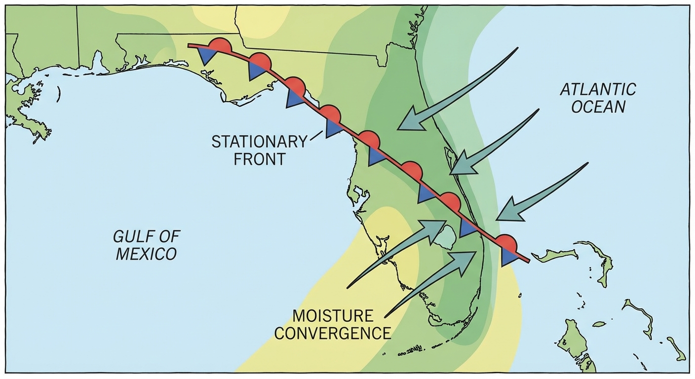
Here is the deal. A stationary front is draped right across the Florida Peninsula, and it is not in a hurry to move anywhere.
Florida's Flood Threat
The Weather Prediction Center has a Slight Risk of Excessive Rainfall posted for the eastern Florida Peninsula today and tonight. We are looking at a persistent northeasterly wind blowing off the Atlantic. That wind is pushing right into that stationary boundary.
This creates a setup where thunderstorms can anchor themselves and dump heavy rain over the same areas. The main focus is the I-95 corridor from Daytona Beach all the way down through the Miami metro. Miami usually sees highs around 83 degrees this time of year. Today, the thick clouds and heavy rain will make for a messy, soggy Wednesday. Watch out for localized flash flooding, especially in those urban, poor-drainage areas.
Fire Danger in the Southeast
Right next door, the weather is telling a completely different story. High pressure is dominating the rest of the Southeast. That is bringing some beautiful, crisp air to the region, but it comes with a catch.
The Storm Prediction Center has outlined a Critical Fire Weather area for portions of southwest South Carolina into eastern and south-central Georgia. We have sustained winds of 15 to 20 mph overlapping with very dry air. Relative humidity values are dropping down to 20 percent. With plenty of dry brush on the ground, any spark could spread rapidly. Please hold off on any outdoor burning today.
Tracking the Plains
Let us check back in on the central United States. Today, things are mostly quiet, though there is a Marginal Risk for an isolated severe storm or two in western and central Kansas this afternoon.
By tomorrow, that Marginal Risk expands from the mid-Missouri Valley down into the Texas Panhandle. We might see some isolated supercells capable of dropping large hail.
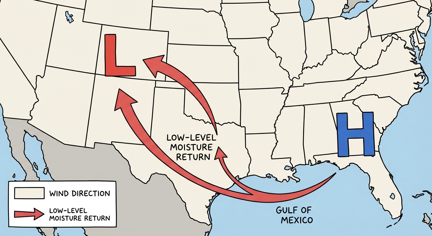
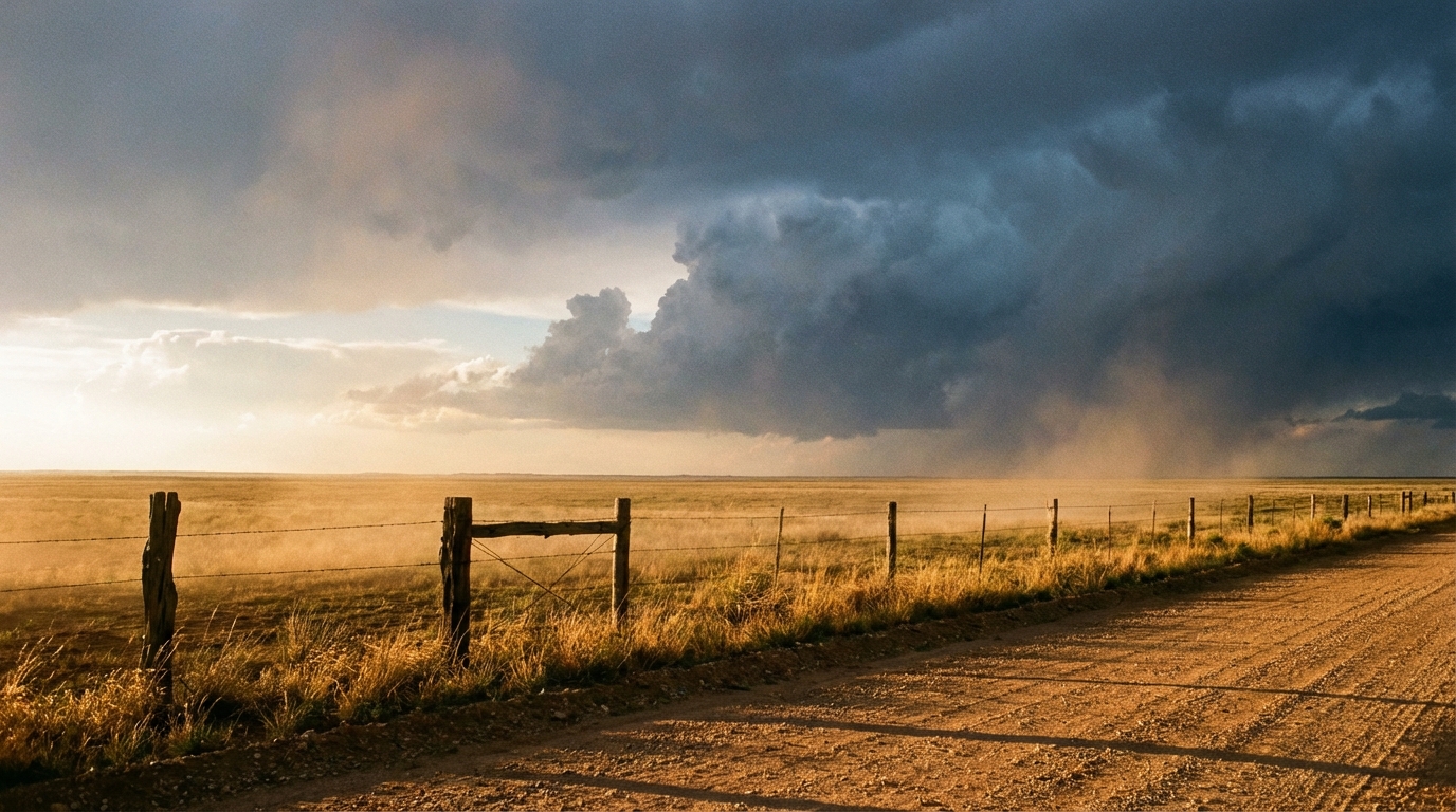
But the main event we are watching is still Saturday. As that upper-level trough digs into the West, it is going to pull rich Gulf moisture straight into Texas. The 15 percent severe risk remains in place for West Texas, including Midland, Odessa, and Lubbock. If you are heading to the Basin Red Dirt BBQ festival, you still have a couple of days of quiet weather to get your setup right. Just know that Saturday afternoon could get loud.
Here is what we are watching for the weekend:
- Strong moisture return off the Gulf of Mexico
- A developing dryline across the High Plains
- Potential for large hail and severe wind gusts Saturday afternoon
Bottom Line
If you live along the eastern Florida coast, give yourself extra time on the roads today and do not drive through flooded streets. Folks in Georgia and South Carolina need to strictly avoid any outdoor burning. And for our friends in Texas and Oklahoma, enjoy the quiet weather now and make sure you have a way to get warnings this weekend.
https://ryanhallyall.com/blog/heavy-rain-soaks-florida-while-the-plains-prep-for-weekend-storms