Blog Article
Sierra Snowstorm and West Texas Severe Weather Forecast
A major winter storm brings heavy snow to the Sierra Nevada this weekend, while a dryline setup triggers severe thunderstorms and large hail across West Texas.
Heavy Sierra Snow and a Rowdy West Texas Dryline
Yesterday we talked about the severe weather threat creeping into the Plains and how it might mess with some big Texas festivals. The data is coming into much better focus today. We are tracking a major split in the national weather pattern as we head into the weekend. Out west, a robust winter storm is taking shape. Down south, the dryline is getting ready to pop.
The Sierra Nevada Snow Machine
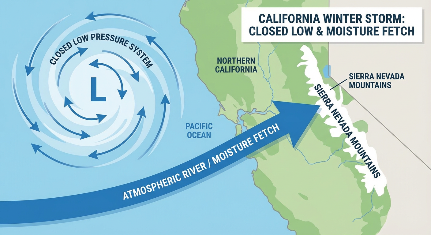
A closed low pressure system is dropping down from the Gulf of Alaska right now. It is going to park itself over Northern California by Saturday night. The moisture fetch off the Pacific is impressive, and it is going to point a firehose of precipitation right at the mountains.
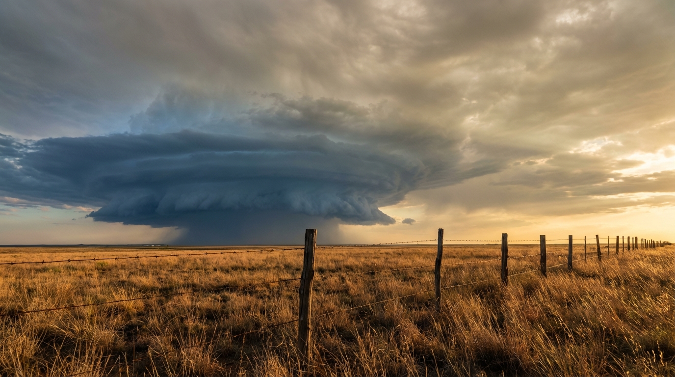
We are looking at moderate to heavy snow over the High Sierra starting late Friday. Here is the catch. Snow levels are going to crash as colder air filters in. We start above 9000 feet tonight. By Friday morning, that drops to around 7500 feet. By Sunday morning, we are looking at snow all the way down to 4000 feet.
The heaviest snow hits Saturday afternoon through the overnight hours. We are talking about snowfall rates of 1 to 3 inches per hour. If you are planning to drive I-80 through Donner Pass this weekend, you need to leave early or change your plans entirely. That kind of snowfall rate will stop traffic in its tracks.
Shifting Severe Threats in the Plains
Meanwhile, the severe weather threat is marching south. Today, we have a Slight Risk centered over northeast Kansas and northwest Missouri. Places like Topeka and St. Joseph need to watch out for large hail and damaging wind gusts this afternoon and evening. By Friday, the threat area shifts into Oklahoma and the Ozarks with a Marginal Risk.
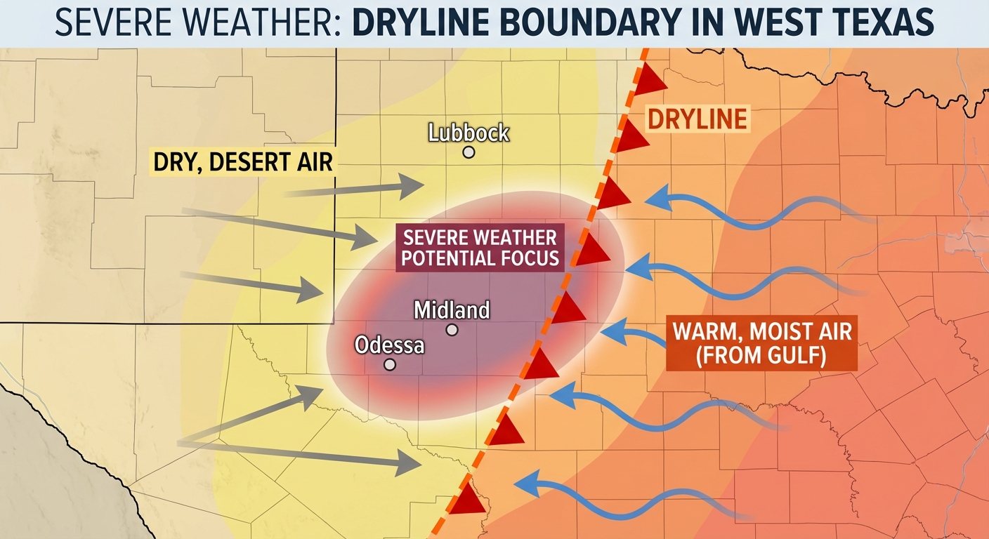
Saturday is the day that really has my attention for West Texas. The Storm Prediction Center has a Slight Risk outlined for the southern High Plains. That includes Lubbock, Odessa, and Midland. Dallas usually sees highs in the upper 70s this time of year, and we are right on target, but the moisture surging north across the state is what makes this setup juicy.
I know the Basin Red Dirt BBQ is happening in Midland on Saturday. If you are heading out to that festival, you need to have your weather app open. A surface trough is going to act as a focus for thunderstorm development as the afternoon heats up. The main threats are going to be isolated large hail and severe wind gusts.
Fire Danger in the Great Basin
I also want to mention the Great Basin. The pressure gradient is tightening up across Utah and western Colorado on Friday. We are expecting sustained southerly winds of 15 to 25 mph. Combine that with humidity dropping down near 10 percent, and we have elevated fire weather conditions. Please avoid burning brush or dragging trailer chains if you are in that area.
Key Items to Watch
- Sierra Nevada snow levels crashing from 9000 feet tonight down to 4000 feet by Sunday morning.
- Snowfall rates up to 3 inches per hour in the High Sierra on Saturday night.
- Large hail and severe wind gusts targeting West Texas on Saturday afternoon.
- Elevated fire danger for eastern Utah and western Colorado on Friday.
Bottom Line
The weekend brings two distinct hazards. If you are in the Sierra Nevada, prepare for heavy, travel-stopping snow. If you are in the southern High Plains, have a reliable way to get severe weather warnings before you head out to any outdoor events.
https://ryanhallyall.com/blog/heavy-sierra-snow-and-a-rowdy-west-texas-dryline