Blog Article
G3 Solar Storm and Severe Weather Threat: June 8 Forecast
A G3 geomagnetic storm brings aurora chances tonight, while Kansas faces softball-sized hail and the Dakotas brace for 75+ mph winds on Tuesday.

Hey Siri, Why Is The Sky Glowing? Solar Storms And Plains Supercells
Get this, y'all. Everyone is talking about Apple's big AI update today. Folks are scrolling through their feeds trying to figure out what their phones will be able to do next. But the most impressive display of power tonight is not coming from Cupertino. It is coming from 93 million miles away.
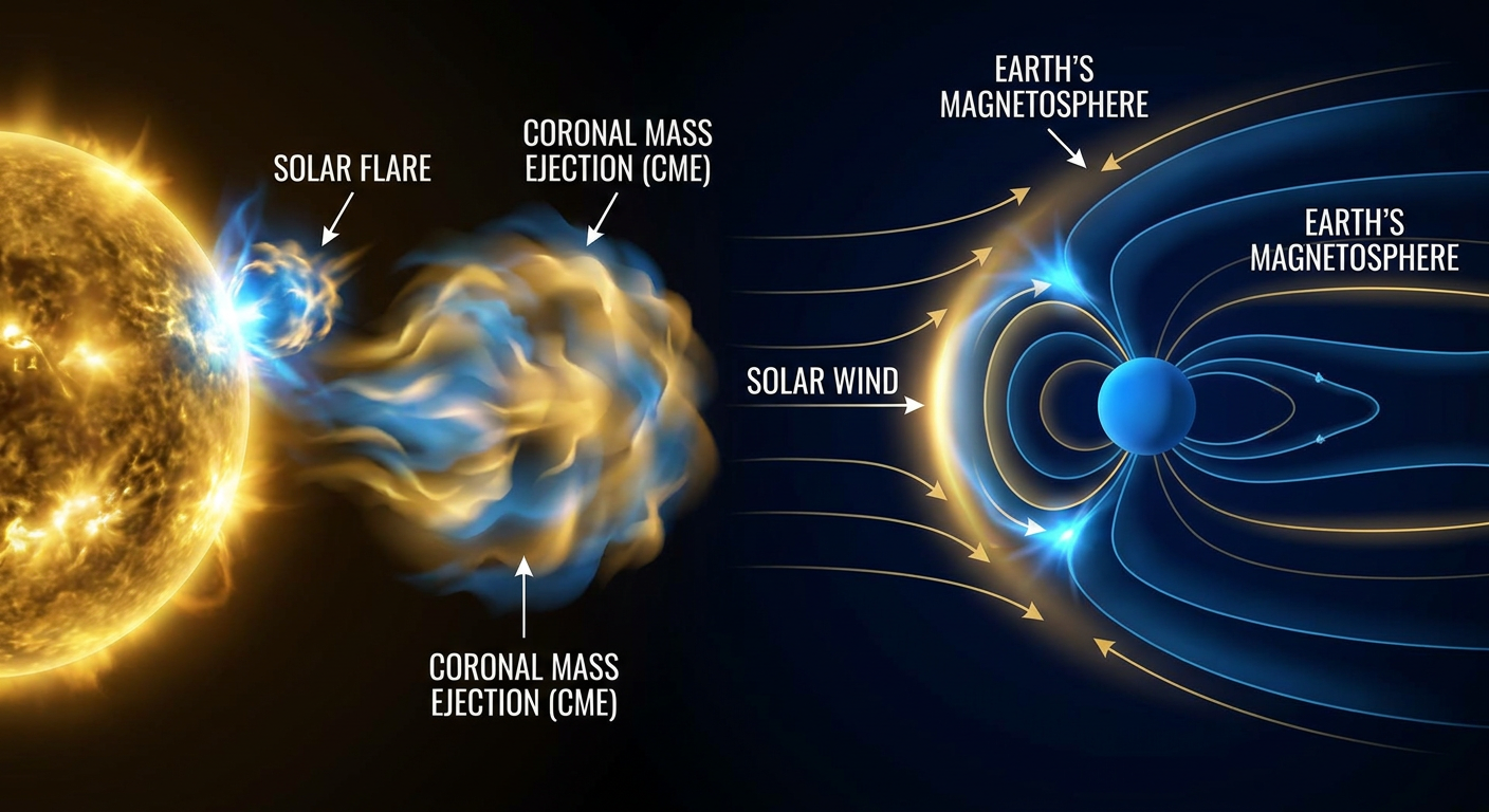
We have a G3 Strong geomagnetic storm hitting Earth right now. A coronal mass ejection left the sun on June 6, and it just arrived on our doorstep. That means if you live in the northern half of the country and the skies are clear, you might see the northern lights tonight. It is a great reminder that our whole planet is just a tiny speck in a very active solar system.
While the sun is acting up, the atmosphere down here is highly volatile. We have active severe weather threats from the Southern Plains all the way up to the Canadian border.
Giant Hail In Kansas Tonight
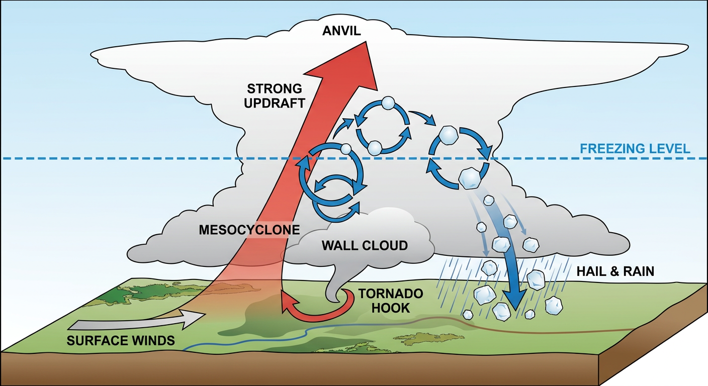
We have an Enhanced Risk for severe weather tonight across northeast Colorado and northern Kansas. The data shows a 15 percent hatched risk for hail. That means if a storm forms, it could drop hailstones up to 3.5 inches across. That is softball size, folks. There is also a 5 percent risk for tornadoes.
Normal high temperatures in Kansas City for early June sit right around 84 degrees. The heat and moisture we have in place right now are providing a massive amount of fuel for these updrafts. If you live near Topeka, Lawrence, or Manhattan, you need to be paying attention. This setup actually echoes June 11, 2008, when EF3 tornadoes hit Manhattan and Chapman during a really active month.
The Threat Shifts North On Tuesday
Things get more intense on Tuesday. The Storm Prediction Center has an Enhanced Risk over North Dakota, South Dakota, and northwest Minnesota. This one looks rough.
We are looking at a 45 percent hatched risk for widespread damaging winds. The strongest gusts could reach 75 mph or more. We also have a 10 percent hatched risk for tornadoes, meaning EF2 or stronger tornadoes are possible. Initial discrete supercells are forecast to transition into a high-end linear system. The 2010 Minnesota outbreak is the gold standard for this kind of setup, and the data is pointing in that direction again.
Tropical Trouble Down South
We are also watching the Eastern Pacific tonight. Tropical Storm Boris is spinning south of Mexico with 46 mph winds. It is bringing heavy flooding rains to portions of southern Mexico. Right behind it, Tropical Storm Cristina is moving slowly northward near the coast of Central America.
So before you go testing out those new AI features on your phone, make sure your weather radio has fresh batteries. Have a reliable way to get warnings tonight if you live in Kansas or Colorado. And if your skies are clear, step outside and look up. You might just catch a solar light show.
https://ryanhallyall.com/blog/hey-siri-why-is-the-sky-glowing-solar-storms-and-plains-supercells