Blog Article
Severe Storms & Giant Hail Threaten Southern Plains Weds
An Enhanced Risk of severe weather brings giant hail and tornado threats to Oklahoma, Texas, and Kansas tomorrow. Find out how this impacts your week.
High Gas Prices and Giant Hail Do Not Mix
Gas just crossed four dollars a gallon across the country for the first time in three years. We are all feeling that pinch at the pump. The absolute last thing you need right now is to pay an auto glass deductible because a rogue supercell decided to drop two-inch hail on your hood.
But here's the thing, y'all. That is exactly the threat we are looking at tomorrow across the Southern Plains.
I noticed "tornado watch vs warning" is spiking heavily on search trends today. That tells me folks are seeing the forecasts and getting prepared. Just to keep it simple, a watch means the ingredients are in the kitchen. A warning means the storm is actively cooking. Tomorrow afternoon, the atmospheric kitchen is fully stocked from Kansas down into Texas.
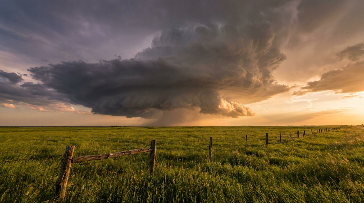
The Southern Plains Dryline Setup
The Storm Prediction Center has upgraded parts of western Oklahoma, western North Texas, and south-central Kansas to an Enhanced Risk for Wednesday. If you live in Wichita, Lawton, or Wichita Falls, you are right in the bullseye.
A potent upper-level wave is ejecting out of the Southwest. When it meets the dryline, the atmosphere is going to pop. We expect discrete supercells to form first. These lone-wolf storms carry a 30 percent probability of dropping massive hail. We are talking hailstones over two inches in diameter. They also carry a 5 percent tornado risk.
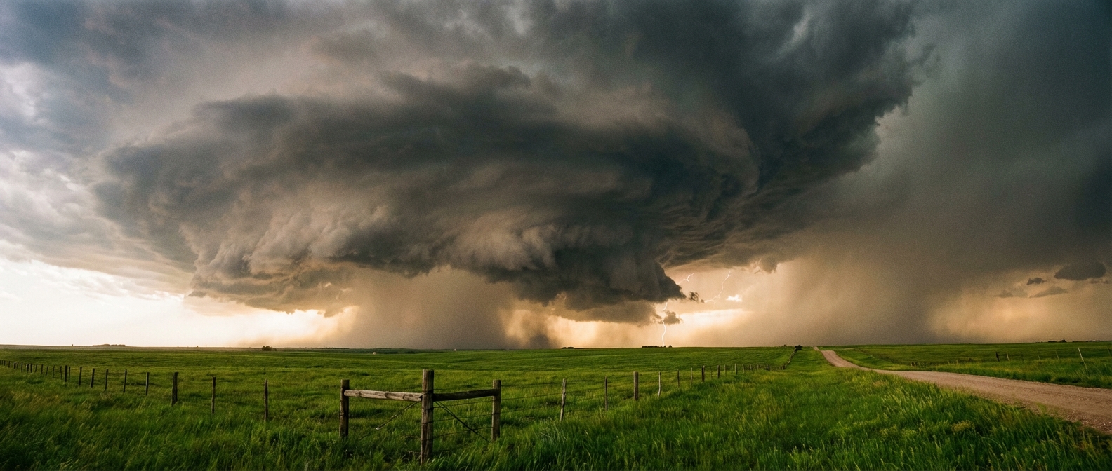
Average late March highs in Oklahoma City sit around 63 degrees. We have been running way above that lately, and that extra heat is just fuel for these storms. By tomorrow evening, those individual storms will likely merge into a fierce line, shifting the threat to damaging wind gusts as they march east.
Ice and Snow Up North
While the Plains deal with severe thunderstorms, the Northern Tier is staring down a major late-season winter storm. Heavy, wet snow is going to pile up across the Dakotas and northern Minnesota.
The bigger problem is the ice. A dangerous freezing rain event is setting up for Wisconsin and northern Michigan. The data shows the potential for a tenth to a half-inch of ice accumulation. That is enough weight to bring down tree limbs and snap power lines. If you have flights connecting through Minneapolis or Chicago tomorrow, expect some serious cascading delays.
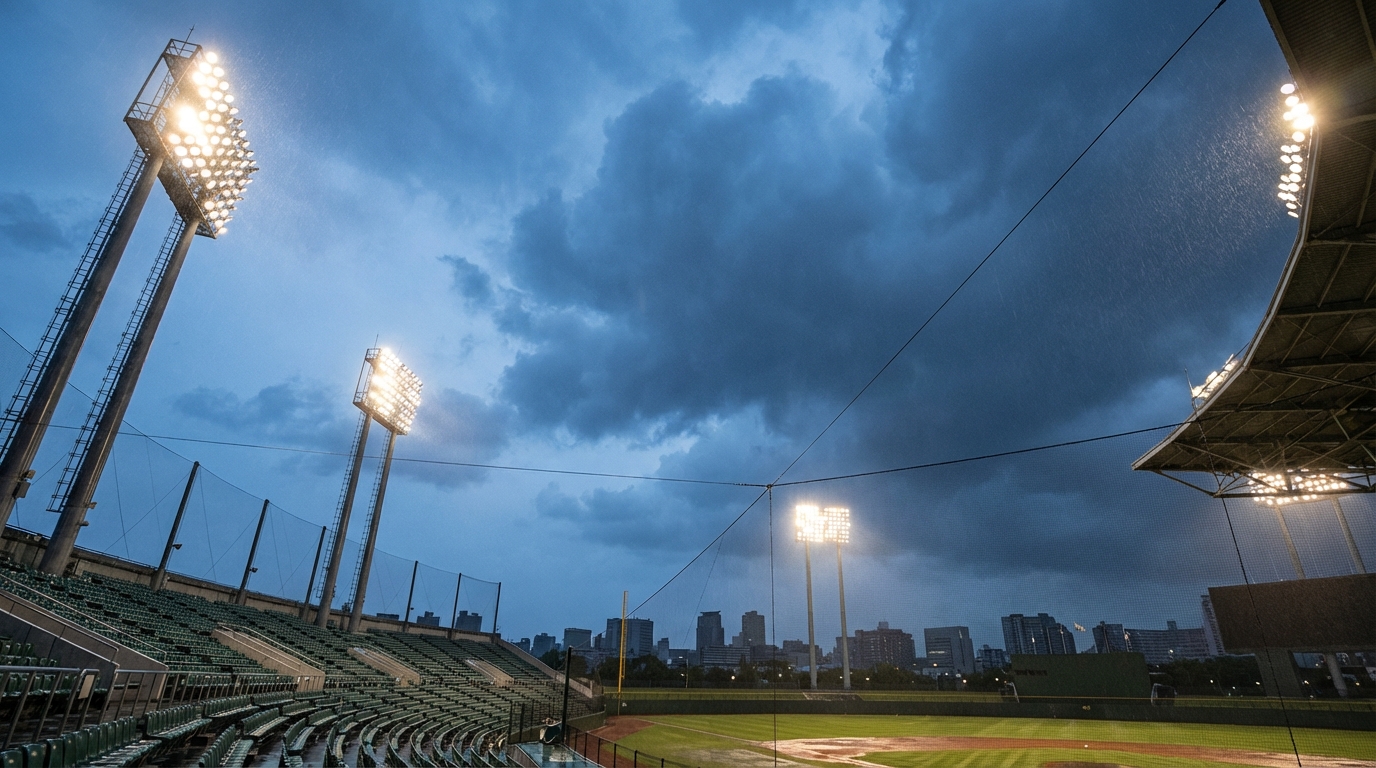
Tonight's Baseball Forecast
Before we even get to tomorrow, we have active weather tonight. The Mets are playing the Cardinals in St. Louis this evening. St. Louis is sitting right inside a Slight Risk area today. A cold front is slicing through the Mid-Mississippi Valley, bringing a 15 percent probability of damaging wind gusts and large hail. If you are heading to the ballpark or just commuting home around the Midwest, keep an eye on the radar.
Park the car in the garage tomorrow if you live in the Southern Plains. We will keep watching the data and updating you as these storms initiate.
https://ryanhallyall.com/blog/high-gas-prices-and-giant-hail-do-not-mix