Blog Article
Heat Dome Hits Fourth of July Weekend Forecast 2026
A heat dome is building over the central and eastern U.S. just in time for July 4th events, while wildfires turn deadly out West. Here's what it means for your plans.
Hot Dogs, Heat Domes, and the Fourth: What the Holiday Forecast Means for Your Plans
Alright folks, let's talk about the week everybody's already planning around. The Fourth of July lands on Saturday, and the whole country is gearing up. Nathan's Hot Dog Eating Contest in Brooklyn. The Peachtree Road Race in Atlanta with 50,000 runners. The National Independence Day Parade in DC. Cookouts in just about every backyard from here to the coast.
Here's the thing. The weather pattern setting up for that holiday stretch is going to be the uninvited guest at a whole lot of those parties. And its name is heat.
The heat dome is real, and the timing is rough
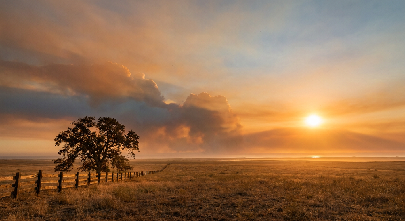
You've probably seen the headlines already. One that's trending right now puts it plainly: a heat dome could bring triple-digit temperatures to the Midwest and Eastern U.S. That's not hype. The Climate Prediction Center discussion backs it up. A persistent upper-level ridge is anchoring over the north-central part of the country, and it's going to drive a prolonged heat wave across the central and eastern states right through the holiday weekend, July 1 through 4.
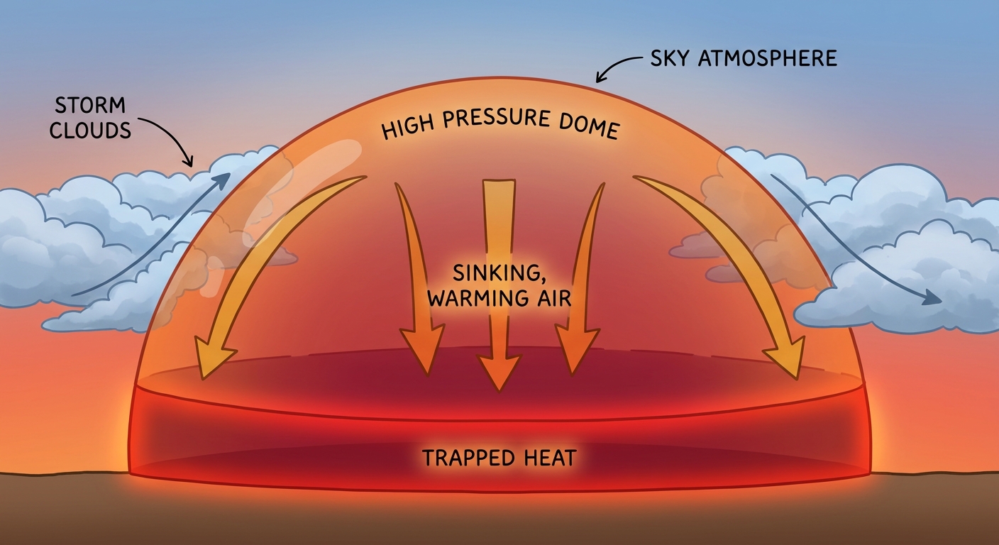
Let me explain what a heat dome actually is, because the term gets thrown around a lot.
Think of the atmosphere like a pot of water. A strong area of high pressure aloft acts like a lid. Air underneath it sinks, and sinking air warms up and dries out. That lid also blocks storm systems from rolling through to cool things off. So you get day after day of building heat, with the worst part being the humidity that comes along with it across the central and eastern states. Dewpoints in the low to mid 70s. That's the kind of sticky, oppressive air that makes 90 feel like 100-plus.
What this means for the big outdoor events
For the folks lining up at Nathan's in Brooklyn on the Fourth, New York's normal high in late June and early July is around 80 degrees. A heat dome can push that well above normal. If you're competing, watching, or just standing in that crowd on Coney Island, hydration is going to matter more than usual.
The Peachtree Road Race in Atlanta is its own animal. Running 6.2 miles in Georgia summer humidity is hard in a normal year. Add an amplified ridge overhead and you've got a real heat-stress situation for runners. Folks running it know to start hydrating days in advance, not the morning of.
And here's the under-the-radar piece. The forecast for that holiday window also keeps a recurring thunderstorm threat in play across the central and eastern states, the kind of pop-up storms that fire up in the afternoon heat. Translation for your cookout or your fireworks plans: keep an eye on the radar, because the afternoon and evening hours are when those storms are most likely to crash the party. Morning is your safer bet for outdoor activity.
The West Coast gets the good deal
Not everybody's stuck under the lid. The West Coast and the Intermountain West are the one part of the country sitting pretty through the holiday. A dry, stable airmass with dewpoints down in the low to mid 40s means comfortable conditions out there. Southern Oregon's Rogue and Umpqua valleys are actually scoring some of the best weather in the country right now.
If you're traveling for the Fourth, that geographic split is worth knowing. Comfortable and dry out West. Hot and humid with afternoon storm chances across the central and eastern states.
A hard reminder from the fire lines
I can't write about this week without slowing down for a moment. Three firefighters were killed on the Colorado-Utah border as wildfires intensified. That's the headline nobody wants to read, and it's the cost behind the fire weather numbers we've been tracking for days.
The Storm Prediction Center has had an extremely critical fire weather area up for southeastern Utah, southwestern Colorado, and the Four Corners region. We're talking relative humidity down around 10 to 15 percent, winds of 15 to 20 mph, and fuels that are bone dry. This is the fourth straight day of that setup. Southwest Colorado has a history with this exact kind of June pattern. The 416 Fire near Durango started June 1, 2018 and burned more than 54,000 acres. The Missionary Ridge Fire in the 2002 drought burned roughly 70,000 acres.
The people fighting these fires are out there in conditions most of us will never experience. When you're enjoying your holiday weekend, they're the reason to keep a thought handy.
Tonight's other notes
Closer to right now, the Storm Prediction Center has a Slight Risk for severe storms tonight across the Dakotas, with large to very large hail and severe winds the main concerns. That threat shifts and intensifies into the northern and central Plains and Upper Midwest on Monday, reaching the Minneapolis area, Sioux Falls, Fargo, and Duluth. A couple of tornadoes are possible near the warm front up in the Dakotas and Red River Valley. If you've got the Twins game or you're anywhere up that way Monday, that's the day to stay weather-aware.
There's also a low-end tropical note. The National Hurricane Center is watching a broad area of low pressure expected to form off the southeastern U.S. coast Monday or Tuesday. Development chances are low, just 20 percent over the next seven days, and conditions are expected to turn unfavorable by week's end. Nothing to lose sleep over, but worth a mention since we're in hurricane season.
The takeaway
The story of this holiday week is the heat dome, and it's going to shape conversations from the cookout to the starting line. If you're east of the Rockies, plan your outdoor time for the morning, drink more water than you think you need, and watch for those afternoon storms. If you're out West, you got lucky this round. And wherever you are, the three firefighters lost on the Colorado-Utah line are a reminder that this dry, hot pattern carries a real cost.