Blog Article
Hurricane Isaias: Pensacola Landfall Timeline and Impacts
Hurricane Isaias is strengthening and on track to hit near Pensacola Friday night. Full timeline, flood and tornado risks, and what to do now.
Hurricane Isaias Takes Aim at the Florida-Alabama Line: Here's the Timeline
Alright y'all, this is the day to get serious if you're anywhere near the northern Gulf Coast. Isaias became a hurricane overnight, and it's not done growing. The window to finish your prep is today. Not tomorrow.
Where Things Stand This Morning
As of the 4 AM advisory, Isaias is sitting about 170 miles northwest of Progreso, Mexico, with 80 mph winds and a pressure of 979 mb. Hurricane Hunters flying through it overnight found the storm still intensifying, and a NOAA P-3 is in there right now confirming that trend. This thing is moving ENE at 9 mph, and that track takes it straight toward the Alabama-Florida line.
The official NHC guidance has Isaias peaking somewhere near Category 2 strength, around 105 mph, before it gets close to shore. Some weakening is possible right at landfall, which is pretty typical, but don't let that soften how you're thinking about this. A strong Category 1 or low-end Category 2 hitting the coast is still a serious hurricane.
The Timeline That Matters
Here's the part you need to actually plan around:
- Today (Thursday): Tropical storm conditions begin arriving along the coast later today and tonight. This is your last full day to finish securing property, fueling up, and getting your supplies squared away.
- Friday: Winds build through the day. Hurricane conditions are expected to arrive along the immediate coast Friday night.
- Friday night into early Saturday: Landfall is expected near Pensacola, with the center crossing the coast somewhere between southern Alabama and the western Florida Panhandle.
- Saturday: Isaias weakens inland but drags heavy rain, gusty wind, and a tornado risk up into Alabama, Georgia, and the Southeast.
Hurricane Warnings stretch from the Mississippi coast to Mexico Beach, Florida, with the highest odds of hurricane-force wind sitting right around Pensacola and Dauphin Island, in the 10 to 30 percent range for sustained hurricane winds depending on location. Tropical Storm Warnings cover New Orleans down through Slidell and over into the Apalachicola to Tallahassee stretch.
A few specific spots worth watching closely:
- Pensacola, FL: 70-80% chance of tropical storm winds, 10-20% chance of hurricane winds, arrival as early as Friday afternoon
- Mobile, AL: 60-70% chance of tropical storm winds, arrival as early as Friday evening
- Dauphin Island, AL: 20-30% chance of hurricane winds, among the highest in this forecast
- Pascagoula, MS: 50-60% chance of tropical storm winds
- New Orleans to Slidell, LA: lower-end chance, up to 20%, of tropical storm winds
The Inland Threat: Rain and Tornadoes Behind the Storm
This isn't just a coastal story. As Isaias moves inland and starts merging with a shortwave trough over the Lower Mississippi Valley on Saturday, the wind field actually expands across a good chunk of the Southeast.
WPC has a Moderate risk of excessive rainfall for southern Alabama and the western Florida Panhandle on Friday into Saturday, the highest tier they issue outside of High. We're talking potential for localized totals up to 10 inches in spots. That's enough for serious flash flooding, especially in areas that have already taken on heavy rain this week.
SPC has a Slight Risk of severe weather posted for the Florida Panhandle, southern Alabama, and southwest Georgia on Friday, with a 5% tornado probability, meaning a few tornadoes are possible if storms fire up in Isaias's outer bands. That risk area grows on Saturday to cover much of western Georgia and eastern Alabama, including Atlanta, Birmingham, and Columbus, as the storm's remnant circulation tracks through.
This part of the setup should sound familiar if you've been following along this week. Florida and the Southeast have already dealt with multiple rounds of flooding rain, including that 9-inch dump near Havana, Florida, earlier this week and the coastal flooding in Charleston. Isaias is piling onto ground that's already saturated in places.
What's Happening With the Fair, the Festival, and Your Weekend Plans
The Alabama National Fair in Montgomery is running today, and Montgomery sits far enough inland that today should be fine, but Saturday's forecast (with Isaias's remnants sliding through) is worth watching if you've got plans there this weekend. Austin City Limits Weekend 2 kicks off Friday in Texas, and that's well clear of this system entirely, no impacts expected there. Same story for the Tulsa State Fair, which stays dry and clear of all this.
If you're along the coast from Louisiana to the Florida Panhandle though, this weekend is about hurricane prep, not festival plans. Flights through the Southeast are expected to see serious disruption by Day 4 of this outlook, with Southeast hubs facing hazardous wind and low visibility.
Elsewhere in the Tropics
Isaias isn't the only name on the board. In the Eastern Pacific, Tropical Storm Rachel is weakening as dry air eats into its structure, and it's forecast to stay well offshore, with only a light brush possible near San Quintín, Mexico this weekend. Tropical Storm Simon is a different story. It's expected to strengthen quickly, with NHC forecasting it could reach Category 4 strength near Puerto Vallarta by Saturday night. Mexico's Pacific coast from San Blas to Puerto Vallarta is under a Tropical Storm Watch, and that's one to watch if you've got travel plans to that part of Mexico this weekend. There's also an Invest near 92EP and a developing disturbance south of Guatemala that NHC is giving a 40% chance of development over the next week. None of that is a US concern right now.
A Quick Space Weather Note
SWPC is watching for a G1 to G2 geomagnetic storm Friday as a CME that left the sun on October 6th arrives. If you're in the northern tier and it's clear overnight Friday, there's a shot at some aurora. Nothing that affects power grids or daily life for most folks, just a nice bonus if the skies cooperate.
Key Factors We're Watching
- Whether Isaias continues to intensify today and tonight ahead of landfall
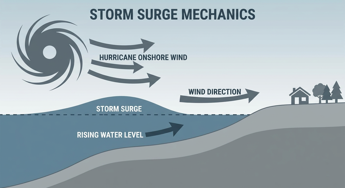
- The exact landfall point, since a shift of even 20-30 miles changes which communities see the worst surge and wind
- Storm surge heights along Mobile Bay and the Mississippi Sound
- How far the tornado and flash flood threat pushes into Alabama and Georgia on Saturday
- Rainfall totals in southern Alabama and the Florida Panhandle, where Moderate risk flooding is in play
Bottom Line
If you live anywhere between southeastern Louisiana and the Florida Panhandle, today is prep day. Finish securing property, know your evacuation route if you're in a surge zone, and have your supplies ready before winds pick up Friday. If you're farther inland in Alabama, Georgia, or the Southeast, Saturday is your day to watch closely for heavy rain and a tornado threat as Isaias's remnants push through. This storm has been intensifying steadily since Tuesday, and there's no sign of that stopping before it reaches the coast.