Blog Article
Hurricane Lowell Nears Kauai; Southeast Storm Risk Today
Hurricane Lowell threatens Kauai with a close pass Monday while the Southeast faces overlapping severe storm and flash flood risks today.

Hurricane Lowell Takes Aim West of Kauai While the Southeast Watches for Storms and Heavy Rain
Alright y'all, let's start where the biggest story is: out over the open Pacific, where Hurricane Lowell is still churning away southwest of Hawaii.
Lowell, Marie, and Karina: A Full House in the East Pacific
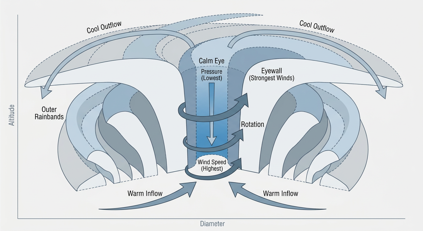
We've got three named systems out there right now, and Lowell is the one that matters most for the Hawaiian Islands. As of this morning it's a Category 3 hurricane with 127 mph winds and a pressure of 947 mb, sitting about 610 miles south-southwest of Kauai and creeping northwest at just 5 mph. NOAA's Hurricane Hunters are literally inside it right now, with a recon fix this morning showing 53 knot flight-level winds and a pressure near 1000 mb as they sample the storm's structure.
Here's the thing though. Lowell isn't forecast to make landfall anywhere. The official track has it passing well west of Kauai late Monday into early Tuesday, with the closest approach putting the center about 67 kilometers from Kauai's south shore. By that point, the forecast has Lowell down to roughly 93 mph, so it'll have lost some punch, but it's still going to be close enough that Tropical Storm Watches are up for Kauai County and the surrounding waters. Rainfall on Kauai could run 4 to 8 inches with isolated totals over a foot, and that's the kind of number that causes flash flooding and mudslides on steep island terrain regardless of whether the center comes ashore. Dangerous surf, rip currents, and some coastal flooding are all in play too.
Marie, the second hurricane in this trio, is a Category 1 with 92 mph winds sitting way out west of Baja California. It's forecast to start weakening later today and there are no coastal watches or warnings anywhere near it. Tropical Storm Karina, the weakest of the three at 58 mph, is running out of gas thanks to shear, dry air, and cooler water, and NHC expects it to become a post-tropical low within a day or two. Karina's closest pass to the islands brings it near Maui's east coast, but by then it's forecast to be down around 25 mph, basically just a spinning remnant. Kauai and Oahu get an "aware" level flag from it, nothing more.
Severe Weather Slides Into the Southern Appalachians and Savannah River Valley
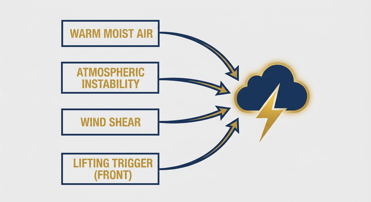
Back on the mainland, SPC has a Slight Risk posted today for a corridor running from the Southern Appalachians down through the Savannah River Valley, which covers Charlotte, Atlanta, Charleston, Savannah, and Columbia. That's a step down in coverage compared to Friday and Saturday's rounds of storms, but the threat is real. The setup favors widely scattered damaging wind gusts through the afternoon and evening, with hail up to quarter size possible if a few storms manage to organize. This comes right on the heels of a rough 24 hours for the Carolinas, where storms produced a 72 mph gust at Fayetteville Regional Airport and 2 inch hail in Johnston County, plus a tornado warning down in Brevard County, Florida. Today's setup isn't expected to be quite that intense, but if you're headed to a Sunday cookout or outdoor gathering anywhere in that Atlanta-to-Charlotte-to-Charleston stretch, keep half an eye on the sky in the afternoon.
A separate Slight Risk pocket sits over western and central Montana today for large hail, and a broad Marginal Risk stretches from Jacksonville and Denver up through Kansas City and Omaha. If you've got tickets to the Rockies game in Denver tonight, that's inside the Marginal zone, and the Front Range has a track record this year of spinning up hail-producing storms on hot late-summer afternoons.
Rain Piling Up in the Same Southeast Corridor
Here's where it gets interesting. WPC also has a Slight Risk for excessive rainfall today, and it overlaps almost exactly with the SPC severe risk in the Southeast. High precipitable water values and strong instability mean any storms that fire this afternoon could dump rain fast enough to cause localized flash flooding on top of the wind and hail threat. There's a second Slight Risk area today for the mid-Missouri River Valley, covering southeastern South Dakota, far western Iowa, and the northwest corner of the region, where a separate batch of storms is expected.
This fits the pattern we've seen all week. Yesterday alone brought flash flooding to Logan County, Ohio, where 3.5 to 4.5 inches of rain flooded roads and homes in Bellefontaine, plus urban flooding in Mitchell, South Dakota. The ground is primed, and any slow-moving cell today can repeat that story in a new location.
Where Today Actually Looks Great
Not everybody's dealing with storms today. If you're at the Michigan Renaissance Festival in Holly, the Ohio Renaissance Festival in Waynesville, or the Renaissance Festival in Shakopee, Minnesota, you landed on a good weekend. High pressure has scoured out the humidity across the Great Lakes and Ohio Valley behind the front that fired up all that severe weather the last few days, and today's the payoff with low dewpoints and clear skies. Same story for anyone catching Wisconsin at Notre Dame tonight in Green Bay.
Meanwhile in the Southeast, September's climatological norms have Atlanta running a high near 83 and Charlotte near 82, so any storms that fire today are doing it in typical late-summer heat and humidity, not some unusual heat spike. That warmth and moisture combo is exactly the fuel severe storms and heavy rain both feed on this time of year.
What We're Watching
- Hurricane Lowell's exact track and intensity as it closes in on its closest approach to Kauai late Monday
- Whether Karina fully transitions to a post-tropical low before it gets anywhere near the islands
- Storm mode in the Southeast today: scattered cells with isolated wind and hail, or something more organized
- Overlapping severe and flash flood risk in the same Southeast corridor through this evening
- Denver-area storms tonight given the Marginal severe risk over northeast Colorado
- A Slight Risk for northern Montana's excessive rainfall setup tomorrow, plus a Marginal severe risk building across the Dakotas and Minnesota Monday
Bottom Line
If you're on Kauai, today's the day to finish storm prep. Lowell isn't making landfall, but a close pass by a hurricane still means tropical storm conditions, dangerous surf, and heavy rain are likely starting Monday. On the mainland, folks from Atlanta to Charlotte to Charleston should have half an eye on the radar this afternoon for pop-up storms capable of wind gusts and localized flooding. Everybody else, especially around the Great Lakes and Ohio Valley, is sitting under a genuinely nice September sky today. Enjoy it while it lasts.