Blog Article
Hurricane Polo Nears Baja, Southwest Flash Flood Risk Rises
Hurricane Polo threatens Baja California Sur as its moisture sets up a Moderate flash flood risk in the Southwest. Plus Nolo, the nor'easter, and more.
Hurricane Polo Aims at Baja California Sur While Its Moisture Sets Up a Southwest Flash Flood Threat
Alright y'all, we've got a genuinely busy tropical map this morning, and the ripple effects reach a lot farther than the storms themselves. Let's get into it.
Hurricane Polo: A Strong Cat 3 Closing In on Baja
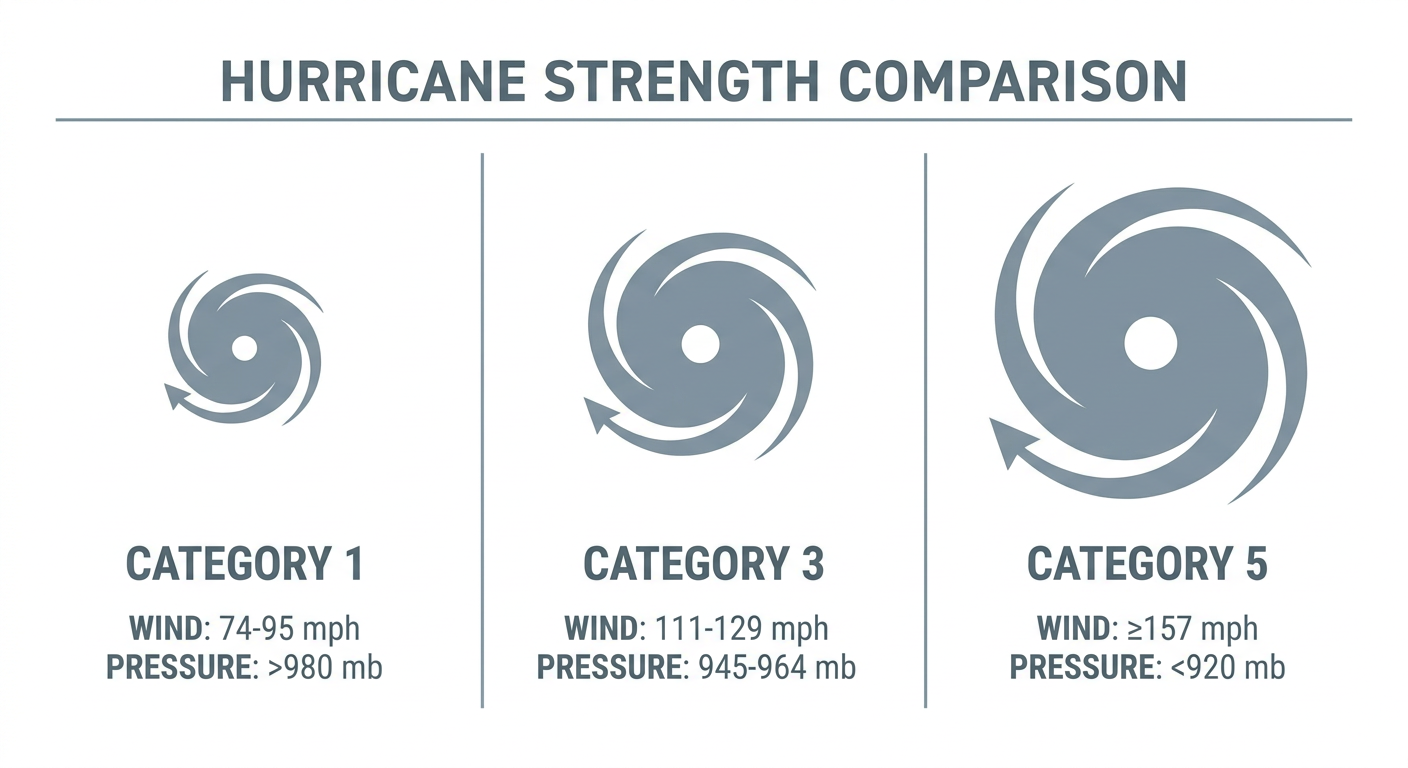
Hurricane Polo is sitting about 300 miles southwest of Cabo San Lucas early this morning, packing 121 mph winds and a 952 mb central pressure. That's a strong Category 3, and NHC's overnight bulletin says preparations should be "rushed to completion" across Baja California Sur. Polo is creeping NNW at 10 mph, and our impact model has Loreto and Santa Rosalía in the highest "action" tier, with the storm expected to pass within roughly 35 to 80 miles of those towns in about two days. Guaymas and Hermosillo over on the Sonora mainland are one notch down, in "prepare" mode, as Polo's wind field and moisture plume reach across the Gulf of California.
Landfall guidance points toward the Loreto area late Monday night into early Tuesday, right around 39 hours from now. Forecasters note the satellite presentation has held remarkably steady, with hints of an eye still visible, so there's no strong signal of rapid weakening before it gets to the coast.
The Bigger Concern: Polo's Moisture Floods the Desert Southwest
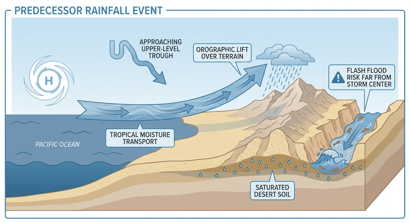
Here's the thing about a hurricane crossing Baja. The wind and surge damage stays fairly local. But the moisture plume doesn't. WPC has already pulled the trigger on a Moderate risk of excessive rainfall for Monday across the Four Corners, and that risk holds into Tuesday as it spreads into the southern High Plains.
The setup is what forecasters call a predecessor rainfall event, or PRE. Basically, deep tropical moisture gets pulled north and northeast ahead of Polo by an approaching upper-level trough, well before the storm's center ever gets close. That means places like eastern Arizona, western and central New Mexico, southern Utah, and southwestern Colorado can see life-threatening flash flooding without a hurricane in sight. Burn scars, slot canyons, arroyos, and desert washes are the areas to watch, and our AI-generated outlook specifically flags this as the top national concern for Monday, ahead of the coastal flooding, ahead of the hurricanes themselves.
If you've got plans in Flagstaff, Sedona, the Mogollon Rim, or Capitol Reef and Glen Canyon country in Utah, Monday and Tuesday are not the days to be down in a canyon or crossing a normally-dry wash. This is the same kind of setup that dropped considerable-tag flash flood warnings across Coconino and Yavapai counties back on September 13, when monsoon storms hit Havasupai Creek and Antelope Canyon. This week's threat is broader and driven by a much bigger moisture source.
Hurricane Nolo Still Grinding Away South of Hawaii
Hurricane Nolo is a Category 2 with 98 mph winds, sitting about 200 miles south-southwest of South Point on the Big Island and creeping west at just 9 mph. It's actually gaining a little strength, with forecasters noting the eye is becoming better defined. Hawaii Island's south shore stays in "prepare" status, and Kauai's south shore picks up that same level by Tuesday as Nolo's wind field expands. Gusty trade winds, heavy rain, and large waves are continuing across the islands, and reconnaissance aircraft have been flying repeated missions to keep tabs on the core. This is on the heels of Hurricane Lowell's pass by Kauai earlier this month, so island residents have already had one round of this in September.
Odalys Fading, Fay and Eighteen-E No Immediate Threat
Further out to sea, Hurricane Odalys is rapidly weakening, still technically a low-end Category 1 at 75 mph but losing organization fast, about 865 miles west of the Baja tip with no coastal watches posted. Tropical Depression Fay is way out in the central Atlantic, moving south, and poses no threat to land. And south of Acapulco, Tropical Depression Eighteen-E just organized overnight; it's forecast to eventually approach the southern Baja peninsula, but that's roughly eight days out, so treat it as something to watch, not something to plan around yet.
Closer to Home: A Lingering Nor'easter and a Plains Hail Risk
That slow-moving nor'easter parked off the Mid-Atlantic coast hasn't left. WPC has a Slight risk of excessive rainfall today for New Jersey, southern New York, and southern into central New England, as northerly flow keeps funneling moisture onshore. If you're headed to the Big E in West Springfield, Massachusetts today, keep an umbrella handy and check for lingering coastal showers. Folks heading to All Things Go in Columbia, Maryland, look to be far enough from the coastal core that today should stay in decent shape.
Meanwhile SPC has a Marginal risk of severe storms today for the central and northern High Plains, mainly western Nebraska and the Black Hills of South Dakota, where isolated storms could produce large hail. Nothing widespread, just something for Rapid City and Alliance-area folks to keep an eye on this afternoon.
The Best Weather Today Is, Ironically, in the Middle of the Country
With all that tropical chaos on the coasts, the nicest weather in the country today sits over the central Great Lakes and Ohio Valley: clear skies, bone-dry air, light wind. That's genuinely good timing for the Michigan Renaissance Festival in Holly, the Ohio Renaissance Festival in Waynesville, and the Pittsburgh Renaissance Festival in West Newton, all running today. If you've got tickets, this is about as good as fall festival weather gets.
What We're Watching
- Hurricane Polo's exact landfall point near Loreto, Baja California Sur, expected late Monday night into Tuesday
- The Moderate excessive rainfall risk sliding from the Four Corners on Monday into the southern High Plains on Tuesday
- Hurricane Nolo's slow westward crawl and whether it strengthens further before its closest pass by Kauai
- The lingering Northeast nor'easter and any additional coastal flooding through Monday
- Two additional Pacific disturbances (EP-AREA-2 and EP-AREA-3) both carrying high development odds behind Polo and Odalys
Bottom Line
If you're in Baja California Sur or along the Sonora coast, Polo is a real hurricane threat arriving late Monday night, and preparations need to be done today. If you're anywhere from eastern Arizona through New Mexico into southern Utah and southwestern Colorado, the real danger isn't the hurricane itself, it's the flash flooding tied to its moisture starting Monday. Stay out of canyons, washes, and burn scars through midweek. Hawaii stays in a prepare posture with Nolo offshore, the Northeast keeps dealing with a stubborn nor'easter, and if you want the calmest, prettiest day in the country, the Ohio Valley and Great Lakes are your spot today.