Blog Article
Hurricane Polo Nears Cat 5 as NM Faces Flood Risk
Hurricane Polo is rapidly intensifying off Mexico while New Mexico and West Texas face a Moderate Risk of excessive rainfall and flash flooding through midweek.
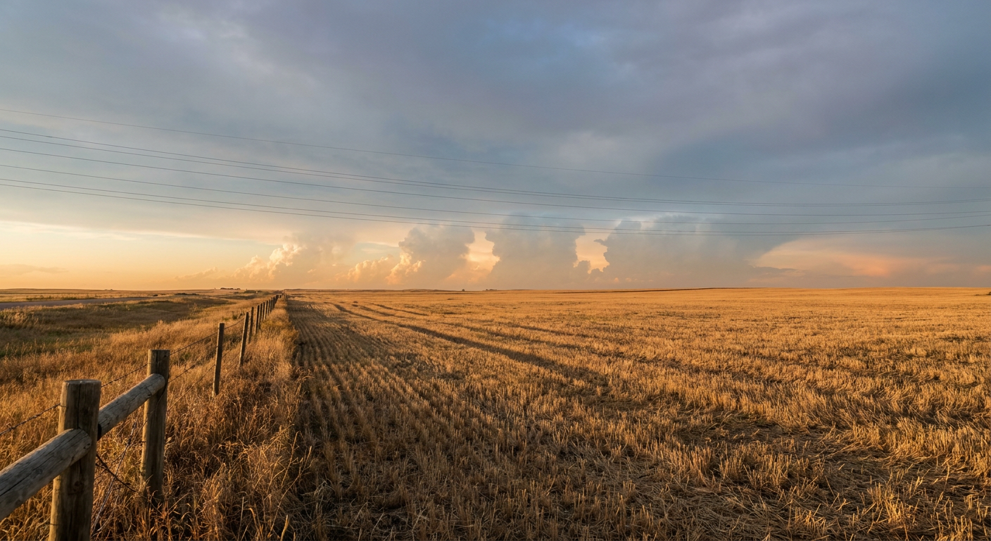
Hurricane Polo Closes In On Category 5 Off Mexico, While New Mexico Braces For a Multi-Day Flood Threat
Alright y'all, we've got a busy morning board, so let's get right to it. The big story is out in the East Pacific, where Hurricane Polo is doing something you don't see every day, intensifying at a genuinely impressive clip and knocking on the door of Category 5 strength. Closer to home, New Mexico and far West Texas are dealing with a serious multi-day flood setup that deserves just as much of your attention.
Hurricane Polo: Rapid Intensification in Real Time
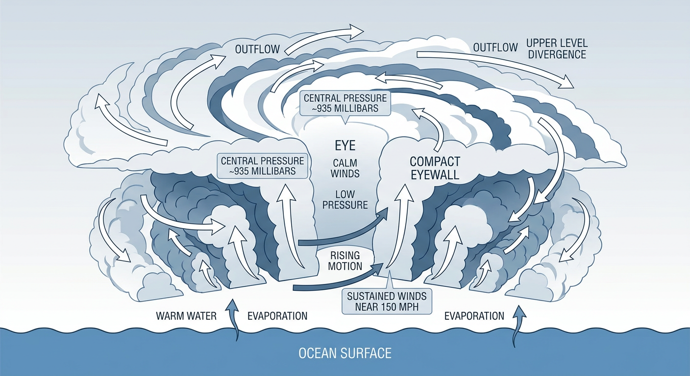
As of the 5 AM advisory, Polo is sitting a few hundred miles south-southeast of Manzanillo, Mexico, with maximum sustained winds of 150 mph and a central pressure down to 935 millibars. That's a legitimate Category 4 hurricane, and NHC's forecast discussion says it's "closing in on category 5 strength." The eye is compact and well-defined, wrapped in an intense eyewall, and the intensification rate over the past day has been remarkable.
Here's the good news for anyone worried about a US impact: Polo is not forecast to make landfall. NHC's official track keeps the center offshore, with the closest approach to the Mexican coast still more than 100 hours out and roughly 31 kilometers of separation from land near the southern Baja peninsula late Saturday. By that point the model guidance has Polo weakening to around 110 mph as it moves over cooler water and into a less favorable environment.
That doesn't mean nobody feels it. Coastal Mexico, from Zihuatanejo up through Lázaro Cárdenas, Manzanillo, Acapulco, and Puerto Vallarta, is in the direct path of dangerous surf, rip currents, and heavy squally weather even without a direct hit. The RHY impact model has several of those cities flagged at "action" level given how close Polo is expected to swing by.
Polo isn't traveling alone out there either. Tropical Storm Odalys, well southwest of the Baja coast, is forecast to become a hurricane later today, though NHC's projected track keeps it well offshore too, with any closest approach to Baja California still more than four days away. And way out in the open Atlantic, Tropical Storm Fay is on its last legs as a tropical system, expected to transition to post-tropical later today southwest of the Azores. None of these three systems have a US landfall threat on the board right now.
New Mexico's Turn: A Multi-Day Flood Threat
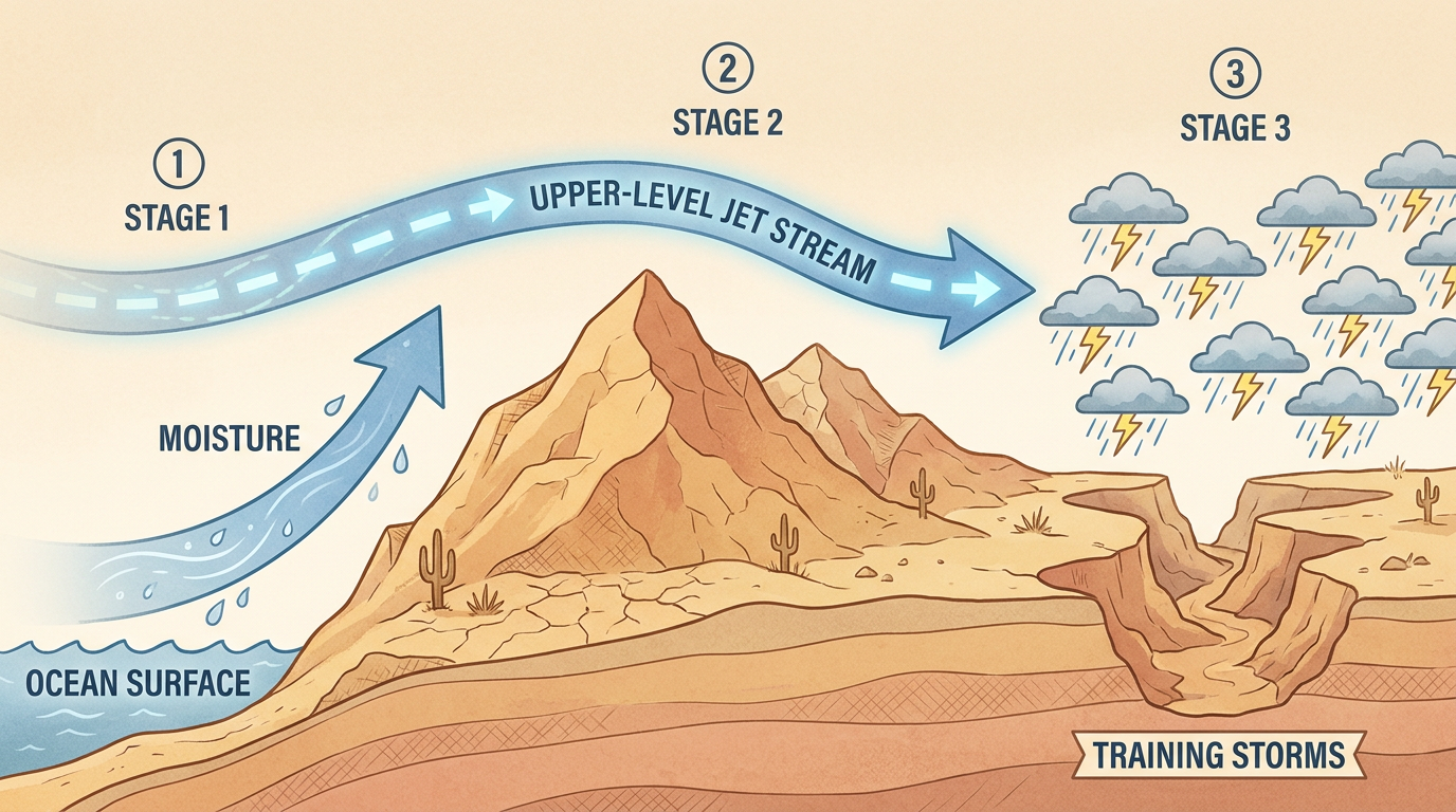
While the tropics are churning out west, the more immediate hometown concern is a genuinely dangerous flash flood setup building over New Mexico and West Texas. WPC has posted a Moderate Risk of excessive rainfall for Day 1 (today) across southern New Mexico, and that Moderate Risk holds, and even shifts, into Day 2 across central and eastern New Mexico as well.
Here's the ingredient list. An upper level trough is approaching from the west and strengthening the upper jet, which keeps the region parked in the favorable right entrance region for lift. At the same time, deep southerly flow is hauling in tropical moisture, and precipitable water values are running near record levels for this time of year. Put that together and you get the recipe for training thunderstorms, meaning storm after storm rolling over the same areas.
That's a flash flood forecaster's least favorite phrase. WPC's own discussion calls this a "potentially high impact multi-day heavy rainfall event," and the AI-assisted outlook for Wednesday backs that up, flagging localized 3 to 5 inch rainfall totals, debris flows, and mudslides as real possibilities, especially around the Sacramento Mountains and other burn scar terrain where soil can't soak up water fast enough.
By Thursday (Day 3), the strongest forcing shifts north into Colorado and the central Plains, and the risk over New Mexico eases to Slight. But daytime destabilization is actually expected to increase behind the departing system, so this isn't a clean break, just a step down in intensity.
Our AFD-based recommendations point straight at the National Weather Service offices in Albuquerque, El Paso, and Midland/Odessa as the ones to watch closest, since they sit right under the bullseye of this Moderate Risk corridor. If you've got low-water crossings, arroyos, or burn scar drainages anywhere near your daily routine in that stretch, today and tomorrow are the days to have an alternate route in your back pocket.
The Rest of the Board: Marginal Severe and a Quiet Sky Overhead
SPC has a Marginal Risk of severe thunderstorms up today across parts of the Southeast, stretching from around Charlotte and Atlanta down through Huntsville and Birmingham, plus a separate pocket near Salt Lake City. A cold front sliding south into the Southeast is the trigger. This is not a big severe setup, we're talking isolated damaging wind gusts and maybe some quarter-size hail if a storm or two manages to get organized, both capped at the lowest SPC probability tier. Have the weather app handy, but there's no need to rearrange your day over this one.
Up in space, NOAA's SWPC is calling for mostly quiet geomagnetic conditions today, with a coronal hole high-speed stream expected to nudge things toward unsettled by late Wednesday into Thursday. The bigger geomagnetic storm potential, a G1 (Minor) watch with a peak Kp of 5, sits out on September 25. That's aurora-chaser territory for the far northern US, nothing that affects your daily forecast.
And if you're just looking for a nice day outside, today's best weather sits under building high pressure across the northern Plains, Upper Midwest, northern Rockies, and northern New England, where clear skies and light winds are producing some genuinely beautiful conditions, even if cool mid-60s highs keep it just short of perfect. Farther south and east, clouds and a lingering frontal boundary are the limiting factors.
Key Factors We're Watching
- Hurricane Polo's peak intensity. Reconnaissance aircraft are scheduled to investigate later today, which should firm up whether Polo actually reaches Category 5.
- New Mexico's rainfall totals over the next 48 hours. Training storms over the same burn scars and canyons are the main flash flood driver.
- The Southeast cold front today. Marginal severe risk, mainly wind and small hail, from Charlotte to Birmingham.
- Odalys becoming a hurricane later today or tonight, though it stays well offshore of Baja California.
- The coronal hole stream arriving late Wednesday, which nudges geomagnetic activity from quiet to unsettled but stays well below any major storm threshold outside the September 25 window.
Bottom Line
If you're anywhere near coastal Mexico from Manzanillo down through Acapulco, keep tabs on Hurricane Polo even though it's forecast to stay offshore, because dangerous surf and squally weather don't need a landfall to cause problems. Here in the US, the real actionable item today is New Mexico and far West Texas. If you live in or are traveling through that Moderate Risk zone, especially near mountain terrain, arroyos, or recent burn scars, plan for the possibility of sudden road closures and avoid low-water crossings during and after any storm. Everybody else, today's a pretty ordinary late-September day, with just a marginal severe threat in the Southeast and a gorgeous stretch of early fall weather up north.