Blog Article
Hurricane Simon vs. Plains Severe Weather: Oct 12 Forecast
Hurricane Simon stalls off Mexico as SPC flags a Slight Risk for severe storms Tuesday across Kansas, Missouri, and the lower Missouri Valley, with flash flooding to follow.
Hurricane Simon Lingers Off Mexico While the Plains Brace for Tuesday's Severe Threat
Alright y'all, Monday morning here on October 12, and we've got a layered setup to walk through today: a major hurricane that's stubbornly camped off Mexico's Pacific coast, a Plains severe weather day shaping up for Tuesday that's a direct sequel to the rough stretch we just saw in the Carolinas, and a flooding threat that's basically going to follow that same severe weather corridor east through the week.
Hurricane Simon Isn't Going Anywhere Fast
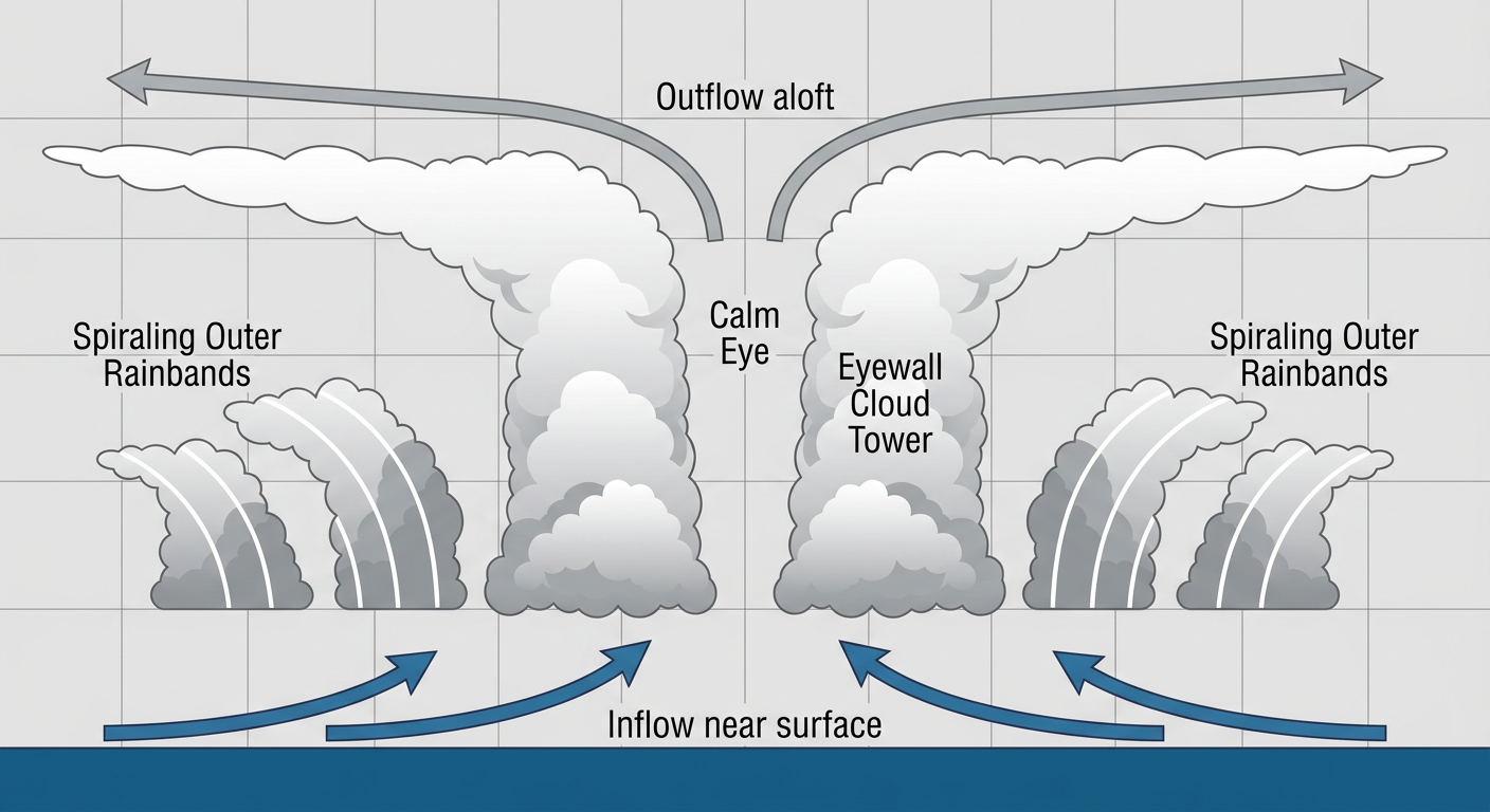
Let's start with the big offshore story. Hurricane Simon is sitting about 145 miles northwest of Manzanillo and 50 miles southwest of Cabo Corrientes this morning, packing 115 mph winds as a Category 3 hurricane with a central pressure of 958 millibars. Here's the thing about Simon: it's basically parked. The storm is drifting northwest at only 5 mph, which means it's had days to grind up dangerous surf, flooding rain, and destructive wind along the same stretch of coastline.
NHC's forecast discussion this morning notes the eye has filled in and the cloud pattern has degraded a touch, so Simon has nudged down slightly in intensity. That's a small mercy, but a Cat 3 hurricane crawling along a coastline for days is still a serious situation for the people living there.
Mexico has Hurricane Warnings up from San Blas to Manzanillo, and a Hurricane Watch covers Mazatlan, where Simon's center is forecast to approach by early Thursday morning. Puerto Vallarta, San Blas, and Manzanillo are all in the highest-priority tier right now, meaning preparations there needed to be wrapped up by Monday morning. Mazatlan has a bit more runway, with impacts possibly starting as early as Tuesday afternoon, more likely Tuesday night.
This storm has no direct US impacts on the table. But after the week we've had, with Isaias hitting the Florida Panhandle and Hurricane Nolo crossing into the Western Pacific, it's worth keeping an eye on just because the eastern Pacific has been unusually busy this month.
What's Behind Simon: A Pacific System Worth Watching
There's a second player out there too. Invest 93EP, a broad area of low pressure several hundred miles south of Guatemala, has become better organized over the last day, and NHC's outlook gives it a 60 percent chance of development in the next two days and a 90 percent chance over the next week. That's a high-confidence call for eventual development, even if it's too early to talk tracks or US relevance. We'll keep watching it as it organizes.
Meanwhile, over in the Atlantic, there's a sloppy, disorganized area of low pressure west of the Cabo Verde Islands. NHC only gives that one a 20 percent chance of development through the next week, and it's far enough out to sea that it isn't a concern for anybody reading this.
Tuesday's Real Concern: Severe Storms From Kansas to the Lower Missouri Valley
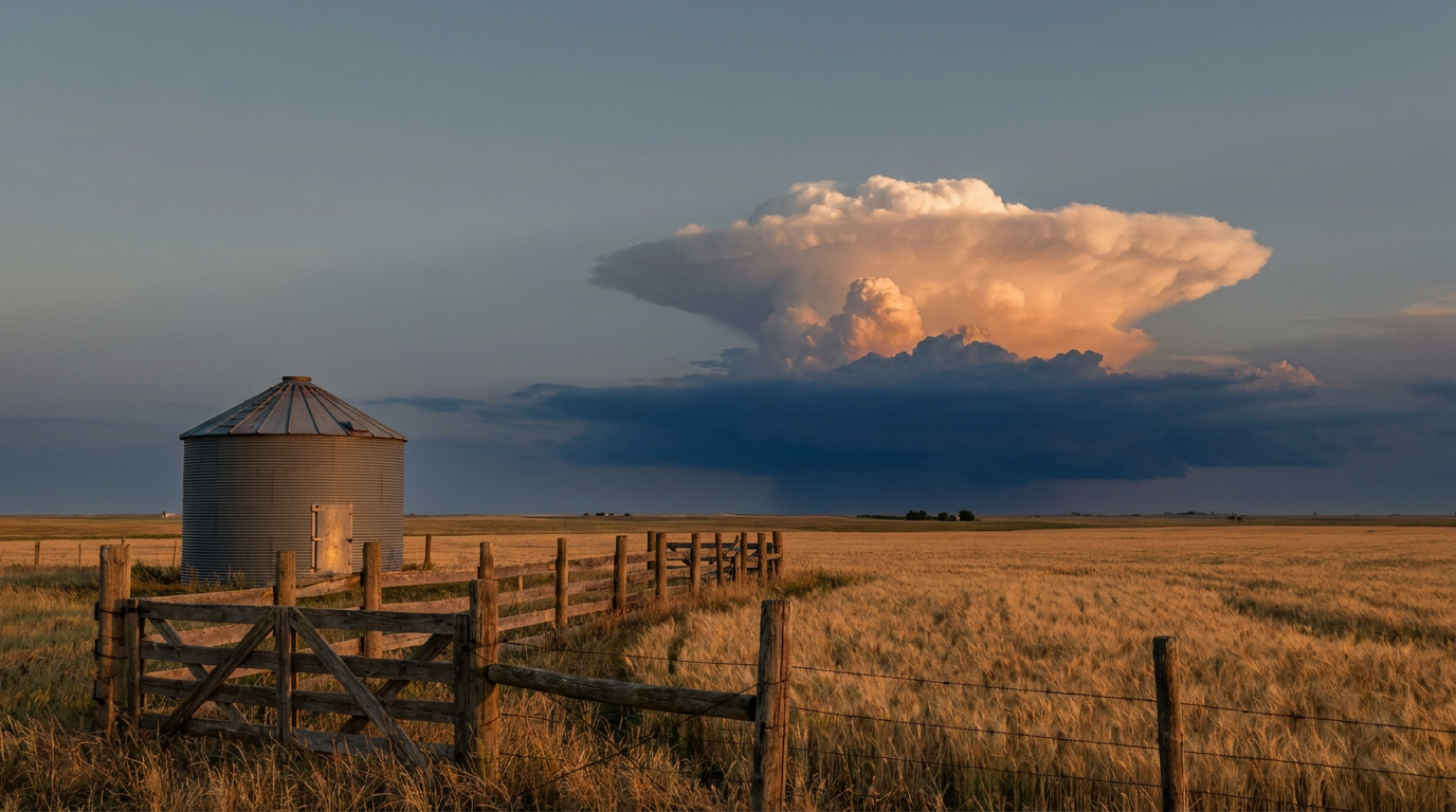
Now here's the part that actually affects a lot of y'all directly. SPC has a Slight Risk posted for Tuesday afternoon and night across the central and southern Plains into the lower Missouri Valley. That includes Kansas City, Wichita, Topeka, and a good chunk of central Kansas, with roughly 3.7 million people inside that Slight Risk zone. A much broader Marginal Risk wraps around it, stretching from Lubbock and Midland in Texas all the way to Rochester and Syracuse in New York, covering more than 8 million more people.
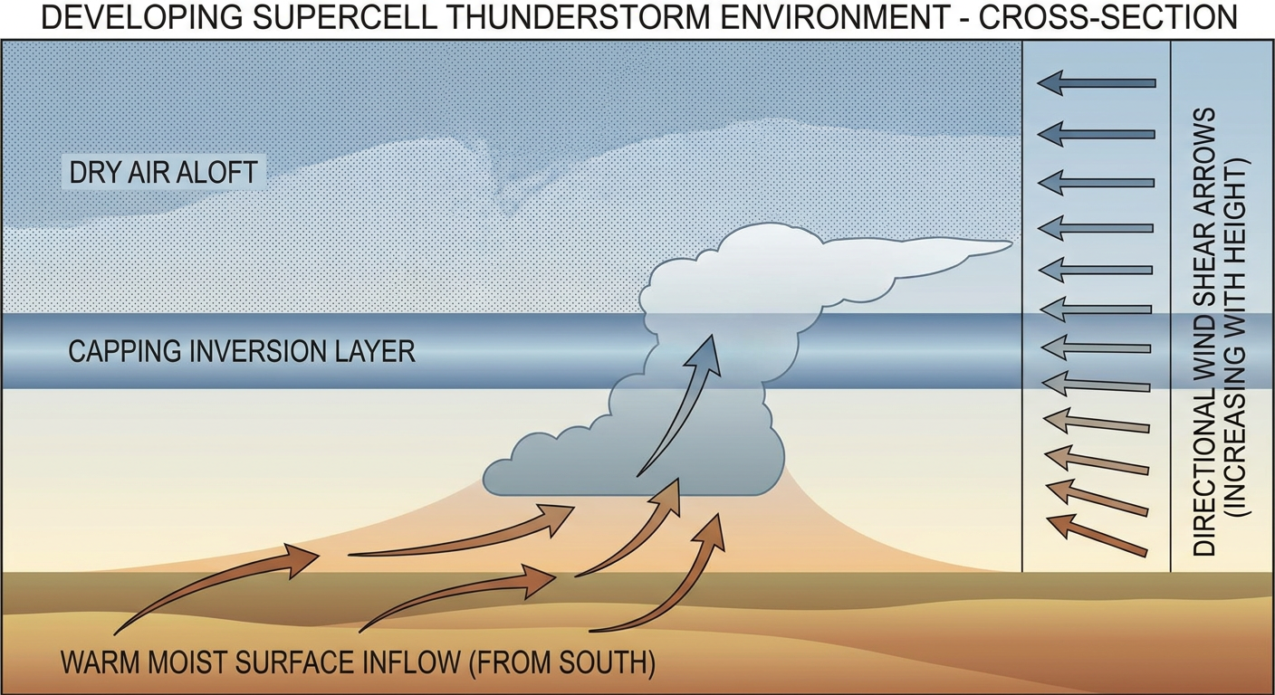
The setup, per the forecast offices watching it closest: an upper low digs into the region, and a southerly low-level jet pulls up moist air that supports 1,000 to 2,000 J/kg of instability with 40 to 50 knot deep-layer shear. That's a recipe for discrete supercells before storms start clustering and trending linear. SPC's probabilities put the wind and hail threat at the Level 2 scattered tier, meaning 60 mph-plus gusts and quarter-size or larger hail are both realistic outcomes if storms fire as expected. There's also a 2 percent tornado probability, which SPC labels an isolated tornado threat. It's not a tornado outbreak signal like we saw over the weekend across North Carolina, but it's not zero either, especially if discrete cells hold together ahead of the main line.
If you've got outdoor plans Tuesday afternoon or evening in Wichita, Topeka, or the greater Kansas City area, that's your heads up. Keep a way to get severe weather alerts, and don't be shocked if storms interrupt evening commutes.
Wednesday's Round Two, and the Flooding Risk Underneath It All
The Plains aren't done after Tuesday. SPC has a Marginal Risk posted for Wednesday across Oklahoma City, Tulsa, Wichita again, Lubbock, and Amarillo, as another vorticity max pivots through an upper low forecast to sit over Colorado by midweek. The Permian Basin in west Texas gets its own separate round, with a dryline and surface trough interaction plus a strong upper jet supporting isolated large hail and damaging wind Tuesday night into Wednesday.
Layer on top of that a legitimate flooding concern. WPC has a Slight Risk of excessive rainfall today across the Great Basin and Southwest, tied to a potent upper low pivoting south out of Oregon. That same system is expected to stall over Utah through midweek, and local forecasters are already flagging Wasatch Front flash flood potential, including burn-scar runoff and urban flooding risk from Provo up to Logan. Then, by Wednesday into Thursday, WPC shifts that Slight Risk east into the southern High Plains, central Plains, and lower Missouri Valley, the same real estate that gets hit with severe storms Tuesday and Wednesday. A slow-moving surface low under an arcing jet stream means repeat rounds of heavy rain are possible in the same spots, which raises the flash flood risk well beyond what a single round of storms would produce.
Looking Further Out
A couple of things on the radar for later this week and beyond:
- A deepening northern-stream trough is forecast to phase with central US energy by Friday into Saturday, dragging unseasonably cold Canadian air into the Great Lakes and Northeast. That sets up isolated wintry precipitation and higher-elevation snow potential across the Upper Great Lakes and interior New England, which would be an early-season event for that corridor.
- NOAA's Space Weather Prediction Center has a G1 (Minor) geomagnetic storm possible Tuesday, October 13, with a Kp index near 5, driven by lingering CME effects and a coronal hole high-speed stream. If skies are clear, that could put aurora within range of the far northern US, though confidence on timing and strength is only low to medium.
- The good news for North Carolina: after the rough tornado stretch around Fayetteville, Raleigh, and points east this weekend, the building ridge forecast to settle over the Carolinas by midweek should bring the nicest weather of the week back to the Piedmont, good timing for the North Carolina State Fair opening Thursday in Raleigh.
Key Factors We're Watching
- Whether Hurricane Simon's slow drift continues to prolong rainfall and surge impacts along the Mexican Pacific coast before it approaches Mazatlan Wednesday night into Thursday
- Development odds on Invest 93EP south of Guatemala, which NHC gives a 90 percent chance of becoming a tropical system within a week
- Storm mode Tuesday afternoon across Kansas and Missouri: discrete supercells with a higher tornado and large hail risk, versus a quicker transition to a wind-driven line
- Repeat-round flash flooding as the same corridor from the southern Plains into the lower Missouri Valley gets hit with both severe storms and a slow-moving rain producer Tuesday through Thursday
- Confirmation on the strength and timing of Friday's cold shot into the Great Lakes and Northeast
Bottom Line
Nothing in today's data points to a US landfall threat from the tropics, so Simon is a Mexico story for now, not an American one. The thing to actually plan around is Tuesday's severe weather in Kansas, Missouri, and the surrounding Plains. If you're in or near Wichita, Topeka, or Kansas City, keep your phone charged and your weather alerts on for Tuesday afternoon and evening. And if you're anywhere between the Permian Basin and the lower Missouri Valley through Thursday, watch for flash flooding on top of the severe threat, since the same ground could get hit more than once this week.