Blog Article
Hurricane Simon and Plains Severe Storm/Flood Risk Update
Hurricane Simon drifts off Mexico as Invest 93EP organizes nearby, while Kansas, Missouri, and the southern Plains face days of severe storms and flash flood risk.
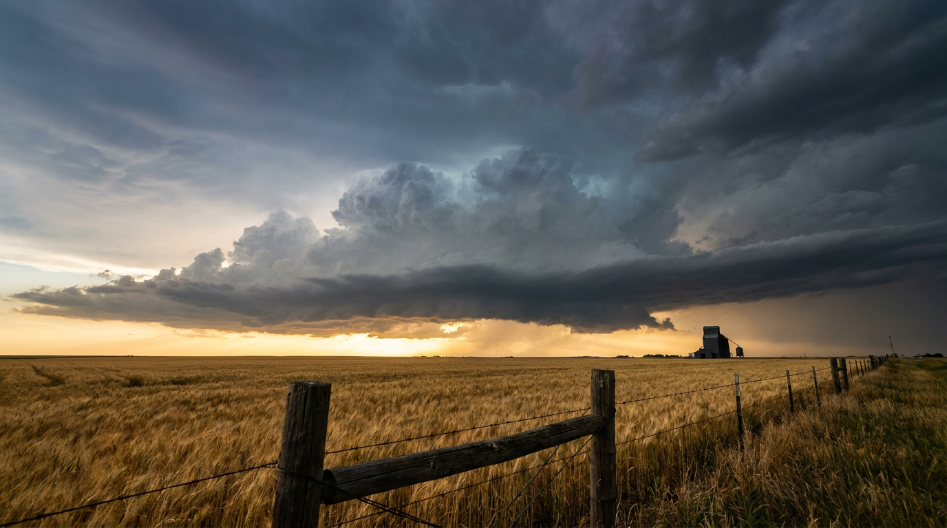
Hurricane Simon Spins Off Mexico While the Plains Gear Up for a Multi-Day Severe and Flood Threat
Alright y'all, good morning. We've got a little bit of everything on the board today: a hurricane that's been stubbornly parked off Mexico, a new system trying to get its act together behind it, and a Plains setup here at home that's gonna bring both severe storms and heavy rain over the next few days. Let's get into it.
Hurricane Simon: Small Storm, Big Watch Area
Hurricane Simon is sitting about 100 miles west of Cabo Corrientes, Mexico, and it is barely moving, drifting northwest at just 3 mph. Simon peaked at Category 3 strength over the weekend and has steadily weakened since, now holding Category 1 status with 92 mph winds and a central pressure of 977 millibars.
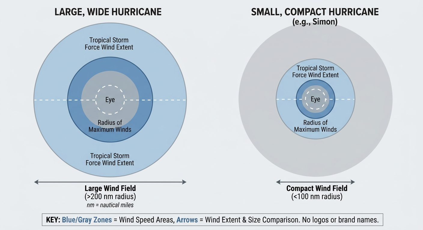
Here's the thing about Simon that makes it tricky to forecast: it's tiny. NHC says the radius of maximum winds is only about 5 nautical miles, and tropical-storm-force winds only extend 30 to 40 miles out from center. A storm that compact can fool satellite estimates and can also intensify or weaken faster than a bigger system would, so confidence in the exact strength at any given moment stays a little lower than normal.
A Hurricane Watch is up for Mazatlan, where forecasters put the odds of 39+ mph winds at up to 1 in 10, with impacts possibly starting Wednesday night and more likely Thursday afternoon. Tropical Storm Watches cover San Blas to Puerto Vallarta, and the Cabo San Lucas to San José del Cabo stretch is in an "aware" tier for later this week. NHC's current track eyes a possible landfall near Topolobampo around October 17, still more than four days out, so plenty of time for the track to wobble. None of this affects the US directly, but if you've got friends or travel plans along that stretch of Mexico's Pacific coast, now's the time to watch the updates closely.
Right behind Simon, Invest 93EP is organizing a few hundred miles south-southwest of Guatemala. NHC's outlook puts both the 2-day and 7-day development odds at essentially 100 percent, so this one is very likely to become our next named storm in the East Pacific. It's far enough south and west right now that it's not a US concern, but we'll keep tracking it as it develops.
Plains Severe Weather: Slight Risk Today, Marginal Risk Through Midweek
Back home, SPC has a Slight Risk of severe thunderstorms up for parts of Kansas and northwest Missouri into the southern High Plains today, covering Kansas City, Wichita, and Topeka. A broader Marginal Risk stretches from Buffalo, New York, down through Rochester, Des Moines, Lubbock, and Amarillo.
The setup supports widely scattered storms capable of large hail and damaging wind gusts this afternoon into tonight, with an isolated tornado not out of the question. SPC's numbers put the wind threat at 15 percent (scattered damaging gusts of 60+ mph) and hail at 15 percent (quarter-size or bigger), with tornado odds a modest 2 percent. That's not a high-end setup, but it is a "know where the warnings will show up" kind of day if you're in that corridor.
If you're headed to the Sonic Live In Concert show in Wichita tonight, keep half an eye on the sky this afternoon. Storms should be scattered, not wall-to-wall, but Wichita sits right inside today's Slight Risk zone.
The risk doesn't just go away tomorrow. Day 2 brings a Marginal Risk across the southern Plains into the Ozark Plateau, including Oklahoma City, Tulsa, Lubbock, and Springfield, Missouri, with isolated severe storms mainly capable of damaging gusts. Day 3 shifts the Marginal Risk into the mid-Mississippi and Ohio Valleys, covering Columbus, Indianapolis, Cincinnati, and Dayton. An upper low over the Four Corners is what's driving this whole multi-day train, slowly translating east and keeping the severe threat moving with it.
Flooding Right Behind the Storms
Here's where it gets more serious for some folks: WPC has a Slight Risk of excessive rainfall up for today across the central and southern Plains into the lower Missouri Valley, the same general area dealing with severe storms. That risk shifts into the southern High Plains, central Plains, and mid-Mississippi/Ohio Valleys tomorrow, then holds over the southern High Plains into the central Plains and lower Missouri Valley on Day 3.
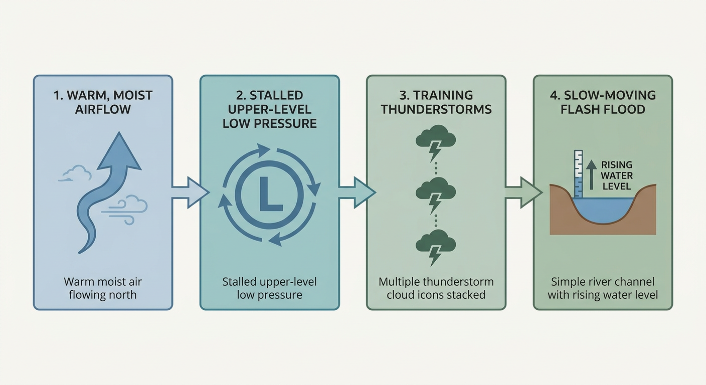
This is a classic repeating setup. The same corridor gets hit day after day as storms train over similar ground, and WPC's discussion specifically flags flash flooding potential across southwest Texas, Oklahoma, Kansas, Missouri, Arkansas, and the valleys nearby, with additional 2 to 3 inch rainfall totals possible and locally higher amounts on top of what already falls today.
For context, this comes just a day after the Paria River along the Utah-Arizona border saw a 3-foot rise in 30 minutes from heavy rain, and days after Montana picked up two feet of early-season snow. The pattern has been throwing a lot at the country lately, and this week's Plains target is heavy rain and severe wind more than anything frozen.
Quick Hits: Space Weather and the Nicest Weather in the Country
SWPC has a G1 Minor geomagnetic storm watch up for today, with a Kp index of 5 expected as a coronal hole high-speed stream moves into a geoeffective position. If you're way up north and skies are clear tonight, it might be worth a glance for aurora, though G1 is on the mild end of the scale.
Meanwhile, the best weather in the country today runs in a broken corridor from the central Plains through the Mid-Atlantic and into the Southeast, where building high pressure means sunny skies, light wind, and essentially no rain. Air quality is the only thing keeping it from being truly spectacular. Looking ahead to Days 4 through 7, an amplifying trough brings early-season wintry precipitation to the Northeast and interior high country late this week, followed by high-elevation snow in the Pacific Northwest early next week, with widespread frost and freeze returning behind a building Canadian high over the weekend.
For reference, this time of year Kansas City normally sits near 67 for a high and 47 overnight, Tulsa and Oklahoma City run around 73/49-50, and Dallas averages a high near 79. Those are the kinds of numbers you'd expect from a calm October day in this region, which makes this week's active pattern stand out a bit more than usual.
What We're Watching
- Hurricane Simon's track and intensity as it creeps toward Mexico's Pacific coast, with a possible Topolobampo-area landfall around October 17
- Invest 93EP organizing south of Guatemala, with NHC giving it near-certain odds of development
- The Slight/Marginal severe risk corridor across Kansas, Missouri, Oklahoma, and the southern High Plains running through Thursday
- WPC's Slight Risk of excessive rainfall riding right along that same corridor, raising flash flood potential for multiple days in a row
- G1 minor geomagnetic storming today, with a small shot at aurora for northern latitudes
- An early-season wintry push into the Northeast and Pacific Northwest arriving by late this week into next week
Bottom Line
If you're in Kansas City, Wichita, Topeka, Oklahoma City, Tulsa, or anywhere along that southern Plains corridor, keep your phone's weather alerts on through Thursday. The severe threat each day is modest, mainly hail and damaging wind, but the flooding risk is the bigger story here because the same ground gets hit repeatedly. Low-lying roads and areas with poor drainage are where the trouble will show up first. Along Mexico's Pacific coast, Simon is weak and small but still worth watching if you've got plans near Mazatlan or Puerto Vallarta this week. For the rest of the country, today is genuinely one of the nicer stretches of weather out there, so get outside if you can before the next system starts reshaping things late week.