Blog Article
Hurricane Trudy Intensifies as West Texas Faces Flood Risk
Hurricane Trudy is forecast to rapidly intensify off Mexico this weekend while West Texas faces a Moderate flash flood risk and Mid-Atlantic storms loom Friday.

Hurricane Trudy Set to Rapidly Intensify Off Mexico While West Texas Faces Another Round of Flash Flooding
Alright y'all, lots to get to this morning. We've got a hurricane down in the East Pacific that's about to go through a growth spurt, and we've got unfinished business back here at home in West Texas, where the ground is still soaked from this week's flooding.
Hurricane Trudy: Rapid Intensification On the Way
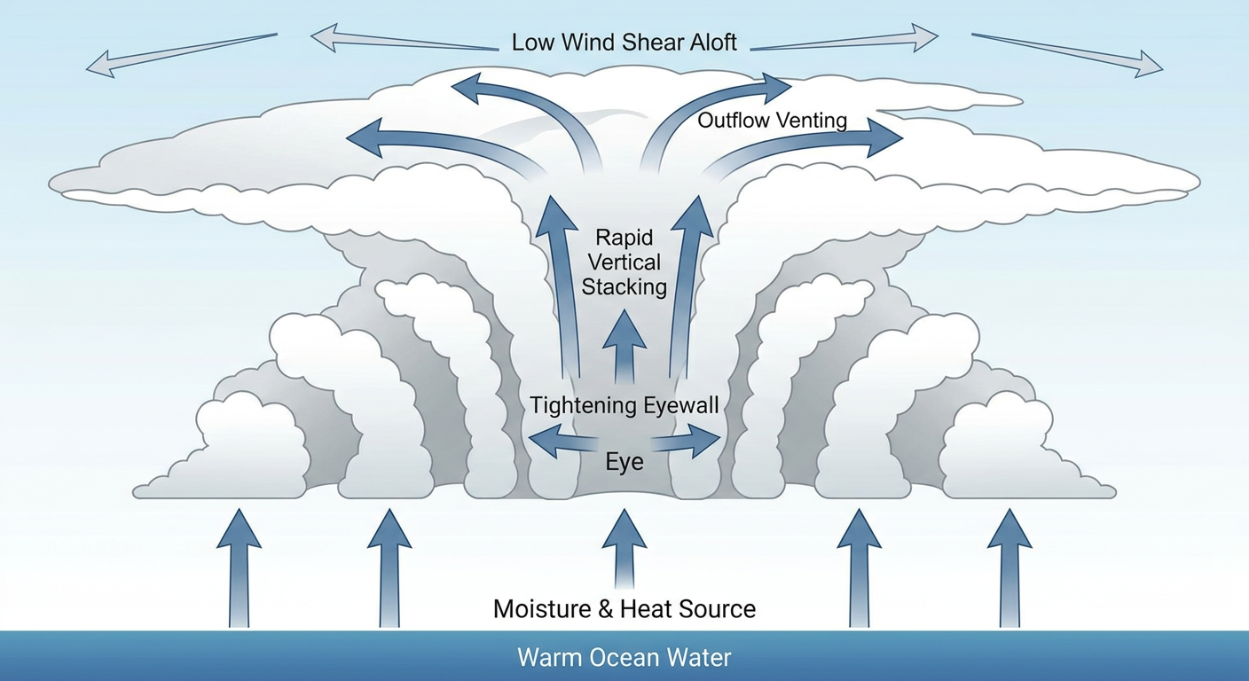
Hurricane Trudy sits about 300 miles south-southwest of Acapulco this morning with 75 mph winds, a Category 1 hurricane as of the 300 AM advisory. Here's the thing though, the National Hurricane Center expects Trudy to rapidly intensify and approach the coast of Mexico as a major hurricane by this weekend. The latest peak intensity guidance near the coast runs as high as 130 mph, which would put Trudy at Category 4 strength.
Satellite presentation backs up that intensification forecast. Trudy's got an expanding central dense overcast with cloud tops as cold as -85 degrees Celsius, plus a curved band wrapping in from the north. That's the signature of a storm getting its act together fast.
The NHC's impact model has the stretch from Puerto Vallarta to Lázaro Cárdenas in a "Prepare" tier, with a 3 in 10 to 5 in 10 chance of tropical storm force winds and up to a 1 in 10 chance of hurricane force winds. Impacts could start as early as Friday afternoon, more likely Friday night. Manzanillo, Puerto Vallarta, and Lázaro Cárdenas are the names to watch on the Mexican coast.
Trudy isn't the only one out there. Tropical Storm Simon is sitting nearly stationary a few hundred miles southeast of the tip of Baja California with 58 mph winds. Simon's expected to stay offshore but close enough that Cabo San Lucas and San José del Cabo are in an "Aware" tier for gusty tropical storm force winds. Neither system has any forecast impact on the US, but if you've got friends or family along the Pacific coast of Mexico, now's the time to make sure they're watching the forecast closely.
West Texas: The Flooding Isn't Over Yet
Folks in Oklahoma and West Texas know this story already. Yesterday brought 2 to 11 inches of rain across central and western Oklahoma, high water rescues near Greenfield, a road cave in near Hydro, and flooding bad enough that Lawton Fire had to go pull stranded motorists out. Meanwhile in Texas, a tornado touched down near Fort Stockton and a Severe Thunderstorm Warning carried a Destructive tag for 80 mph winds in Foard, Hardeman, and Knox counties.
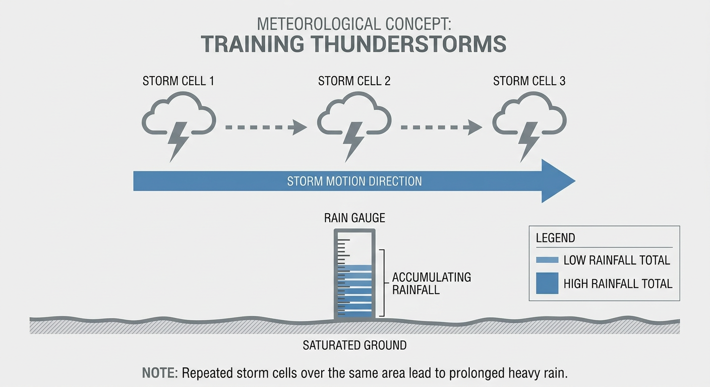
Today, the Weather Prediction Center has bumped West Texas up to a Moderate Risk of excessive rainfall, the highest category they issue short of High. That's because a cold front is driving south out of Canada and running into a complex surface pattern that's going to wring out another round of heavy rain on ground that's already saturated. The setup favors training thunderstorms again, meaning storm after storm rolling over the same spots, which is exactly the recipe that caused yesterday's flash flooding in the first place.
The good news is this threat drops off fast. WPC's Day 2 outlook puts the flash flood probability back under 5 percent, so this looks like a one-day hard push rather than a repeat multi-day soaking. By Saturday, the excessive rainfall risk shifts to a Marginal level along the Florida east coast as a separate cold front pushes through the peninsula.
Severe Weather Today and Tomorrow
Today's SPC outlook holds a Marginal Risk of severe storms from the mid Mississippi Valley into the Ohio Valley, covering Columbus, Indianapolis, Cincinnati, Akron, and Dayton. Isolated severe wind gusts and maybe a brief tornado are possible, along with additional isolated wind gusts across the southern Plains. Tornado probabilities sit at just 2 percent and wind at 5 percent, so this is a watch-and-wait kind of day, not a hide-in-the-basement kind of day.
Friday the action shifts east. SPC has posted a Slight Risk over eastern Ohio, West Virginia, western Pennsylvania, western New York, the Delaware Valley, Delmarva, Maryland, and eastern Virginia, with Philadelphia and Scranton inside that zone. A broader Marginal Risk wraps around New York City, Washington DC, and Baltimore. The driver is a strong trough tracking from the Great Lakes toward the Appalachians, with a belt of strong winds aloft supporting damaging gusts, a few embedded supercells, and an isolated tornado or two Friday afternoon and evening. Wind is the headline threat there too, with a 15 percent probability in the higher-end zone.
Behind that front, expect a noticeable temperature drop and gusty winds pushing through the Northeast into the weekend. If you've got outdoor plans in the DC to Philly corridor Friday, keep half an eye on the sky during the afternoon.
What We're Watching
- Hurricane Trudy's rapid intensification over the next 48 hours, with potential Category 4 strength near the southwestern Mexico coast this weekend
- Moderate Risk of excessive rainfall in West Texas today, a continuation of the flooding threat that hit Oklahoma hard this week
- Slight Risk severe storms in the Mid-Atlantic Friday afternoon and evening, mainly damaging wind and an isolated tornado threat
- A G1 minor geomagnetic storm influence lingering through tonight as a coronal hole high-speed stream winds down, nothing disruptive expected
- Fire weather concern building in western LA County and southeastern Ventura County, California, with critical conditions both today and Friday
Bottom Line
If you're on the Pacific coast of Mexico, especially Puerto Vallarta down through Lázaro Cárdenas, this is the week to finalize storm plans, because Trudy is not messing around with its intensification forecast. If you're in West Texas, don't let your guard down just because yesterday's storms have moved through. The ground is full, and today's Moderate Risk means more water has a real shot at going where it shouldn't. Everyone from Columbus to Philadelphia should keep an eye on the sky today and tomorrow, but this isn't a lock-down-the-house kind of setup, just a know-your-plan kind of week.