Blog Article
Weekend Weather Alert: Major Ice Storm South & Heavy Snow Northeast
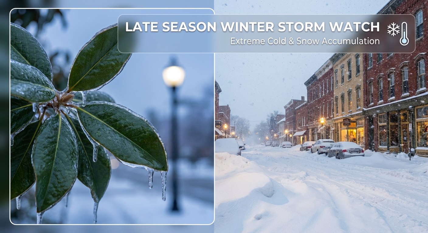
A major winter storm brings catastrophic ice to the South and 12+ inches of snow to the Northeast. Dangerous travel and power outages likely. Jan 24-26 forecast.
Ice in the South, Buried in the North: The Weekend Weather Mess is Here
Alright folks, grab a hot drink and listen up because the weather map is lighting up like a Christmas tree this morning. If you tuned in yesterday, you know we were tracking a massive system moving out of the Plains. Well, it is here, and it is behaving exactly as badly as we feared. We are looking at a messy, dangerous weekend for a huge chunk of the country.
Here is the thing. This isn't just a snowstorm. It is a complex beast with a "warm nose" of air sitting about 5,000 feet up that is melting snow before it hits the freezing ground. That means for millions of you in the South, you aren't getting fluffy snow. You are getting freezing rain and sleet, and that is a recipe for power outages.
The Southern Ice Sheet
If you are in northern Mississippi, Tennessee, northern Alabama, or the Carolinas, please take this seriously. The data this morning is showing a "critical icing threat." We are talking about ice accretion of a quarter-inch to maybe even three-quarters of an inch in some spots.
Get this—if you have plans for the Queen City R&B Martini Festival in Charlotte today, you need to be extremely careful. The roads are going to be treacherous. The National Weather Service is using words like "crippling" and "catastrophic" for parts of the region because that much ice brings down trees and power lines. If you lose power, remember that arctic air is rushing in right behind the storm. It is going to get very cold, very fast.
The Northeast Snow Globe
Now, let's look up North. As this system moves east, it is going to hand off energy to a new low pressure center forming off the coast. This is going to dump a heavy blanket of snow from the Ohio Valley right into Pennsylvania, New York, and New England.
If you are heading to the Philly Chocolate, Wine & Whiskey Festival in Oaks, PA today, leave early or check if it is still on. The I-95 corridor from D.C. up to Philly is in a tricky spot where you might see a mix of sleet and freezing rain before it potentially turns to snow. But inland? Central PA and upstate New York could see 12 to 18 inches of snow. That is heavy, shovel-breaking snow.
The Deep Freeze Behind It
While all this moisture is swirling around, we cannot ignore the temperature. A massive 1052mb high pressure dome is pushing Arctic air deep into the heart of the country.
- Northern Plains: It is downright dangerous up there. Wind chills are hitting -40°F to -60°F. Exposed skin can freeze in minutes.
- Denver: For folks going to the Patriots vs. Broncos game tomorrow, bundle up. You are looking at upslope snow and temperatures that will make that stadium feel like a freezer.
- The South: Even if you dodge the ice in Texas or Louisiana, the cold air is coming. We are seeing freezing temps push all the way to the Gulf Coast.
What We Are Watching
- Power Grid Strain: With widespread ice in the South and extreme cold following it, the risk of long-duration outages is high. Keep your devices charged.
- Travel Nightmares: I-40 and I-81 are going to be parking lots. Avoid them if you can.
- The Transition Line: That rain/snow/ice line is going to wobble. A shift of 50 miles could change your forecast from 6 inches of snow to an inch of solid ice.
Bottom Line
- Stay Home if Possible: If you are in the ice warning areas (TN, MS, NC, VA), the roads are not worth the risk.
- Prepare for Cold: Have blankets and emergency heat sources ready. This cold air is sticking around through next week.
- Check on Neighbors: Especially in the Plains where the cold is life-threatening.
Stay safe out there, y'all. We will keep watching the radar so you don't have to.
https://ryanhallyall.com/blog/ice-in-the-south-buried-in-the-north-the-weekend-weather-mess-is-here