Blog Article
Isaias Floods Southeast as Simon, Rachel Churn Two Coasts
Post-tropical Isaias brings moderate flood risk to the Southeast while Hurricane Simon nears Mexico and Tropical Storm Rachel targets Baja and SoCal.
Isaias's Flooding Rain Keeps Going as Hurricane Simon and Tropical Storm Rachel Spin Up Two Coasts at Once
Alright y'all, three different tropical systems are doing three different things on three different coasts this morning, and if you were tracking Isaias crashing into the Florida Panhandle Friday night, here's the update: the wind problem is basically over. The water problem is not.
Isaias isn't a hurricane anymore, but it's still dangerous
We talked about this one coming ashore near Destin Friday night as a Category 2, and the numbers from that landfall were rough. Pensacola City Hall clocked a 102 mph gust. A StickNet station near Oriole Beach measured 116 mph. Over 250,000 customers lost power across northwest Florida and south Alabama. If you're in that corridor, you already know.
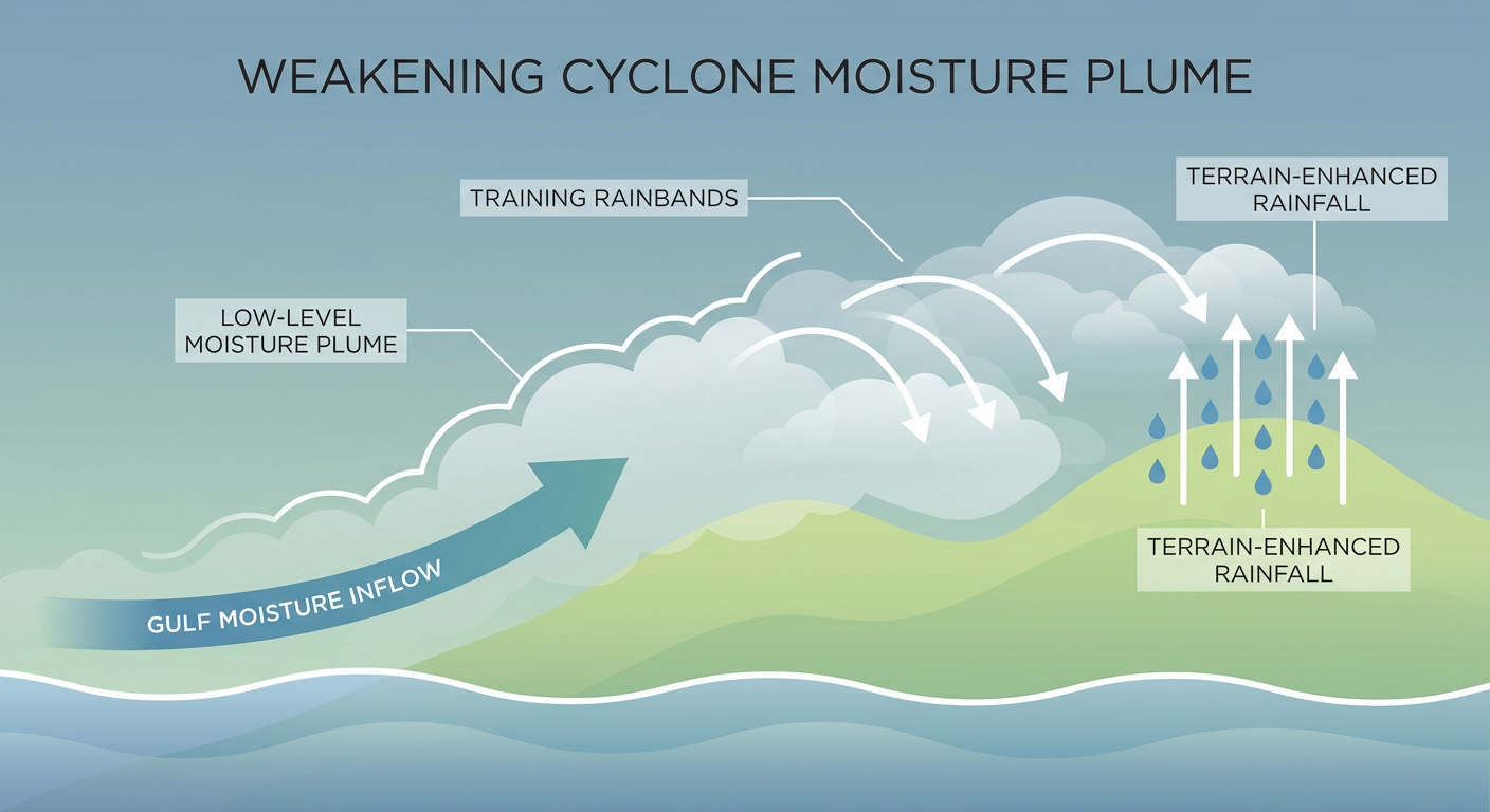
What's happening now is the part that doesn't make for dramatic video but causes just as much trouble. Isaias is post-tropical, down to 35 mph winds, sitting about 25 miles southwest of Montgomery and sliding north at 14 mph. The center is weak, but the moisture plume riding up and over it is not. WPC has already logged a High Risk of excessive rainfall overnight for the Big Bend into southern Georgia, and today's Day 2 outlook upgrades to a Moderate Risk of excessive rainfall across portions of the Southeast, with widespread 5 to 8 inch rainfall totals possible and locally higher amounts, especially from northern Georgia and eastern Tennessee through western South Carolina and western North Carolina.
That's steep terrain country. Heavy rain in the mountains means river rises and landslide risk, not just street flooding. If you're anywhere in that footprint through Sunday, pay attention to river gauges near you, not just the rain totals.
SPC also has a Slight Risk of severe storms posted for today across the eastern Florida Panhandle, Georgia, and the Carolinas, tied to the same system, with a 5 percent (Level 2) chance of a few tornadoes and a 5 percent chance of isolated damaging wind gusts. That risk shifts northeast for Day 2, with a Slight Risk over North Carolina, Virginia, and southeastern Maryland Sunday afternoon and evening, a 5 percent tornado chance and a 15 percent (Level 2) chance of scattered damaging wind. Raleigh, Richmond, Virginia Beach, and Washington DC all fall inside that window. If you've got outdoor plans around the Carolinas or DC region Sunday, keep half an eye on the sky in the afternoon and evening.
Hurricane Simon: a major hurricane closing in on Mexico's Pacific coast
Off to the west, Hurricane Simon has rapidly intensified into a Category 4 storm with 144 mph winds and a 942 mb central pressure, sitting about 125 miles south of Manzanillo, Mexico. The National Hurricane Center's forecast discussion notes the tiny eye is clearing out on satellite, which is usually a sign a hurricane means business.
A Hurricane Warning is in effect from San Blas to Manzanillo, and NHC's near-term peak intensity estimate has Simon reaching Category 4 strength, possibly near 155 mph, within the next 12 hours. Puerto Vallarta sits almost directly in the path with a 70-80 percent chance of tropical storm force winds and a 20-30 percent chance of hurricane force winds. Landfall is expected near Manzanillo late Saturday into Sunday. This storm has no direct US impacts, but it's a serious situation for a stretch of Mexican coastline that sees heavy October tourist traffic.
Tropical Storm Rachel: Baja and Southern California's turn
Rachel is the system with the most direct US relevance today. It's a 58 mph tropical storm racing northeast at 22 mph, about 640 miles southwest of San Diego. Tropical Storm Warnings stretch from Tijuana to San Quintín in Baja, and that warning extends into San Diego and Imperial Beach, California, where there's a 10-20 percent chance of tropical storm force winds.
The bigger story for Southern California is rain and surf, not wind. WPC has a Moderate Risk of excessive rainfall for Day 2 across southern California, southern Nevada, northwest Arizona, and southwest Utah as tropically enhanced moisture streams north ahead of Rachel. If you're at the Niteharts Festival in San Diego today, or anywhere along the SoCal coast this weekend, expect building swell, rip currents, and a real chance of heavy showers moving in by Saturday night into Sunday.
What else is on the board
- Northern Rockies winter storm: A Slight Risk of significant winter weather is posted for Sunday into Sunday night across central Montana, with heavy wet snow likely to cause hazardous mountain pass travel and tree damage around Great Falls and Bozeman. A hard freeze follows Monday night.
- Space weather: SWPC is calling for unsettled to active geomagnetic conditions with isolated G1 (Minor) storm levels today as a coronal hole stream moves into position, and G1-G2 conditions possible again Sunday from recent CMEs. Aurora watchers in the northern tier, tonight might be worth a look outside.
- Day 4-8 severe weather: SPC's extended outlook flags a modest 15 percent severe risk over the Texas and Oklahoma Panhandles (Amarillo, Guymon, Liberal) for Tuesday as an upper-level trough slides into the Rockies. Nothing locked in yet, but worth watching if you're out that way midweek.
- The nice-weather winner: If you just want a good day outside, the Texas Big Bend (Alpine, Marfa, Fort Davis) has the best weather in the country today, dry air, light wind, full sunshine.
Bottom line
If you're anywhere from northern Georgia through eastern Tennessee, western South Carolina, or western North Carolina, this is a flash flood and landslide watch situation through Sunday, not just a rainy weekend. Have a way to get flood warnings on your phone and know which roads near you flood first. Folks in North Carolina, Virginia, and the DC area should watch the sky Sunday afternoon for a few strong to severe storms. Along the San Diego and Baja coast, stay out of the water this weekend, rip currents and rough surf are going to be a real hazard even without a direct hit. And if you're trying to decide where to go outside and enjoy it, the Big Bend of Texas is your pick today.