Blog Article
Josephine Exits New England, Southwest Flood Risk Grows
Subtropical Storm Josephine races away from Cape Cod while a WPC Moderate flood risk and SPC severe threat build again over the Desert Southwest.

Josephine Races Away From New England While the Southwest Gets Soaked Again
Alright y'all, two stories matter most this morning, and they're about as different as weather gets. Up in New England, Subtropical Storm Josephine is making her exit stage right. Out in the Desert Southwest, the same flood machine that drowned Zion National Park and flipped river gauges over flood stage this week is cranking right back up. Let's get into both.
Josephine's Quick Goodbye
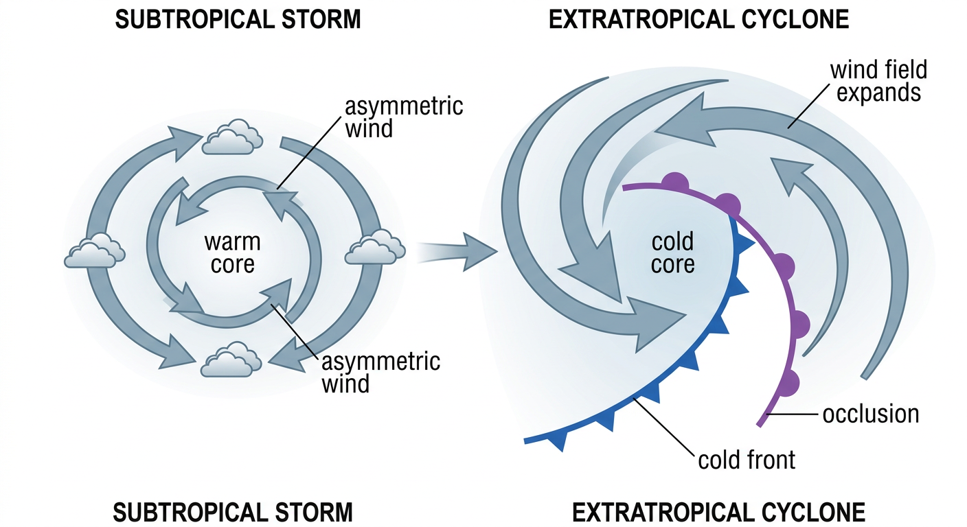
Josephine formed fast out of what used to be Invest 93AL, the same offshore low that had been pounding the Outer Banks with coastal flooding all week. As of the 5 AM advisory, she's sitting about 195 miles south-southeast of Nantucket with 65 mph winds and a 988 millibar pressure, and she's hauling northeast at 13 mph. That speed is the good news here. This storm is not lingering.
Cape Cod and the islands are in NHC's "Action" tier right now, meaning there's a 9-in-10 chance of seeing 39+ mph winds, and the storm's wind field could already be arriving as you read this. Rhode Island sits one notch down in the "Prepare" tier with a 5-in-6 chance of those same gusty conditions. The headline from our impact model says it plainly: storm winds could show up any time now across Cape Cod.
Here's the silver lining. Josephine is accelerating away from the coast, not stalling over it. NHC expects her to transition into a powerful extratropical cyclone as she races toward Nova Scotia, where places like Sable Island and the Liverpool, NS area are looking at a much rougher go, including an outside shot at hurricane-force gusts. For New England, this is a few hours of blustery, rainy, whitecap-on-the-harbor weather, then she's gone. Boaters and anyone with outdoor plans along the Cape today should expect a sloppy morning before things calm down this afternoon.
The Southwest's Flood Threat Hasn't Let Go
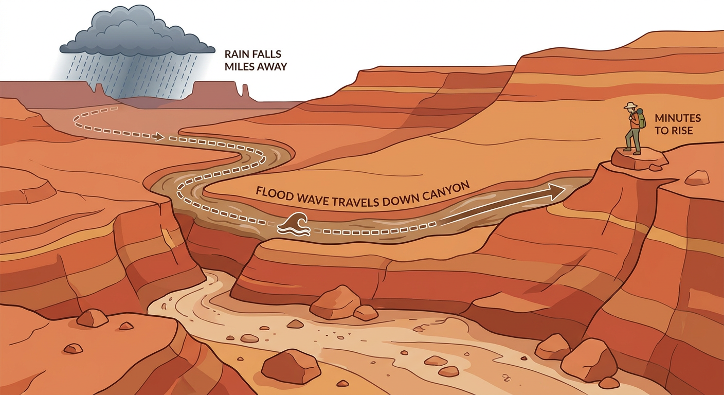
If you've been following along this week, you know the Desert Southwest has been a mess. Flagstaff clocked a 72 mph thunderstorm gust, Moenkopi Wash near Tuba City blew past flood stage to 31.82 feet, and hikers got stranded in Zion National Park's Behunin Canyon when flash flooding hit with almost no warning. That same moisture plume and upper-level low are still parked over the region, and WPC has upgraded part of it to a Moderate Risk of excessive rainfall today across southwest Colorado and southern Utah, including the San Juan Mountains.
That's WPC's second-highest tier, and it's not issued lightly. The setup is a deep upper-level low tracking in off the West Coast, with strong upper divergence ahead of a jet streak adding extra lift on top of already-saturated ground from this week's storms. Rainfall rates could run heavy enough to trigger more debris flows and rapid stream rises, especially in burn scars and steep terrain. If you're anywhere near the San Juans or southern Utah canyon country today, this is not a day to be hiking slot canyons or camping near a wash.
Arizona and New Mexico Still Under a Slight Risk
Same storm system, different hazard. SPC has a Slight Risk of severe thunderstorms posted today from central and eastern Arizona into western New Mexico, covering Phoenix, Tucson, and the Mogollon Rim country, an area that's home to just over 6 million people. The setup calls for scattered severe storms through the afternoon and tonight, with large hail up to 2 inches in diameter possible in the hatched zone, damaging gusts, and SPC gives a 5% chance of a tornado or two if storms can organize. That's a notch down from Tuesday's tornado-watch day in Flagstaff and Coconino County, but it's the same pattern, just shifting slightly east. Friday brings a Marginal Risk to the Albuquerque and El Paso corridor as the cutoff low keeps drifting along.
Out in the Pacific, Vance Is Strengthening (But Staying Offshore)
Tropical Storm Vance formed down near Acapulco and is now sitting about 510 miles southwest of there with 52 mph winds, moving west at a lazy 7 mph. NHC's forecast has Vance strengthening into a Category 3 hurricane with 120 mph winds by Saturday, but the track keeps it well offshore of mainland Mexico. Puerto Vallarta down to Zihuatanejo has only a 1-in-10 to 2-in-10 shot at tropical storm force winds late this weekend. Worth watching if you've got travel plans to that coastline, but not an immediate US concern.
A Little Space Weather Static
SWPC says active to G1 Minor geomagnetic storm levels are possible again early today thanks to a coronal hole high-speed stream, similar to what we saw Monday and Tuesday. If you're way up in the northern tier, there's a small shot at aurora after dark tonight before things settle into unsettled conditions. Nothing that affects your day-to-day plans.
Where the Good Weather Is Hiding
If you want an actual nice day, head for the Ohio Valley and central Appalachians. Light winds, crisp dewpoints, and a strong ridge have cities like Pittsburgh, Birmingham, and Knoxville sitting in the upper 80s on our 'nice weather' scale today, about as good as October gets even if background air quality keeps it just shy of a perfect score.
Bottom Line
- Cape Cod and coastal Massachusetts: Gusty, rainy conditions from Josephine could already be underway. It passes quickly, improving by this afternoon as the storm accelerates toward Nova Scotia.
- Southwest Colorado and southern Utah: WPC Moderate Risk for excessive rainfall today. Avoid canyon hiking and low-water crossings, especially anywhere burned or already saturated from this week's storms.
- Central Arizona and western New Mexico: SPC Slight Risk for severe storms with large hail and damaging wind possible this afternoon into tonight, isolated tornado can't be ruled out.
- Pacific Mexico: Vance strengthens offshore, no US impact expected, but watch if you're headed to the Pacific coast of Mexico this weekend.
- Best outdoor weather: Ohio Valley and central Appalachians, about as crisp and clear as fall gets.