Blog Article
Hurricane Lala Update and Plains Severe Storm Risk Aug 18
Hurricane Lala pulls away from Hawaii as a Category 1 storm while SPC posts a Slight Risk for severe storms from Kansas City to the Ozarks through midweek.
Lala Pulls Away From Hawaii While the Plains Brace for Another Round of Storms
Alright y'all, we've got two stories worth your coffee this morning. Out in the Central Pacific, Hurricane Lala found a little more gas in the tank overnight. Back on the mainland, the Plains are stuck in the same loop they've been in most of August: another day, another severe weather outlook, another flood threat riding right on top of it.
Lala Restrengthens, But She's Headed Away From the Islands
Here's the thing about Lala. She weakened enough yesterday that the Central Pacific Hurricane Center dropped the land-based Tropical Storm Warning for Kauai County. Then overnight she found better structure, an eye tried to open up on satellite a couple times, and she's back to Category 1 strength with 80 mph winds and a pressure of 985 millibars as of the latest advisory.
The good news for the islands: Lala's closest pass to the Kauai South Shore area happened a few hours ago, with the center staying offshore and tropical storm force winds brushing within roughly 66 kilometers at closest approach. She's now moving west at 10 mph, away from the main Hawaiian Islands and toward the more remote Northwestern Hawaiian Islands, including waters near Maro Reef and Lisianski Island. There's no landfall forecast on the main islands. Marine interests and anyone out on the water in that direction should still respect the swell and wind field, but this is a storm that's leaving, not arriving.
Farther out, two other disturbances are on the National Hurricane Center's radar in the eastern and central Pacific. One is forecast to form south of Mexico by the end of the week, with NHC giving it a 70% chance of development over the next seven days, categorized as a high-risk area. A second area near the Central Pacific carries a medium risk, with a 50% seven-day chance. Neither is an immediate concern, both are days out and hundreds of miles from land, but they're worth keeping half an eye on if you've got interests along Mexico's Pacific coast or out in Pacific shipping lanes later this week.
Central Plains Get Another Round: Slight Risk Today, Shifting South Tomorrow
Now to the mainland story that's been the real headline all month. SPC has posted a Slight Risk of severe thunderstorms today stretching from Kansas City and Topeka up toward Julesburg, Colorado, and Atchison and Beloit, Kansas. A much broader Marginal Risk wraps around that core, covering Chicago, Milwaukee, Omaha, Wichita, and Madison.
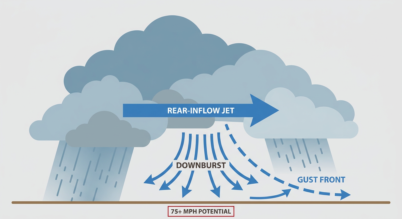
If you're headed to the Kansas City area tonight, that includes fans going to the Athletics at Royals game, this is a night to keep one eye on the sky. The setup features a broad cyclonic flow aloft feeding into a cold front and outflow boundary, with 0-6 km shear around 40 knots. That's enough to support a few supercells before things try to organize into a bowing line segment through the evening. The main threats are damaging wind gusts, with SPC's hatched area suggesting some gusts could reach 75 mph or better, plus isolated large hail up to quarter size. There's only a 2% tornado chance, so this is not a tornado-focused setup, but it is a wind and hail day for a healthy chunk of the central Plains and lower Missouri Valley.
By Wednesday, that focus slides south and east. SPC's Day 2 outlook keeps a Slight Risk over southern Missouri, northern Arkansas, southern Illinois, and western Kentucky and Tennessee, with organized clusters, a few supercells, and a warm front in play that keeps a conditional isolated tornado threat on the table. Springfield, Missouri sits right in the bullseye, with a 50-55 knot mid-level jet and enough directional shear to worry about rotating storms near that boundary.
Rain Piles On Top of Rain: The Flood Risk Underneath the Storms
This is the part of the pattern that's been the real story all August. WPC has a Slight Risk of excessive rainfall today across the Midwest and Missouri Valley, right underneath that severe threat, as a shortwave rides around a broad trough and digs southeast. Tomorrow, that Slight Risk shifts into the Mid-Mississippi and Ohio Valleys, the same corridor that's already seen repeated flash flooding this month, including the 13.7 inch total near Muncie, Indiana on August 12 and the Flash Flood Emergency in Knott County, Kentucky a few days later. Ground in a lot of these spots is still saturated from those earlier rounds, so even a couple inches falling fast today can cause quick flooding on roads and low-lying areas. By Thursday, the flood risk eases back to Marginal but stretches into the Ohio Valley, Mid-Atlantic, and even the Southwest.
The Good News: There's Actually Some Beautiful Weather Out There Today
Not every corner of the country is fighting storms. Small pockets from western Pennsylvania and eastern Ohio down into the Four Corners and southern New Mexico high desert are looking at what our nice-weather team is calling BEAUTIFUL conditions today, light winds, low humidity, mostly clear skies. If you can get outside in those zones, today's your day. Elsewhere, the dominant theme is heat and humidity capping most of the country at just NICE to fair, and that heat and moisture is exactly what's helping fuel the storm fuel gauge over the Plains.
Space Weather Side Note
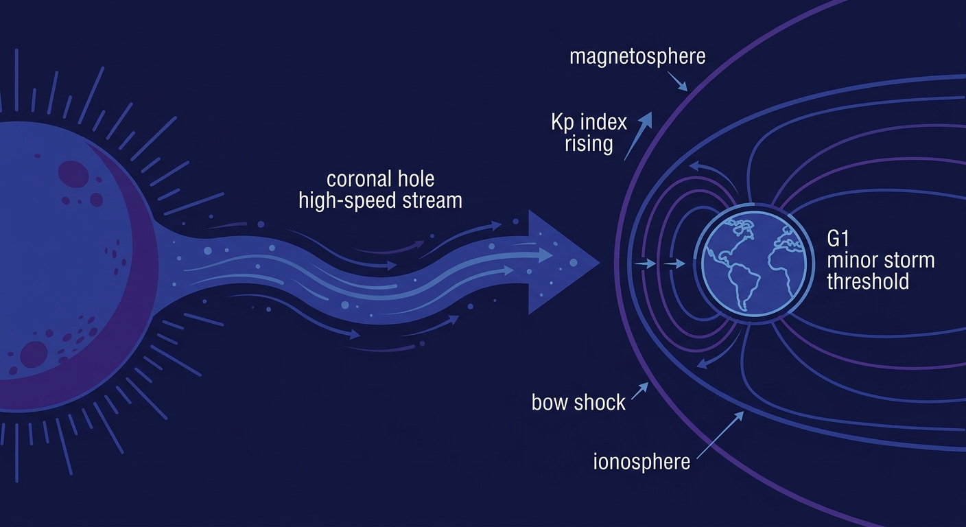
NOAA's Space Weather Prediction Center is calling for a chance of G1 (Minor) geomagnetic storming today as leftover influence from a mid-August CME mixes with an incoming coronal-hole high-speed stream, with unsettled to active conditions continuing into Wednesday. Nothing here affects your day-to-day weather, but if you're near the northern tier and up late, it's worth a glance at the sky for aurora chances.
Key Factors We're Watching
- Hurricane Lala's exact track through the Northwestern Hawaiian Islands and whether any further restrengthening occurs over open water
- Development chances on the two Pacific disturbances, especially the high-risk area forming south of Mexico late this week
- Whether today's Kansas City/Topeka storms organize into a bowing line capable of the higher-end 75 mph gusts SPC has flagged
- The Wednesday shift of the severe threat into the Ozarks, northern Arkansas, and the Mid-South, where a warm front raises isolated tornado potential
- Rainfall totals on top of already-saturated ground in the Mid-Mississippi and Ohio Valleys, where flash flooding has been a recurring theme all month
- Chance of G1 geomagnetic storming tonight into Wednesday for northern-tier aurora watchers
Bottom Line
Hawaii can stand down from the Lala worry for now, she's tracking away from the main islands into open Central Pacific waters, though the two disturbances forming farther south and west are worth a check-in later this week. On the mainland, if you're in or near Kansas City, Topeka, or the broader central Plains today, have a way to get warnings this afternoon and evening, this is a wind-and-hail day with a bowing line possible. Wednesday, shift that attention south into the Ozarks and Mid-South. And no matter where you are in that Midwest-to-Ohio Valley corridor, don't ignore the flood risk sitting quietly underneath the storm threat. Soaked ground plus a burst of heavy rain is exactly how this month's worst flash floods have happened.