Blog Article
Lala Nears Hurricane Strength as Midwest Flood Risk Shifts East
Tropical Storm Lala threatens hurricane conditions and mudslides in Hawaii, while a Moderate flood risk moves into Ohio and Indiana this weekend.
Lala Takes Aim at the Big Island While the Midwest Braces for Round Two of Flooding
Alright y'all, we've got a lot on the board this morning, so let's get right into the story that matters most first.
Tropical Storm Lala Closing In On Hawaii
Lala is sitting about 165 miles east-southeast of South Point, Hawaii, with 63 mph sustained winds and a minimum pressure of 991 mb, and it's forecast to strengthen into a hurricane before its closest pass to the Big Island later today. Hurricane Hunter aircraft found flight-level winds strong enough that NHC is holding the forecast intensity at 67 mph, right at the hurricane threshold, as the storm's closest approach to Hawaii Island South comes in around 20 kilometers offshore.
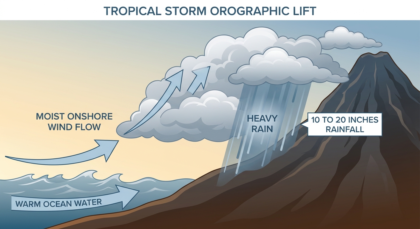
Here's the thing about Lala. This isn't a wind story so much as a water and terrain story. The forecast calls for 10 to 20 inches of rain, locally up to 25 inches, dumped onto steep volcanic slopes that funnel water fast. That's a textbook setup for life-threatening mudslides, and it's why Hurricane Warnings remain up for Hawaii County with Tropical Storm Warnings for Maui County. Add in dangerous storm surge and you've got a multi-hazard event, not just a wind event.
Our RHY impact model has Hawaii Island's west and south coasts, including the Kona Coast, in the highest "action" tier, with closest approach under an hour by tomorrow morning and max intensity near 67 mph. Hilo and the north side of the island sit one notch down at "prepare." If you're on the Big Island, today is not a normal Saturday.
Farther out in the Pacific, Tropical Depression Hernan is a weak, disorganized system well southwest of Baja that's expected to degenerate to a remnant low within 12 hours. It's not a threat to anyone. And two Atlantic invests near the Windward Islands have a low, decreasing chance of organizing as they run into drier air and stronger upper winds. Worth watching, not worth worrying about yet.
The Midwest's Flood Threat Shifts East
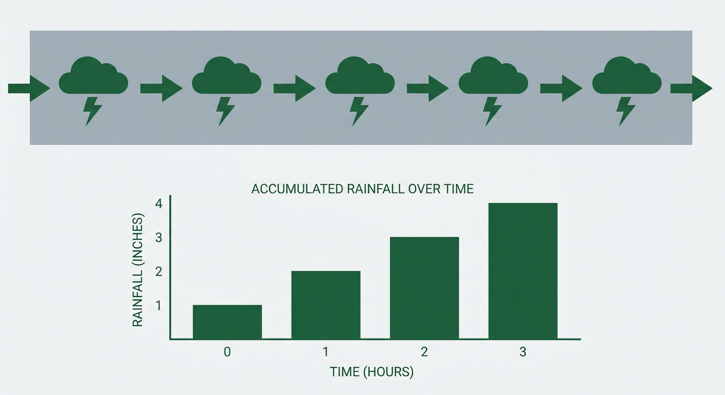
We talked last week about the repeated Mesoscale Convective Systems that have been training over the same ground across the Midwest and Ohio Valley, and that pattern hasn't let go. Yesterday brought a Flash Flood Emergency to northern Knott County, Kentucky, and 5 to 7 inches of rain that flooded Danville, Illinois, and shut down four different roads in central Indiana. Central Indiana was already recovering from a 13.7-inch rainfall event on August 12. The ground out there is tapped out.
Today, WPC has a Moderate Risk of excessive rainfall centered on the corridor from Iowa into northern and central Illinois overnight, with an MCV interacting with precipitable water values near 2.4 inches. That's the kind of atmosphere that squeezes out rain fast.
But here's what's new. By Sunday, that Moderate Risk axis slides east into east-central Indiana and central Ohio, specifically the stretch from Fort Wayne to Zanesville, where CAM guidance is showing 2 to 4-plus inches of rain on top of soil that's already saturated from this week's repeated storms. Cincinnati, Columbus, and Dayton are all in that zone. If you're in those cities, tomorrow is the day to have a flood plan ready, not today.
Severe Storms: Wind Is the Main Threat, Not Tornadoes
SPC has a Slight Risk posted for today from the Ohio Valley southeastward into the Carolinas, covering Columbus, Cincinnati, Fort Wayne, Dayton, and Charlotte, with a broader Marginal Risk stretching out to Chicago, Indianapolis, Denver, Kansas City, and Omaha. A second area of concern sits over the central High Plains.
The numbers tell the story here. Damaging wind gusts carry the highest probability at 15 percent in the favored zone, meaning scattered severe wind is the headline threat. Large hail sits at that same 15 percent level in a smaller pocket. Tornado potential is low across the board, just 2 percent, so this is a wind-and-hail day, not a tornado day.
By Sunday, that severe threat follows the same eastward track as the rain, moving into the southern Mid-Atlantic, including the Washington-Baltimore corridor, while a second Slight Risk holds over eastern Colorado and western Kansas. Our AI analog check flagged some historical wind events for this corridor, the June 2012 derecho and August 2023's multi-hazard day among them, but those are geographic precedent only. Today's setup doesn't carry the same extreme instability or organization, so don't read those old numbers as a forecast for today.
What Else We're Watching
- Chicago Air and Water Show today: Chicago sits in the Marginal Risk zone with a warm, humid afternoon. Storm chances are lower than points east, but keep an eye on the sky along the lakefront.
- Boots on the Bend Festival, South Bend, Indiana: This falls right in the path of today's Slight/Marginal risk zone. Afternoon and evening storms are possible, so have a plan if the skies darken.
- NFL preseason and MLB games across the Ohio Valley and Midwest: Games in Chicago, Cincinnati, and Pittsburgh sit inside or near today's Marginal to Slight risk areas. Nothing to cancel plans over, but pop-up storms with gusty winds are possible.
- Space weather: A coronal-hole high-speed stream is nudging geomagnetic activity toward unsettled-to-active levels today, with a slight chance of a G1 (Minor) storm. That's aurora-at-high-latitude territory, not a disruption to worry about for most of us.
- Fire weather: A building upper ridge over the central US is driving excessively hot temperatures and low humidity across the Plains, keeping fire weather concerns elevated there even as the Midwest drowns.
Bottom Line
If you're on the Big Island of Hawaii, today is serious. Hurricane conditions, torrential rain, and mudslide risk are all in play, and the window to finish prep is closing fast. If you're in the Ohio Valley, especially Cincinnati, Columbus, and Dayton, watch Sunday closely. The flood threat that's been hammering Iowa and Illinois is sliding your way with saturated ground already in the mix. And if you're anywhere from the Ohio Valley to the Carolinas or out on the central High Plains today, expect scattered strong-to-severe storms with damaging wind gusts as the main concern, not tornadoes.