Blog Article
Texas Flash Flood Risk Sunday: Level 2 of 4 Timing, Rain
A Level 2 of 4 flash flood risk covers Texas Sunday, with heavy rain starting tonight in South Texas and easing Monday. Timing, trouble spots and what to do.
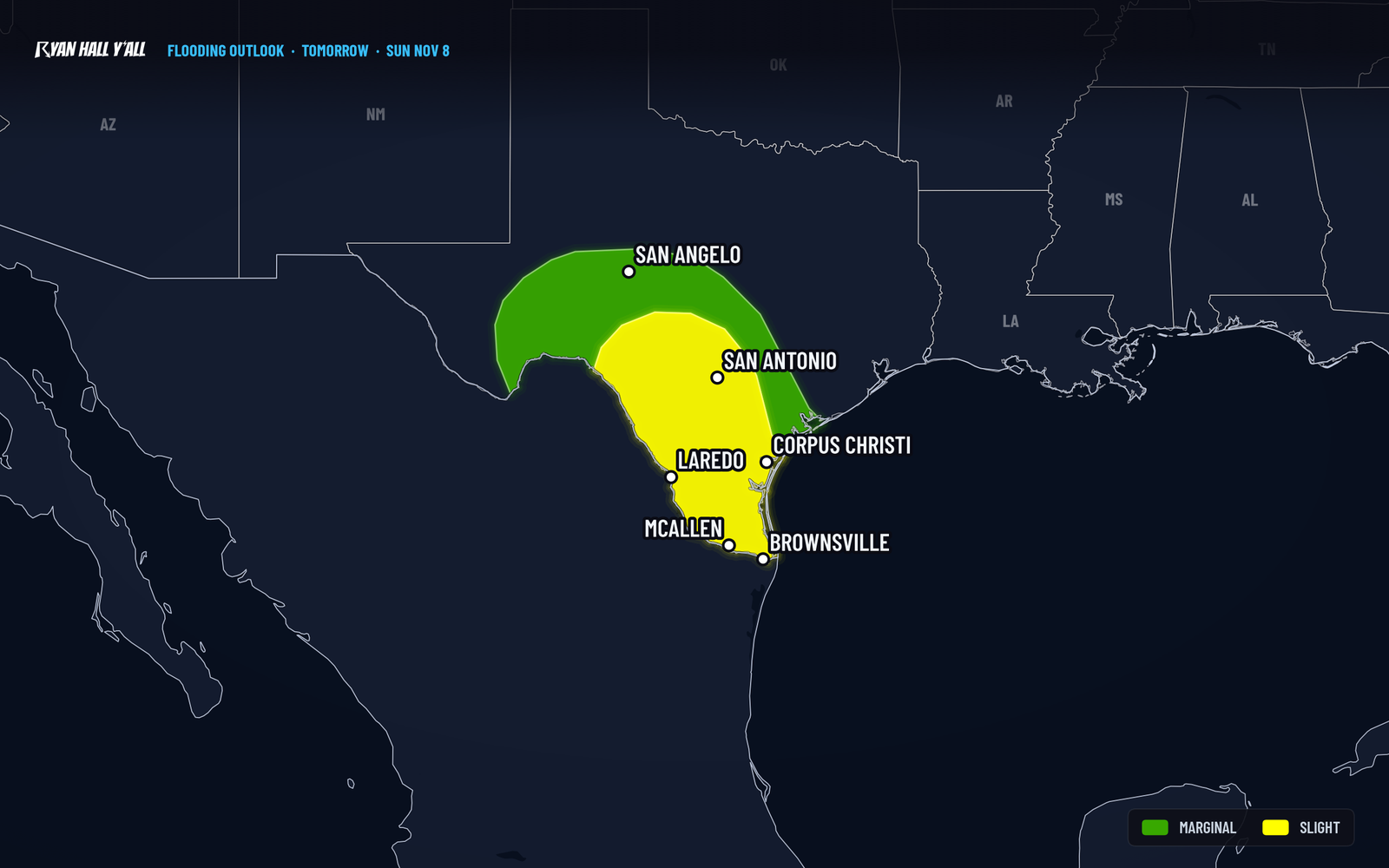
Level 2 flash flood risk for Texas Sunday, rain tapering Monday
A Level 2 of 4 (Slight) flash flood risk now covers Texas for Sunday, with the main window running from about 6 AM Central Sunday to 6 AM Central Monday. Heavy rain starts tonight across South Texas, builds Sunday, and ends from west to east on Monday.
The short version
- Where: Texas, with the higher flood threat centered on South Texas, the Rio Grande Valley and neighboring areas.
- When: Heavy rain develops tonight, the Level 2 window runs from about 6 AM Central Sunday to 6 AM Central Monday, and some heavy rain lingers Monday morning.
- What: Locally 1 to 2 inches tonight, then more rain Sunday, and another 1 to 2 inches possible Monday, mostly in the same area as the Sunday risk.
- What it means: Flash flooding is possible in spots, mainly where rain keeps falling for hours. No severe storms are expected.
Where the flood risk sits Sunday
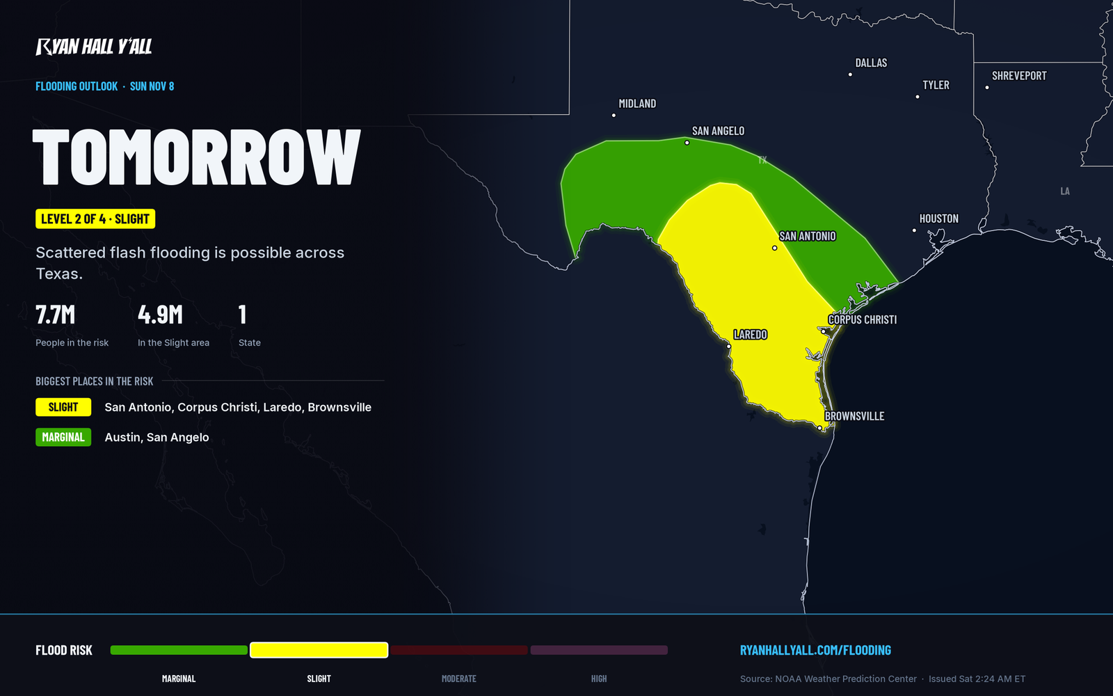
The Level 2 on this map is the official call for Sunday. It means flash flooding is possible in places, not that every town floods. Winds out of the east and a low-level jet will keep feeding moist air up the Rio Grande, and that is what supports longer-lasting heavy rain. The setup supports longer-lasting heavy rain and higher rainfall rates.
Tonight's heavy rain looks strongest across the Rio Grande Valley and the areas next to it, from Val Verde County down through Maverick County (think Del Rio to Eagle Pass). Locally 1 to 2 inches is possible there, with some of that reaching the western edge of the Texas Hill Country. Urban areas along the Rio Grande have greater runoff potential.
Timing: starts tonight, peaks Sunday, ends Monday
Rain is spreading across West Texas today, but the better flood chance shifts to southern Texas this evening and overnight. That part is a Level 1 of 4 (Marginal) risk.
Sunday is the longer event. Soils are fairly dry, so localized flash flooding may take time to develop as the ground saturates.
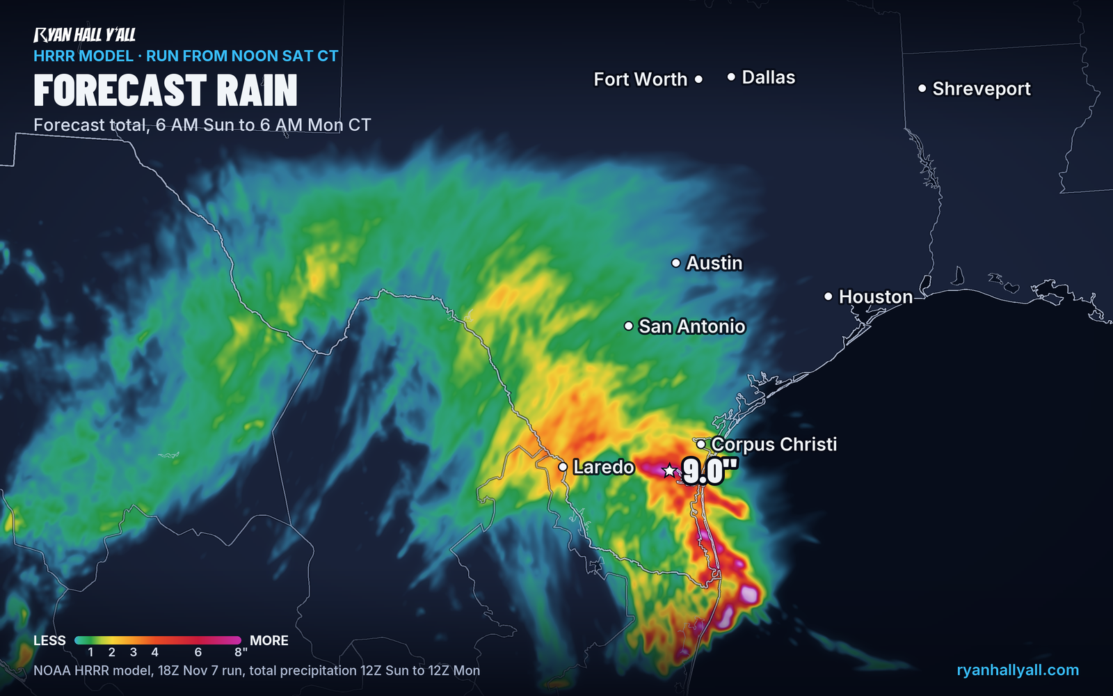
Our model guidance map shows one computer model's rainfall for that same Sunday window. It is a single run, so use it to see the pattern, not to pick a number for your town.
Monday: tapering from west to east
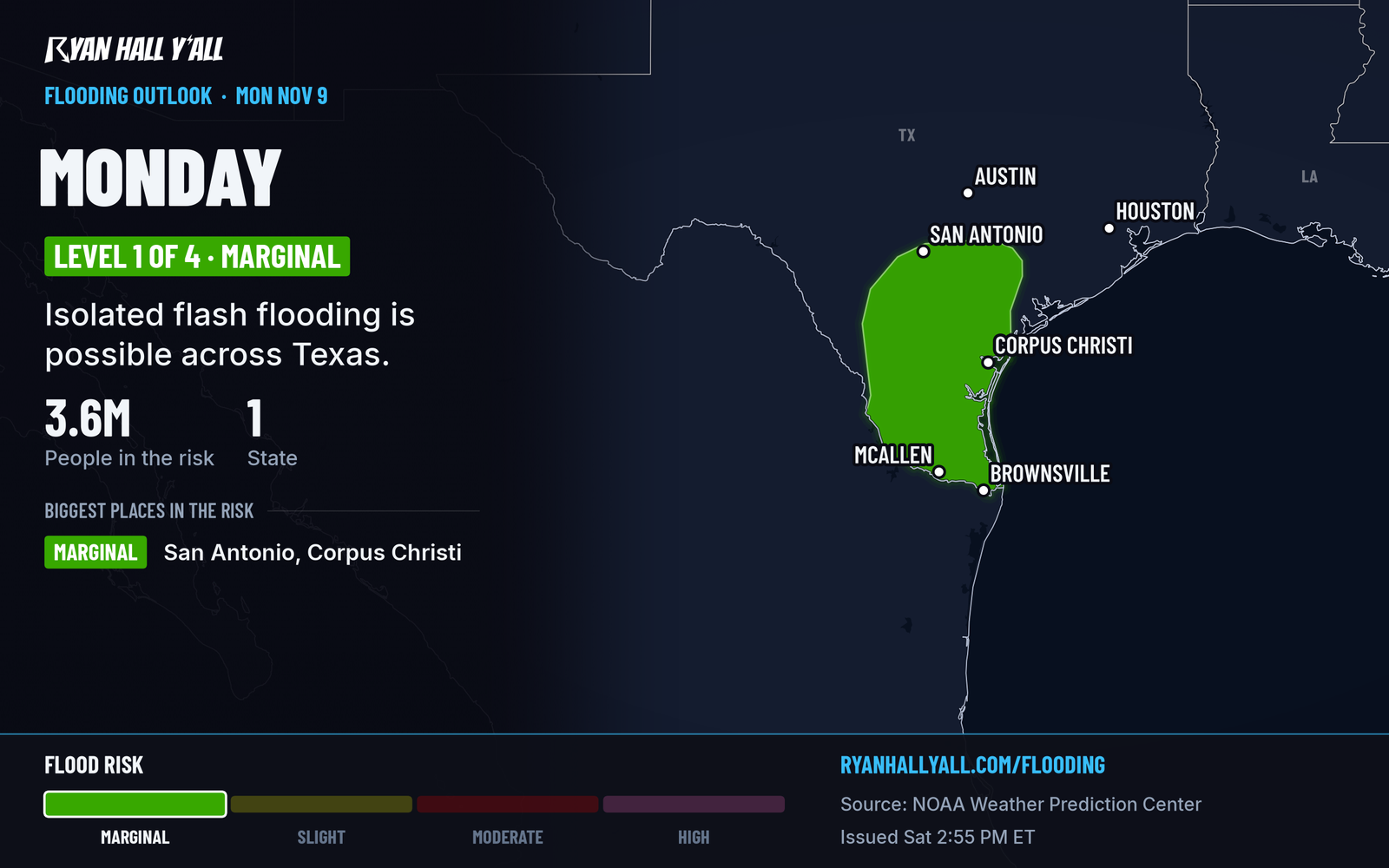
Drier air moves in from the north Monday, and the rain ends from west to east. A Level 1 of 4 risk covers portions of South Texas, with the southern Texas coast likely the last place to clear. Another 1 to 2 inches is possible, mostly in the same area as Sunday's Slight risk.
If the heaviest rain stays right on the coast, sandy soils and fewer buildings and pavement should limit problems. If it shifts west into the more populated parts of far South Texas, the impact grows.
How sure are we
The Level 2 risk for Sunday is official, and so is the Level 1 for Monday. The exact spot for the heaviest totals is still uncertain, and the rain band can shift. Impacts could be greater if the heaviest rain shifts into populated parts of far South Texas.
What to do
- Don't drive into water over the road. Turn around, especially at night when you can't tell how deep it is.
- Plan Sunday travel around the rain. Check the interstate driving outlook and active warnings before you go.
- Know your low spots. Move cars and gear out of areas that collect water, and clear storm drains near your home before tonight if you can.
- Have a plan for overnight. Sunday night is inside the Level 2 window, so keep your phone charged and sound on.
See our flash flood outlook page.
Bottom line
Texas has a Level 2 of 4 flash flood risk Sunday, with heavy rain starting tonight in South Texas and tapering Monday. Slow down on Sunday travel, stay out of flooded roads, and set up alerts before bed.
https://ryanhallyall.com/blog/level-2-flash-flood-risk-for-south-texas-on-sunday-rain-into-monday