Blog Article
Polar Vortex Split Sparks March Severe Weather Threat
The polar vortex split is colliding with record Southern heat. Find out how this extreme temperature clash is jumpstarting the spring severe weather season.
March Madness For Weather: How The Polar Vortex Split Is Jumpstarting Severe Season
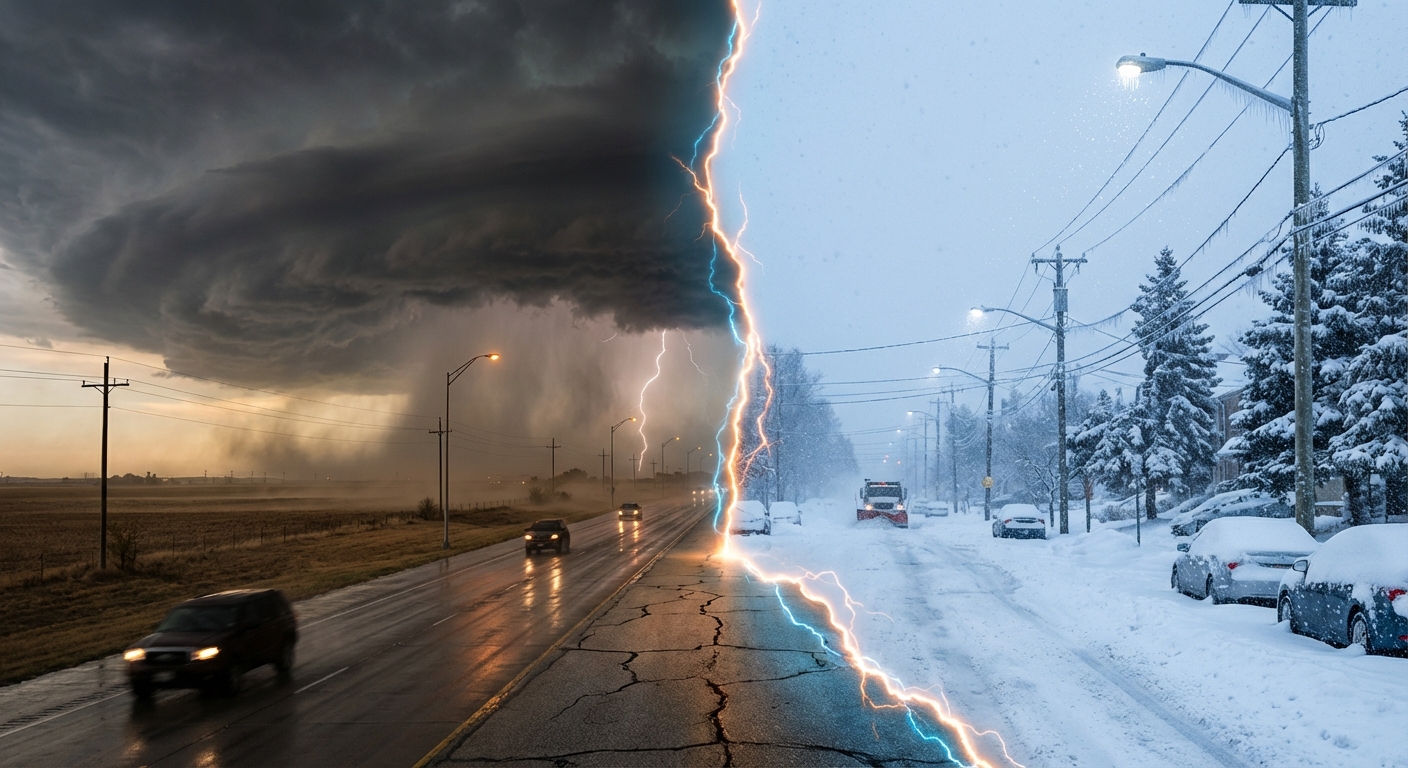
Alright folks, let's talk about what is actually happening in the atmosphere right now. If you have been on social media today, you have probably seen the viral debates. Half the country is posting pictures of their blooming flowers in shorts, and the other half is still digging out of the snow.
Get this. Yesterday, we saw a massive 173-degree temperature difference across the United States. It was 103 degrees down in Laredo, Texas, while folks up in Alaska were dealing with life-threatening 70-below zero wind chills. That is not just a quirky weather fact. That is a massive red flag for what is coming this month.
The Polar Vortex Split Explained
Here is the thing everybody is talking about but nobody is explaining properly. We are dealing with a Polar Vortex split. High up in the stratosphere, a sudden warming event has basically knocked the winter cold right off its axis.
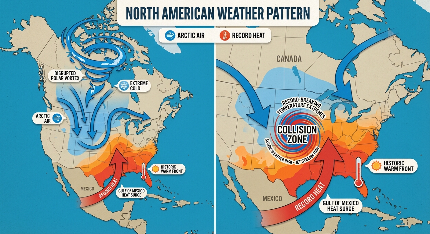
When the Polar Vortex breaks down like this in late winter, it sends rogue waves of freezing air plunging south. But down south, meteorological spring has already kicked the door down. The Gulf of Mexico is pumping near-record heat and moisture northward. When these two completely opposite air masses slam into each other over the central US, the atmosphere has to release that energy.
What This Means For Your Week
Because of this epic tug-of-war, we are looking at a highly volatile week of weather across the country.
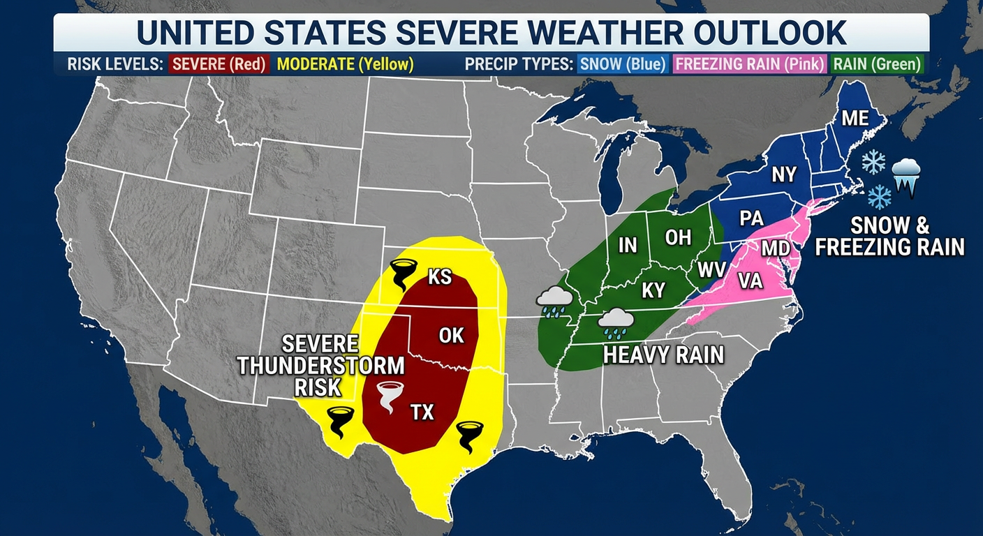
- Early Severe Season Setup: The Storm Prediction Center is already highlighting a Marginal to Slight risk for severe thunderstorms across the Southern Plains. Tuesday evening into Wednesday, we are looking at isolated large hail and damaging winds from western North Texas up through Oklahoma and eastern Kansas. If you live in Dallas, Wichita, or Oklahoma City, you need to be paying attention.
- Ohio Valley Flood Threat: That boundary line between the seasons is going to stall out. We are expecting a steady axis of heavy rain right over the Ohio Valley. Parts of southern Indiana and Ohio could see 2 to 3 inches of rain. Because the ground is already saturated in some spots, localized flooding is definitely on the table.
- Winter Is Not Done In The Northeast: While the South sweats, a wintry mix is sliding into the Mid-Atlantic and Northeast. The cold air damming east of the Appalachians is going to cause some messy freezing rain, while the Adirondacks could pick up another 3 to 5 inches of snow.
- Critical Fire Danger: Out west in the southern High Plains of New Mexico and Texas, we are seeing humidity drop below 15 percent with gusty winds. That means any spark could start a rapidly spreading wildfire.
The Bottom Line
I know a lot of y'all are ready for spring break. The folks down at Spring Training in Florida and Arizona are enjoying great weather right now. But if you are anywhere in the middle of the country, you are caught in the crossfire of this atmospheric March Madness.
Do not put up the winter coats just yet, but make sure the batteries in your weather radio are fresh. We are transitioning from winter storms to severe weather season, and the atmosphere is not taking any days off. Stay safe out there, and keep an eye on the sky.