Blog Article
Southeast Marginal Severe Risk & Flood Watch Nov 4, 2026
Atlanta, Knoxville and Chattanooga face a marginal severe risk today as flooding concerns build in the Tennessee Valley and southeast Florida.
Marginal Severe Risk Lingers Over the Southeast This Morning, With a Flooding Watch in the Valleys
Alright y'all, after the day we had yesterday, today feels like a step down, and it is. But it's not a clean break either. Let's talk about what's left on the plate.
Yesterday was rough. A tornado near Big Cabin, Oklahoma. More tornado warnings across the Ark-La-Tex, with confirmed touchdowns near Belcher and Deberry. Flash flooding in Bossier City and Shreveport. If you were anywhere from eastern Oklahoma through Louisiana, you know exactly what I'm talking about. That system has pushed east overnight, and today it's handing off a smaller, weaker version of itself to the Southeast and southern Appalachians.
The Southeast Setup
SPC has a Marginal Risk of severe thunderstorms up this morning for a corridor that includes Atlanta, Knoxville, Chattanooga, Anniston, and Gadsden. That's about 12.4 million folks in the risk zone. Marginal is the lowest rung on SPC's ladder, so don't read this as anything close to yesterday's outbreak. But it's not nothing either.
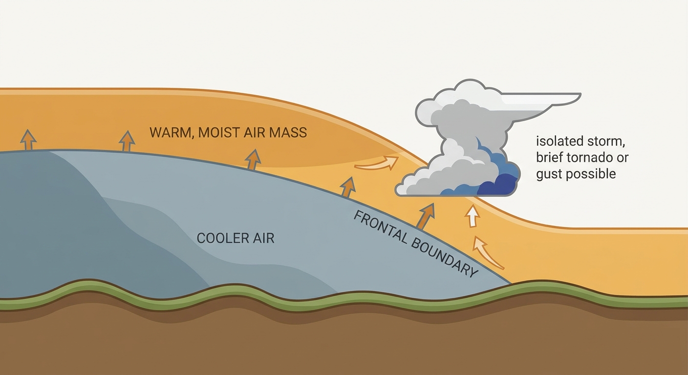
An upper-level trough is sliding eastward out of the Ozarks into the lower Ohio and Tennessee Valleys today, and a warm front lifting north ahead of it is giving storms just enough instability and shear to work with. SPC has tornado probabilities at 2 percent and damaging wind at 5 percent across the risk area, both Level 1 on their scale. Translation: if a storm does go severe, an isolated damaging wind gust or a brief spin-up tornado is the main concern, not a long-track event.
Folks in the FFC and MRX forecast areas, that's Atlanta and Knoxville/Morristown respectively, should keep half an eye on the sky through the afternoon, especially if you've got outdoor plans. The Big Ten Field Hockey Tournament in Columbus and any lingering outdoor events around Atlanta aren't directly in the bullseye for anything dangerous, but a passing downpour or gusty storm wouldn't shock me.
Rain Threat in the Valleys
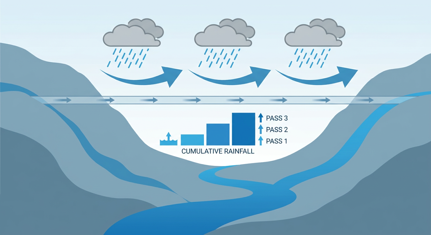
WPC has a separate Marginal excessive rainfall risk posted for the Ohio and Tennessee Valleys and the southern Appalachians today, plus a pocket over southeast Florida. The setup here is a slow-moving cold front dragging across the lower Ohio and Tennessee Valleys, with training showers and a few embedded storms moving over the same corridor repeatedly. That's the ingredient that turns a normal rain day into a localized flooding headache: the same ground gets hit over and over instead of the rain spreading out.
Southeast Florida is the other watch area, and if that sounds familiar, it should. This is the same general region that saw a Flash Flood Emergency in Brevard County on November 2nd with rainfall near 13 to 20 inches in spots, and Broward County picked up a Flash Flood Warning just yesterday evening. Soils down there are saturated. They don't need much more to cause problems again, even under a Marginal risk.
What About the Tropics?
Nothing urgent here, but a few things worth tracking. Invest 95EP sits well southeast of Hawaii in the central Pacific, expected to slowly organize into a tropical depression over the next few days, but it's far from any US impact. Closer to home, NHC is watching an area of low pressure expected to form south of Bermuda over the next day or so. It could pick up some subtropical characteristics by the weekend while drifting east over the open Atlantic. Right now that's a 20 percent chance of development in two days and 40 percent through seven days, both Medium risk categories. Nothing here points toward the US coast. We'll keep an eye on it.
Where the Nice Weather Is
If you want the best weather in the country today, head toward the southern High Plains and Mid-South. San Antonio, Oklahoma City, and Pine Bluff are all sitting in that Beautiful-tier zone, dry air, light wind, plenty of sun. That lines up nicely with the UIL State Marching Band competition happening in San Antonio today. Couldn't ask for better conditions for that one. Vegas has a busy weekend on tap too with the PBR Challenger Series and the Ultimate Music Experience, and current data doesn't show any weather concerns out that way.
For temperature context, November normals put Oklahoma City around 61 for a high and Nashville around 60. Nothing in today's data points to a wild departure from that in the calmer zones. The real story today isn't temperature, it's moisture and timing.
What We're Watching
- Isolated severe storms possible late morning into afternoon across north Georgia, east Alabama, and east Tennessee, mainly wind and an isolated brief tornado
- Training rain bands over the Tennessee and Ohio Valleys could produce localized flash flooding, especially in terrain-enhanced spots in the southern Appalachians
- Southeast Florida remains flood-prone with saturated ground from last week's extreme rain events
- An Atlantic low south of Bermuda bears watching for slow subtropical development this weekend, no US impact expected at this time
- Quiet space weather today, but mark your calendar for a G1 minor geomagnetic storm possible November 17-18
Bottom Line
This is a low-grade day compared to what the Southern Plains and Ark-La-Tex just went through. If you're in the Atlanta, Knoxville, Chattanooga, or Anniston/Gadsden corridor, keep a normal eye on the sky this afternoon, nothing to cancel plans over, but don't be shocked by a gusty storm or a stray severe warning. If you're in the Tennessee or Ohio Valley, or in southeast Florida, watch for ponding water on roads if storms train over your area. Everybody else, especially from the southern High Plains into the Mid-South, you've got about as good a weather day as November offers. Enjoy it.