Blog Article
Moderate Flood Risk Hits I-35 Corridor and Midwest Oct 1
WPC issues a Moderate excessive rainfall risk for the I-35 corridor and Nebraska/Iowa today, while three East Pacific tropical systems stay offshore.

Moderate Flood Risk Sets Up Over I-35 and the Heartland While the Tropics Stay Offshore
Alright y'all, let's get right to it. The headline today isn't wind or hail, it's water. The Weather Prediction Center has a Moderate Risk of excessive rainfall up for parts of the southern Plains, and that's not a category WPC hands out lightly. If you're anywhere near the I-35 corridor from Dallas-Fort Worth down through Austin and San Antonio, today's the day to pay attention.
Why This Setup Is Different
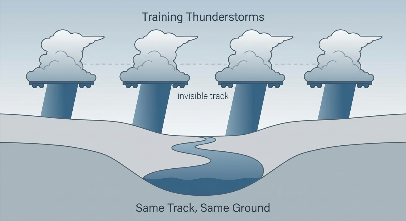
Here's the thing about flash flooding. It's rarely about one big storm. It's about the same storms running over the same ground again and again, a process forecasters call training. Picture a conveyor belt of thunderstorm cells all riding the same track, like cars on a freight line, each one dumping its load on the spot the last one just soaked.
That's exactly what's lining up today. A slow-moving cold front is draped across Texas, and deep Gulf moisture is running right up against it. WPC's guidance shows a 50 to 90 percent chance of 3 or more inches of rain pooling up along and east of I-35, with a secondary max down near the Rio Grande. Add the Hill Country's notoriously flood-prone terrain, steep little creeks and canyons that can go from dry to dangerous in minutes, and you've got a textbook flash flood setup.
Timeline and Who's Affected
- Today (Thursday): Moderate Risk centered on the I-35 corridor, Dallas-Fort Worth to Austin-San Antonio, plus a secondary max near the southern Rio Grande. Widespread 3+ inch totals possible.
- Friday: Risk downgrades to Slight but doesn't go away. The front lingers, with another 2 to 4 inches possible from Laredo to McAllen and a secondary bullseye just east of I-35 in east-central Texas.
- Saturday: The heavy rain threat shifts east, Slight Risk stretching from the central Gulf Coast into the Tennessee Valley as the upper trough finally starts pulling away.
If you've got plans at Austin City Limits Weekend One, which kicks off Friday, keep an eye on the radar Thursday night into Friday morning. The worst of the rain should be sliding east of Austin by festival time, but saturated grounds and lingering showers aren't out of the question early Friday.
A Second Flood Risk, Way Up in the Heartland
Texas isn't the only spot on alert today. Southeast Nebraska, especially the Omaha metro, is looking at one of the highest flash flood threats in the whole country right now, with HREF model guidance showing 70 to 90 percent odds of 3+ inches and 40 to 70 percent odds of 5+ inches along a training warm front. That's a serious number.
Central Iowa is in the mix too, and this one hits close to home if you've been following along. We talked last week about West Des Moines picking up 7.8 inches of rain and pushing Walnut Creek into moderate flood stage. Those soils never really dried out. Now forecasters are watching for another 2 to 4 inches, locally up to 6, right on top of ground that's still primed to run off instead of soak in.

Tropics Watch: Nothing Pointed at the U.S.
Three systems are spinning in the East Pacific right now. Hurricane Rachel is a Category 2 with 98 mph winds, sitting a couple hundred miles southwest of Cabo Corrientes, and it's expected to strengthen a bit more as it tracks WNW, staying offshore of mainland Mexico and the Baja peninsula. Tropical Storm Nolo is winding down southwest of Hawaii, its convection fading as dry air works in. Tropical Depression Nineteen-E is way out west-southwest of Baja and disorganized. None of these are forecast to threaten the U.S. mainland. There's also a disturbance south of southern Mexico that NHC gives a 70 percent chance of development over the next week, worth a glance but too far out and too far south to matter for U.S. weather planning right now.
Space Weather: A Minor Storm Possible Midweek
SWPC is watching a CME that left the sun on September 28th. Its flanking influence could nudge geomagnetic activity up to G1 (Minor) storm levels on October 2nd and 3rd. That's a low-end disturbance, mostly a story for aurora chasers up in the northern tier, not something that affects day-to-day weather.
What We're Watching
- Training thunderstorms repeating over the Hill Country and I-35 corridor through tonight
- Omaha and central Iowa flash flood potential on already-saturated ground
- The front's slow eastward crawl dragging the heavy rain threat into the Gulf Coast and Tennessee Valley by Saturday
- Low-water crossings and urban drainage in Austin, San Antonio, Dallas-Fort Worth, and Omaha metro areas
- Any upgrade to the Day 2 Slight Risk as better data comes in overnight
Bottom Line
If you live along I-35 in Texas or anywhere near Omaha or Des Moines, today's a "know where the high ground is" kind of day. Avoid low-water crossings even if they look shallow, turn around instead of driving through standing water, and keep your phone charged for flash flood warnings overnight. Heading to ACL this weekend? Build in some buffer time Friday morning in case roads are still wet from overnight rain. Everybody else across the Plains and Midwest is looking at a fairly ordinary, near-normal October day, just watch that front as it slides east through the weekend.