Blog Article
Moderate Flood Risk: Kansas, Missouri Rain Threat Today
WPC's Moderate excessive rainfall risk targets NE Kansas and NW Missouri today, with a Marginal severe threat in the Midwest and Utah's turn Wednesday.
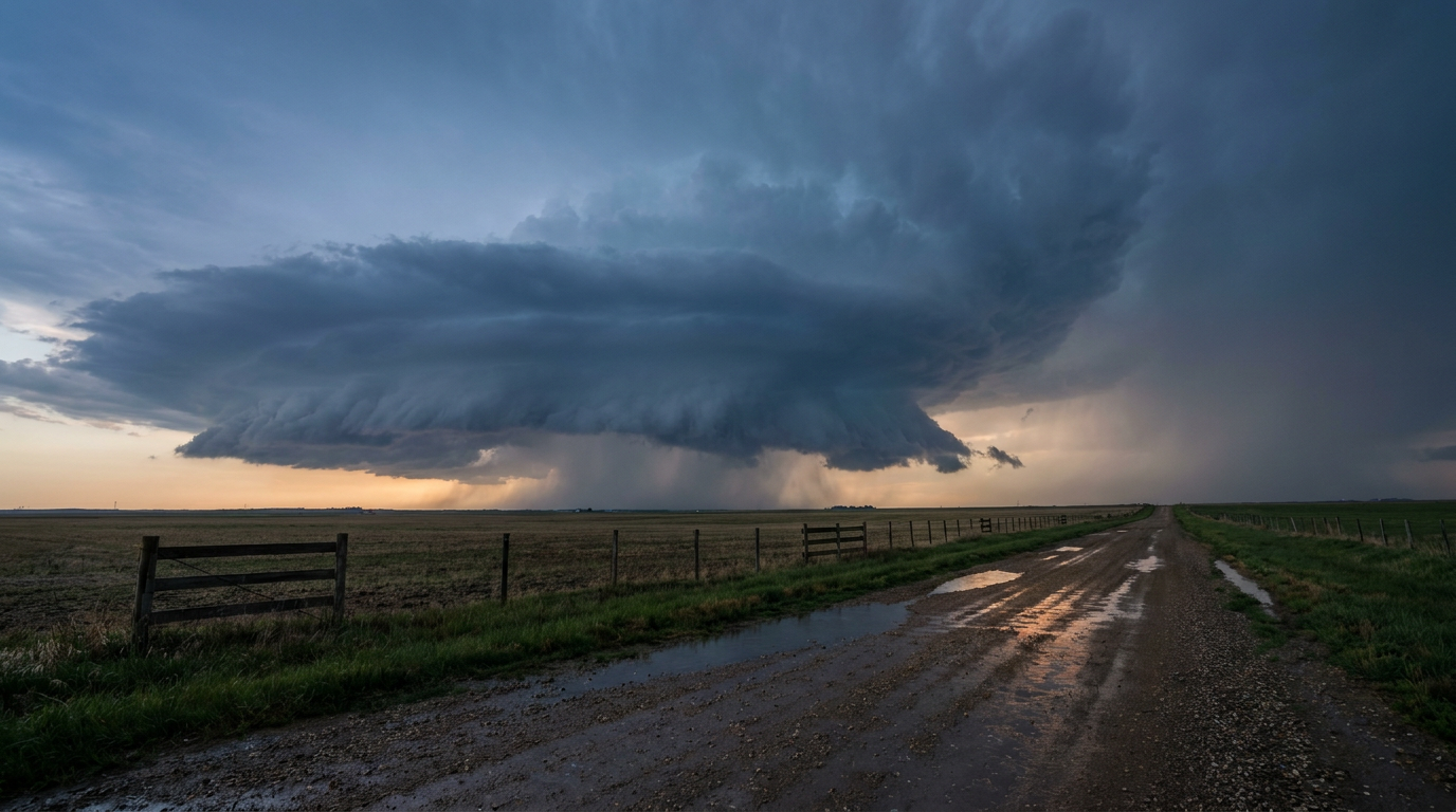
Moderate Flood Risk Sets Up Over Kansas and Missouri While Wednesday's Severe Threat Shifts to Salt Lake City
Alright y'all, let's get into it. The headline today isn't wind or hail, it's water. WPC has drawn a Moderate Risk of excessive rainfall over northeastern Kansas into northwest Missouri, and if you've been following along this month, you know this region has already taken a beating.
The Big Story: Moderate Rain Risk from Kansas into Missouri
Here's the setup. A cold front sliding southeast out of Nebraska is running into deep southwesterly flow, and that's creating a textbook isentropic ascent pattern right along the Missouri River Valley between Kansas, Missouri, and southeastern Nebraska. In plain English: air is being forced to rise steadily over a wide area, and that's a recipe for repeated rounds of rain moving over the same spots. Meteorologists call it training, like boxcars on a train track, one storm after another rolling over the same towns.
WPC's discussion specifically calls out this corridor, and it lines up with what our AFD data is flagging too. Des Moines and the Quad Cities are both sitting in this Moderate Risk footprint, and both offices note that soils in the region are still recovering from earlier flooding this month, including that 7.80 inch Walnut Creek event back on September 9th. When ground is already saturated, it doesn't take as much rain to cause problems the second time around.
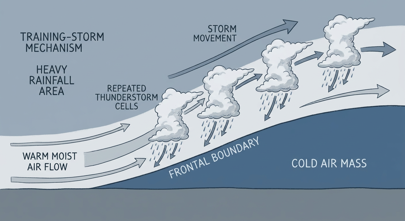
Kansas City sits right on the edge of this zone too, and the AFD out of EAX flags 2 to 4 inches of QPF possible north of the metro. If you're anywhere between Topeka and St. Joseph, this is a day to keep half an eye on the sky and know your low-water crossing spots. Localized amounts over 3 inches are possible where training sets up best, and that's enough for flash flooding on small streams and urban drainage even without a dramatic-looking storm.
Severe Storms: Marginal Risk from the Plains into the Midwest
SPC has a Marginal Risk of severe thunderstorms today running from the south-central Plains into parts of the Midwest, covering Chicago, Indianapolis, Kansas City, Wichita, and Toledo. This ties into the same vigorous mid and upper-level trough that's driving the rain threat. The main concern is isolated damaging wind gusts, with SPC putting a 5 percent probability on that risk. That's Level 1 on their scale, not a big severe setup, but enough that a stray strong storm could knock down a tree limb or two.
If you're headed to Wrigley tonight for Braves-Cubs, or catching the Yankees-Twins game in Minneapolis, keep an umbrella handy and don't be shocked if there's a delay window somewhere in the neighborhood of the front's passage. The St. Louis Cardinals hosting the Giants tonight sits close to the edge of both the rain and wind risk zones too, so that's worth a glance at the radar before first pitch.
Looking Ahead: Salt Lake City's Turn on Wednesday
The severe focus shifts west for Day 2. SPC has a Marginal Risk posted for the Great Salt Lake and Salt Lake City vicinity Wednesday morning. A developing mid-level low near the northern California coast is expected to push increasing shear and just enough boundary-layer instability into northern Utah to support one or two organized storms, possibly even supercell structures. Hail and damaging wind gusts are the main threats, both at 5 percent probability, and SLC's own forecast office flags this explicitly for early Wednesday.
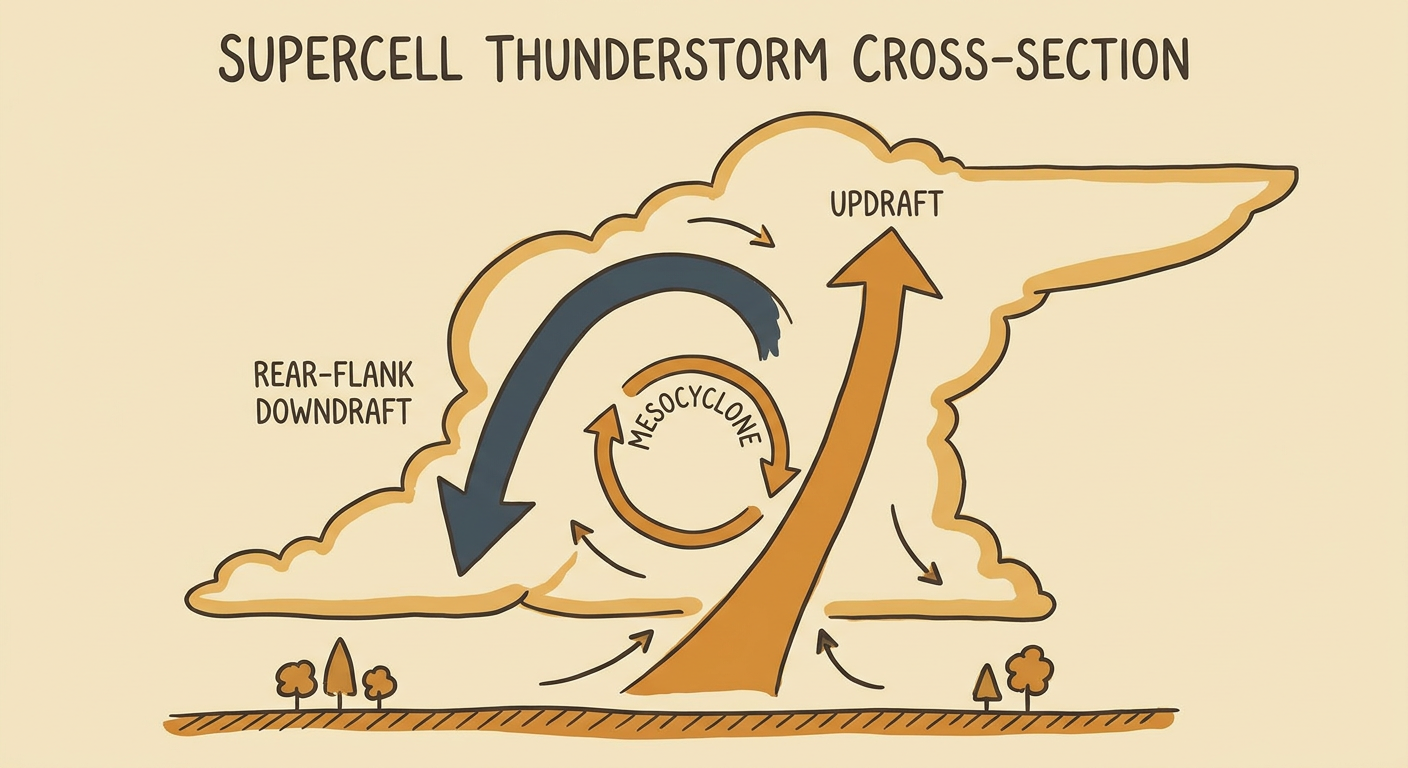
This isn't a huge outbreak setup, but it is a notable shift. Utah doesn't often show up on the severe outlook map, so if you're in the Salt Lake Valley, Provo, or up toward Logan, plan your Wednesday morning errands with that in mind.
Tropics Watch: Norbert Fading, Fifteen-E Still Spinning
Out in the East Pacific, Tropical Depression Norbert is on its last legs as a tropical cyclone. NHC says deep convection has completely fallen apart, with the low-level center now fully exposed on satellite. Norbert is expected to weaken into a remnant low by Tuesday morning. It's still forecast to pass around 28 miles off Hawaii Island's east coast in roughly a day and a half, but as a weakening system with winds near 35 mph. Given how saturated Hawaii's soils already are after Hurricanes Lowell, Moke, and Lala earlier this season, even leftover moisture from Norbert's remnants could be enough to nudge some streams back up. Worth a watch if you're on the Big Island, but this is not a repeat of Lowell.
Further west, Tropical Depression Fifteen-E is spinning down well off the Baja Peninsula, also at 35 mph winds, and it's expected to stay out over open water with no land impacts anticipated. There's also a subtropical Atlantic disturbance that NHC gives a 40 percent chance of development over the next seven days as it drifts northwest, but that's a system for next week's conversation, not this one.
Space Weather: A Little Aurora Potential Tonight
SWPC is calling for the geomagnetic field to reach active to G1 (Minor) storm levels tonight and again Tuesday night, driven by a combination of a coronal hole high-speed stream and flanking effects from CMEs earlier this week. G1 is about as mild as geomagnetic storms get, but if you're at higher latitudes with clear skies, it might be worth a look north after dark.
What We're Watching
- Training thunderstorms and Moderate excessive rainfall risk over northeast Kansas into northwest Missouri today, with 2 to 4 inches of rain possible and localized totals over 3 inches
- Marginal severe risk (isolated damaging wind) from the south-central Plains into the Midwest, affecting Chicago, Kansas City, Wichita, Indianapolis, and Toledo
- The rain and storm threat expanding eastward Wednesday into Iowa, Illinois, Indiana, Michigan, and western Ohio
- A Marginal severe risk shifting to the Great Salt Lake/Salt Lake City area Wednesday morning, with isolated large hail and damaging wind possible
- Tropical Depression Norbert weakening to a remnant low near Hawaii Island, worth monitoring given already-saturated ground there
- Minor G1 geomagnetic storming possible tonight and Wednesday night
Bottom Line
If you're anywhere from northeast Kansas into northwest Missouri and the Quad Cities, today's the day to pay attention to rainfall, not wind. Ground that's already soaked up several flooding events this month doesn't have much room left to absorb another 2 to 4 inches, so keep tabs on local creeks and don't drive into standing water. Everyone from Chicago to Kansas City to Wichita should keep half an eye on the sky for a stray strong storm this afternoon, and if you're in northern Utah, mark Wednesday morning as your window for possible severe weather. Hawaii's Big Island residents should watch Norbert's remnant moisture even though the tropical cyclone itself is on the way out.