Blog Article
Moke Floods Hawaii, Plains Severe Weather Watch: Aug 24 Forecast
Tropical Depression Moke threatens flash floods on saturated Hawaii terrain while SPC flags severe storm risk from the Dakotas to the Gulf Coast today.
Moke Keeps Hawaii's Flood Watches Up While the Mainland Watches Two Separate Severe Weather Days
Alright y'all, let's start where the biggest impact actually is this morning: Hawaii.
Moke Is Kicking Hawaii While It's Down
We were just talking a few days back about Hurricane Lala tearing through the islands with that jaw-dropping 140 mph non-thunderstorm gust up at the Mauna Kea Summit. Well, the ground down there never really got a chance to dry out, and now Tropical Depression Moke is adding insult to injury.
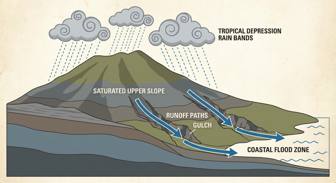
Moke sits a few hundred miles southwest of Hilo with 35 mph winds, and honestly the wind isn't the story. This system is producing 3 to 6 inches of rain across the Big Island and eastern Maui, and that's landing on slopes already saturated from Lala. Flood Watches remain up, and the concern is real: life-threatening flash flooding and mudslides on terrain that's had no time to recover. Moke's center is forecast to pass within about 20 kilometers of Hawaii Island's south side, so this isn't a glancing blow from way offshore. It's close enough to matter.
If you're on the Big Island or Maui, this is a "watch the gulches and low-lying roads" kind of day, not a wind event.
Two More Named Storms Out There, But Not Threats to Land
While Moke soaks Hawaii, Tropical Storm Lala has drifted north-northwest over cooler water a few hundred miles north of Pearl and Hermes Atoll. It's maintaining 63 mph winds for now, but there's no land in its path, and its closest approach late this week keeps it well offshore near 40°N. This one's just spinning itself out over open ocean.
Out in the Eastern Pacific, Tropical Storm Iselle strengthened to 58 mph winds overnight, sitting about 540 miles southwest of the southern tip of Baja California. It's dealing with some northwesterly shear that's displaced its convection, but a few objective intensity estimates suggest it could be a touch stronger than advertised. No coastal watches or warnings are up, and it's expected to stay offshore, so this is one to watch from a distance rather than worry about.
Over in the Atlantic, there's a low pressure area (Invest 95AL) a few hundred miles southeast of Bermuda that NHC gives a 50 percent chance of development, but it's forecast to track north and northeast, well away from Bermuda and the coast. Not a mainland concern.
Back Home: Today's Severe Threat Runs From the Dakotas to the Gulf Coast
On the mainland, SPC has a Slight Risk of severe thunderstorms posted for two separate corridors today.
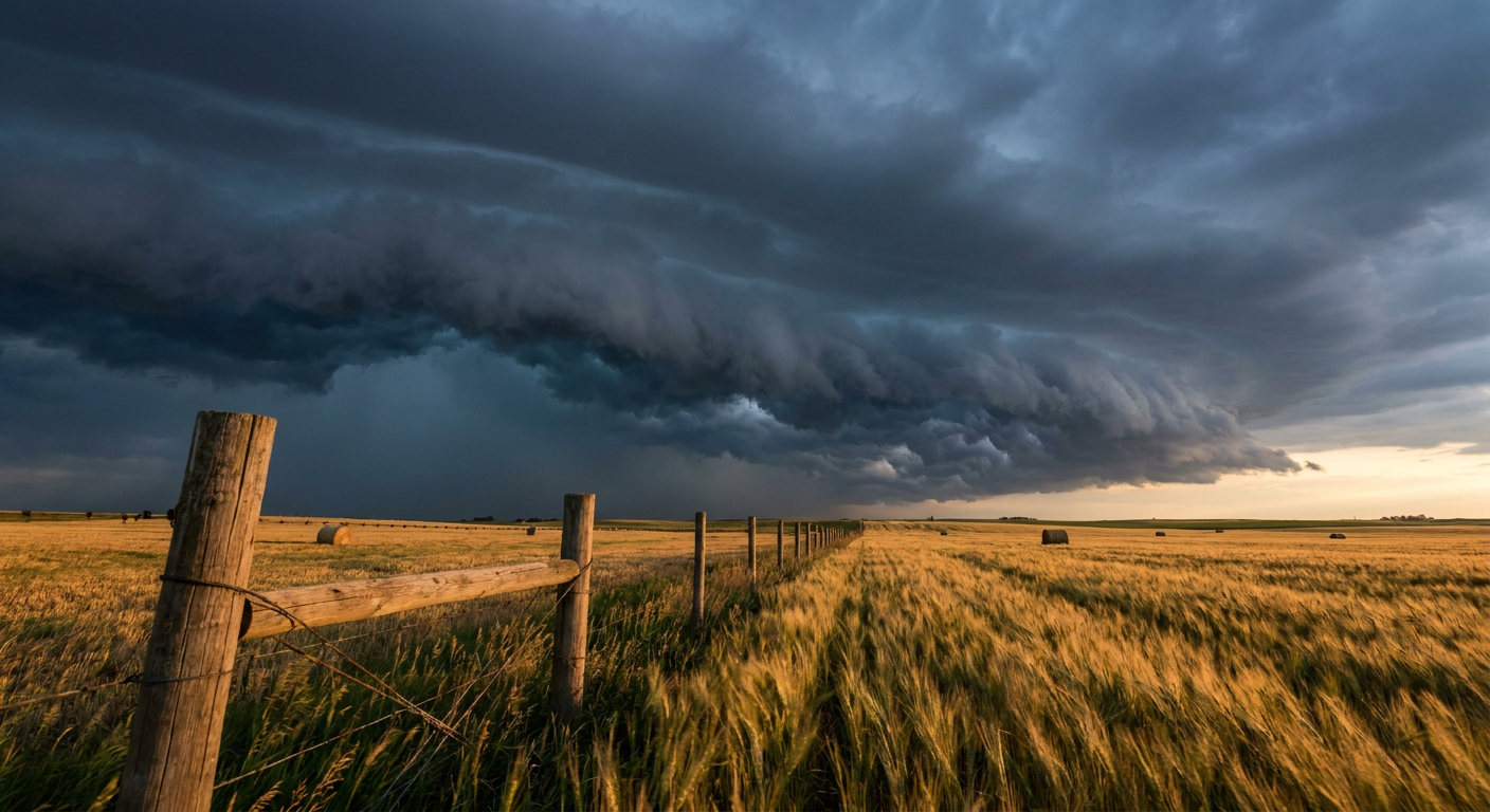
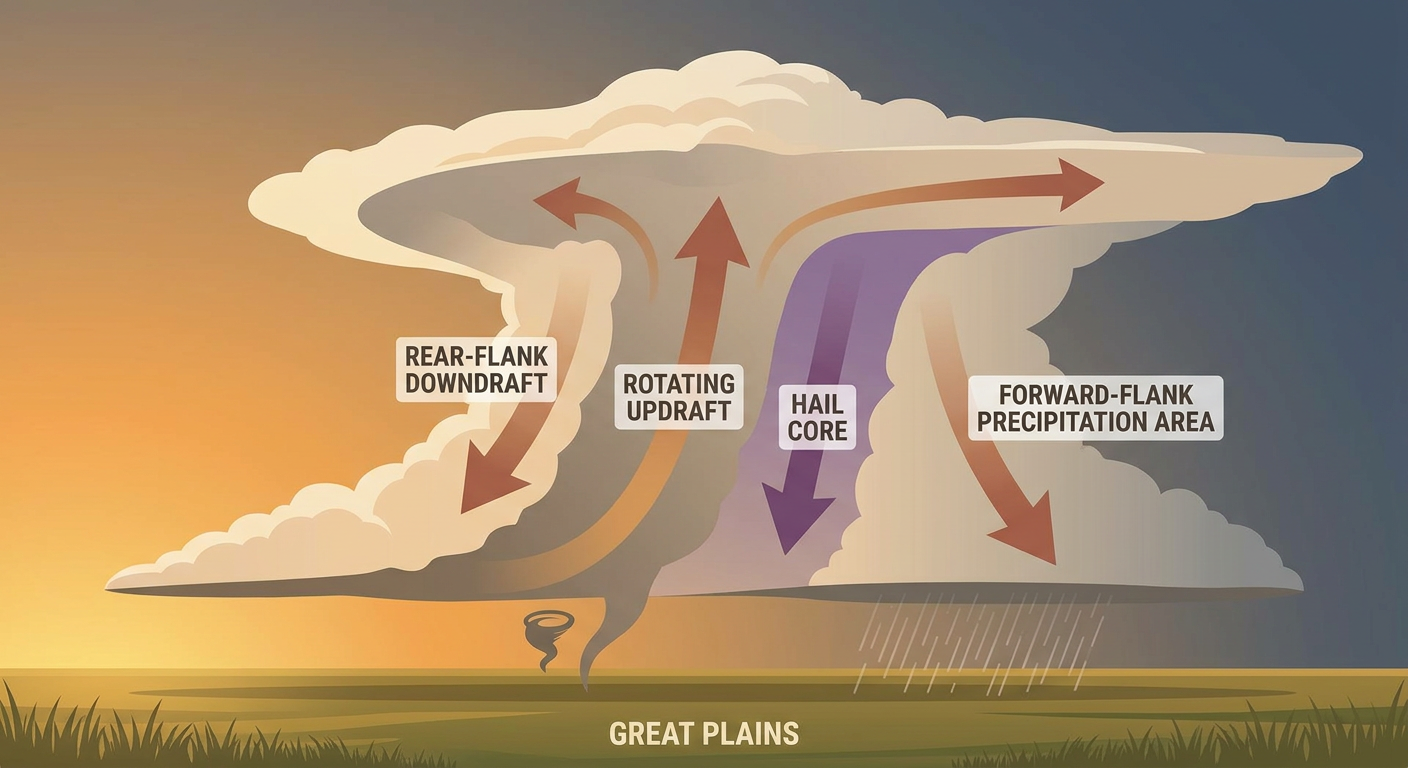
The first stretches across the Dakotas, northwest Minnesota, and the central High Plains, where this afternoon and evening should bring storms capable of large hail and damaging wind gusts. There's a hatched area inside that risk zone where gusts could reach 75 mph or better, and quarter-size hail could go up to 2 inches in the strongest cells. That's the same general neighborhood that got hammered yesterday, with a 75 mph measured gust near Malta, Montana, and 1.75 inch hail down in South Dakota. Today's threat sits a bit farther east and south of that action, but the ingredients are similar.
The second area of concern runs along the middle Gulf Coast into the coastal Carolinas, covering New Orleans, Baton Rouge, Mobile, and Hattiesburg. An isolated tornado can't be ruled out if storms fire along any boundaries down there, but wind and hail are the headline threats.
Key numbers from SPC's Day 1 outlook:
- Tornado: 2 percent (isolated risk) across parts of the outlook area
- Wind: up to 15 percent, with a hatched zone for 75+ mph gusts
- Hail: up to 15 percent, with a hatched zone for 2-inch-plus hail
Tuesday's Threat Shifts West Into the Plains
By Tuesday, SPC moves that Slight Risk into southern Nebraska and northern Kansas, stretching into northeastern Colorado, western Nebraska, and western Kansas. Strong heating, good instability, and steep lapse rates ahead of a cold front should support scattered storms starting mid-afternoon, and initial cells may organize into supercells with large hail before transitioning into a wind-producing complex overnight. Locally, gusts could again reach 75 mph or better in the strongest cores.
There's also a conditional evening threat farther northeast in Minnesota and Wisconsin, which matters if you're headed to the Minnesota State Fair in Falcon Heights when it opens Thursday, or if you've got outdoor plans in that corridor later this week.
Heat and Rain on the Side
WPC has a Marginal excessive rainfall risk today across parts of the western and central U.S. and in the lee of Lake Erie, nothing widespread but enough for a few localized downpours. That risk drifts toward the lower Mississippi Valley and Gulf/Southeast coasts by Tuesday and Wednesday.
Meanwhile, out on the Texas Panhandle, record-level heat is stacking on top of the severe threat, with highs pushing past 100°F around Amarillo. That's well above the August norm there and enough to support dry downbursts and blowing dust even without a classic severe setup. If you're traveling I-40 through that corridor Tuesday or Wednesday, watch for sudden dust reduction in visibility alongside the storm risk.
The One Bright Spot: A Genuinely Nice Day for the Ohio Valley and Mid-Atlantic
Not everything's stormy today. Dry high pressure has scoured the humidity out of the central Great Lakes into the Ohio Valley and Mid-Atlantic, from Philadelphia and DC down through Lexington, Roanoke, and Asheville. That's the best air quality and lowest humidity slice of the country today, a genuinely comfortable, mostly sunny stretch. If you've got tickets to tonight's Nationals-Rockies game in DC or you're catching the Tigers-Rays series in Detroit, you're in good shape weather-wise.
What We're Watching
- Moke's rainfall totals on the Big Island and Maui, and whether Flood Watches get extended
- Whether Iselle strengthens further offshore Baja (no coastal threat currently expected)
- Today's hatched severe zones in the Dakotas/High Plains and Gulf Coast for 75+ mph gusts and 2-inch hail
- Tuesday's shift of the severe threat into southern Nebraska and northern Kansas
- Heat combining with dry downburst potential across the Texas Panhandle
- Marginal rainfall risk drifting toward the Gulf and Southeast coasts by midweek
Bottom Line
If you're in Hawaii, especially the Big Island or Maui, take the Flood Watches seriously today. The ground's already full from Lala, and Moke doesn't need to be a strong system to cause real flash flood and mudslide problems. On the mainland, today's severe threat covers a wide but scattered area from the Dakotas to the Gulf Coast, mainly a wind and hail story with a hatched zone for the strongest gusts and largest hail. That threat migrates into the central Plains Tuesday, so if you've got outdoor plans in Nebraska or Kansas midweek, keep an eye on the forecast. Everybody else east of the Mississippi in the Ohio Valley and Mid-Atlantic corridor gets a genuinely pleasant, low-humidity day to enjoy.