Blog Article
Spring Break Weather Chaos: Blizzards & Severe Storms (2026)
A massive weather system is bringing a high-risk blizzard to the Midwest and severe storms to the South this weekend. See how it impacts your Spring Break.

Mother Nature is channeling Beth Dutton this weekend: Blizzards, severe storms, and Spring Break travel chaos
Y'all, everybody on the internet today is talking about the new 'Yellowstone' update and the return of the Dutton ranch. But here is the thing. Mother Nature has been acting exactly like Beth Dutton all week long. She is being absolutely ruthless, taking no prisoners, and remaining completely unpredictable.
We have a massive weather whiplash situation setting up across the country this weekend. Right as folks are packing their bags for Spring Break, heading out to food festivals, or catching some MLB Spring Training games, the atmosphere is deciding to throw everything but the kitchen sink at us.
Let's break down exactly what this means for your weekend plans, because this is not just another standard forecast.
The Travel Nightmare: A High-Risk Blizzard
If your Spring Break plans involve flying through or driving across the Upper Midwest this weekend, you need to pay close attention.
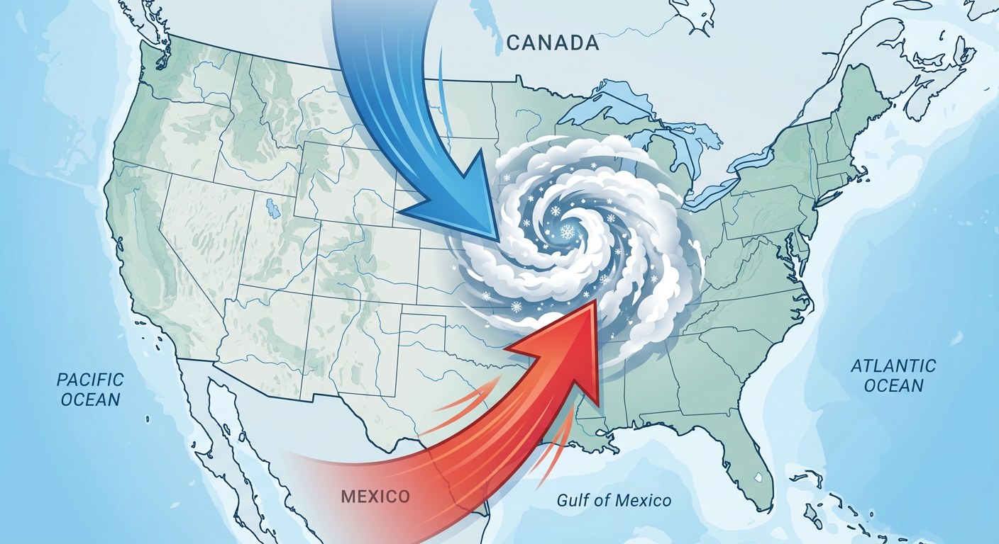
We have a rapidly deepening cyclone ejecting out of the Rockies that is going to trigger a major winter storm. The Weather Prediction Center has actually issued a rare HIGH RISK for significant winter weather for Sunday across parts of Wisconsin, with an Enhanced Risk stretching from the Northern Plains right through the Twin Cities.
We are talking about widespread snow totals of 12 to 18 inches and wind gusts hitting 40 to 60 mph. That means pure blizzard conditions and impossible travel.
Get this. We are already seeing news stories today about TSA workers missing full paychecks while travelers keep paying security fees. Now, you combine potentially understaffed security lines with a historic blizzard shutting down major airline hubs like Minneapolis, Milwaukee, and Chicago. That is a recipe for a massive domino effect of flight cancellations nationwide. If you are flying this weekend, check your flight status obsessively.
Sunday's Severe Threat: Keep an eye on your festivals
Now, let's look down South. A lot of you are probably looking forward to outdoor events this weekend. I see the big Houston Crawfish Fest is happening, plus tons of outdoor concerts and early spring festivals across Texas and the Gulf Coast.
While Saturday might be decent in many spots, Sunday is going to be a completely different animal.
The Storm Prediction Center has outlined an ENHANCED RISK (level 3 out of 5) for severe thunderstorms on Sunday stretching all the way from northeast Texas, through the Lower Mississippi River Valley, and up into southern Indiana and southwest Lower Michigan.
- The Main Threat: A widespread damaging wind event is likely, but there is absolutely a tornado threat we need to watch closely.
- Who is in the bullseye: Cities like Indianapolis, Memphis, Nashville, Louisville, and Shreveport.
- The Timeline: The greatest wind threat looks to be during the evening and overnight hours.
If you are throwing a party, attending a festival, or just hanging out outdoors in the warm sector this Sunday, you have to be weather aware. Have multiple ways to get warnings that will wake you up, especially since these storms will be moving fast and happening after dark in some areas.
By Monday, this system pushes east, bringing a 30 percent severe risk to the Mid-Atlantic, including Baltimore, Washington DC, and Charlotte. So the East Coast is not off the hook either.
Spring Training Scorcher and Fire Risk
While the middle of the country deals with severe storms and blizzards, the West is experiencing a totally different extreme.
If you are heading to Arizona to watch the Cubs, Rangers, or Guardians play some Spring Training baseball, pack the sunscreen and hydrate. We are looking at an anomalously early heatwave building in the Desert Southwest, with record highs pushing near 90 degrees.
But that heat comes with a serious downside. There is a Critical Fire Weather Risk on Saturday for a massive chunk of real estate covering New Mexico, eastern Colorado, western Kansas, western Nebraska, and west Texas.
We are talking about bone-dry humidity and sustained winds of 20 to 30 mph. One spark from a dragging trailer chain or an abandoned campfire can start a rapidly spreading wildfire in these conditions.
The Takeaway
Alright folks, the weather is not playing around this weekend. It is a true clash of the seasons. If you are traveling, pack your patience and have a backup plan. If you are in the severe risk areas, make sure your weather radios are loud and your phones are charged.
Stay safe, enjoy your Spring Break if you are taking one, and keep looking up y'all.