Blog Article
Mother's Day Storms: Texas Severe Weather & Hail Threat
A severe weather setup is impacting Mother's Day evening plans in Texas with large hail and damaging winds. Plus, a look at critical fire weather in the North.
Mother's Day Dinners and Texas Thunderstorms: What to Watch Tonight
Y'all, I hope everyone had a fantastic Mother's Day. Maybe you took your mom out for brunch. Maybe you just gave her a long phone call. Today is all about showing appreciation. But if your evening plans involve a patio dinner in central Texas, you might want to ask for a table inside. We have a pretty serious weather setup rolling through right as folks are trying to head home.
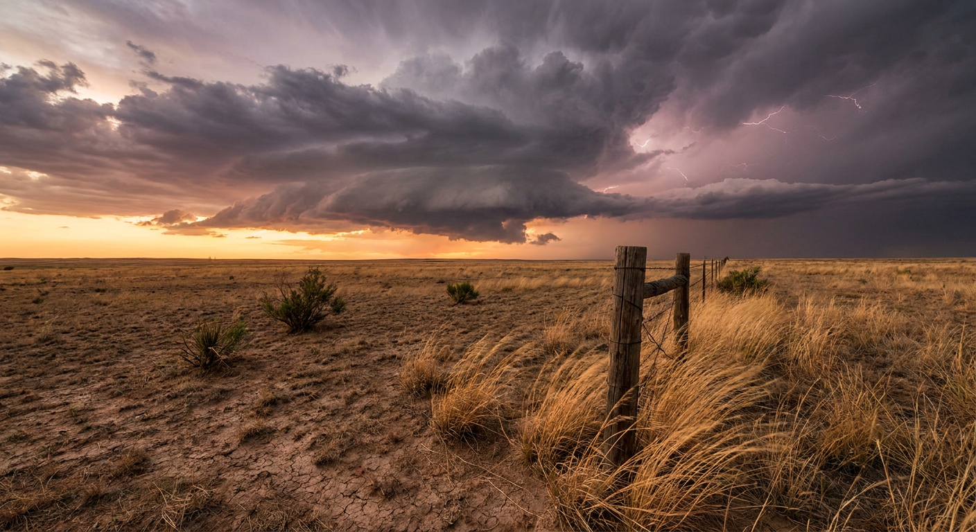
The Texas Hail and Wind Threat
The Storm Prediction Center has an Enhanced Risk for severe storms across parts of west-central and central Texas tonight. We are talking about places like Waco, Abilene, Killeen, and San Angelo.
The main threats with these evening storms are massive hail and damaging winds. If a severe storm forms over your neighborhood, it could drop hailstones the size of hen eggs. That is two inches across. We could also see wind gusts top out around 75 mph. That is enough to ruin a nice evening out real quick and cause some serious property damage.
Here is the thing about these storms. They are dumping a lot of water. The Weather Prediction Center expanded their Slight Risk for excessive rainfall today. That risk area now includes the entire DFW Metroplex.
Get this, y'all. The Texas Rangers and Chicago Cubs played indoors at Globe Life Field in Arlington today. The game itself was perfectly dry. The drive home is a different story. If you are navigating those interstates tonight, expect heavy downpours, slick roads, and reduced visibility.
A Flip to Fire Weather Up North
Looking ahead to Monday, the weather map flips entirely for the northern tier of the country. Up in eastern Montana and western North Dakota, we are tracking a Critical Fire Weather area.
There is a strong cold front pushing through the region. It is pulling in a very dry air mass, dropping humidity levels down to 15 percent. Pair that dry air with sustained southerly winds of 25 to 35 mph and gusts up to 45 mph.
That combination is a textbook recipe for rapidly spreading wildfires. Any spark in those conditions can get out of control before local fire departments even have a chance to respond. If you live up that way, hold off on any outdoor burning and secure anything in your yard that might blow away in those 45 mph gusts.
Weather has a funny way of interrupting our daily lives. Tonight it is complicating Mother's Day travel in Texas. Tomorrow it brings fire concerns to the Northern Plains. Keep a close eye on your local forecast tonight, especially if you have a long drive ahead.
https://ryanhallyall.com/blog/mothers-day-dinners-and-texas-thunderstorms-what-to-watch-tonight