Blog Article
California's 51-Day Streak and a Near-Perfect I-5 Pocket
California's Central Valley hits a 51-day nice weather streak while a cluster of small Washington towns is set to post near-Perfect scores Thursday.
California's Quiet 51-Day Streak Meets a Near-Perfect Pocket Along I-5
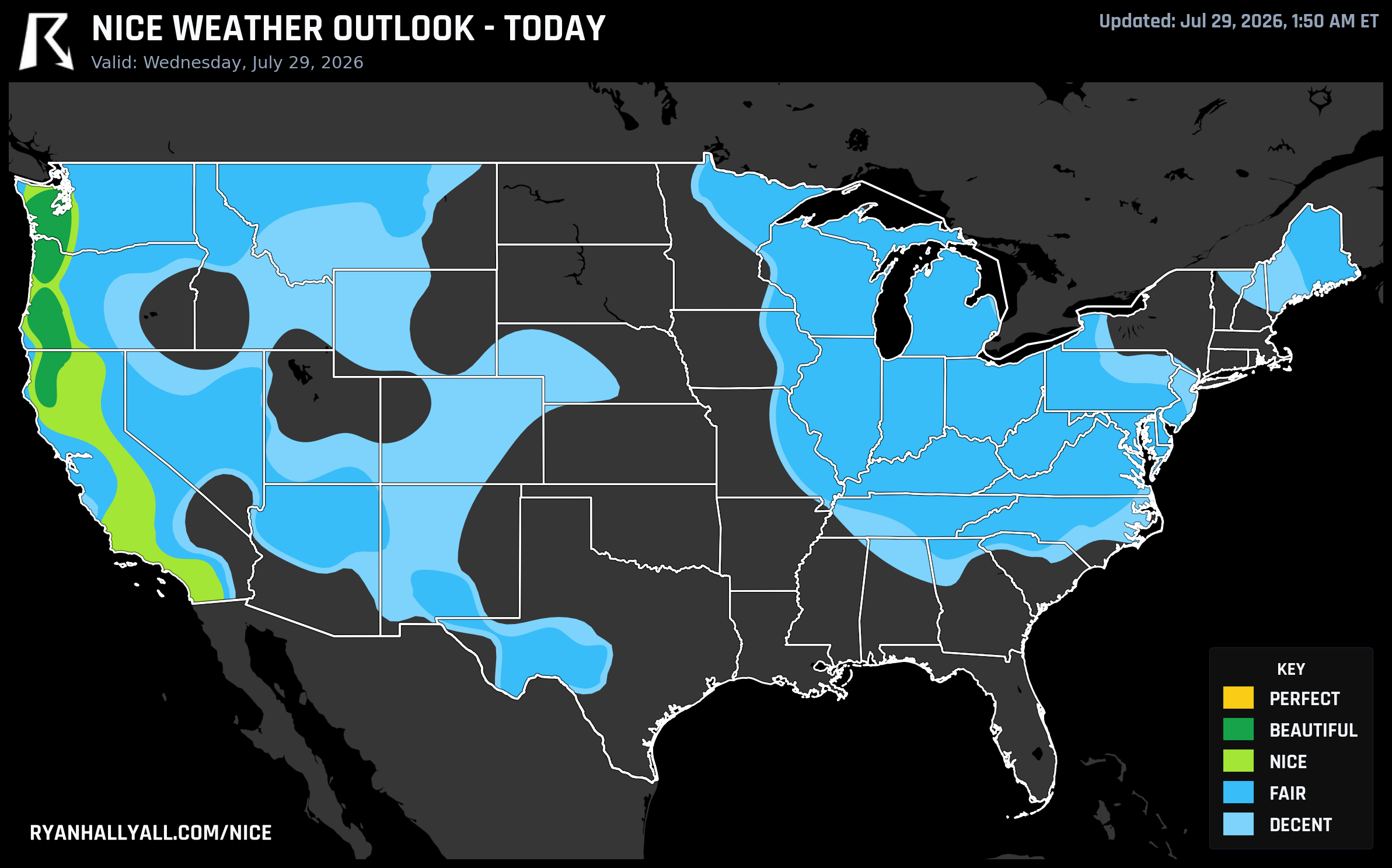
While the rest of the country has been dealing with tornado warnings in the Mid-Atlantic, training storms in Massachusetts, and a heat dome building out west, one region has been quietly having a very good summer. California's Central Valley and Bay Area, places like Sacramento, Oakland, Stockton, Modesto, Fairfield, and Napa, are sitting on a 51-day streak of Fair-or-better weather that stretches all the way back to early June. No rain to speak of, steady sky cover, and a dry-season rhythm that just keeps rolling.
That streak isn't flashy. It's not the kind of thing that shows up as a headline number like a heat index or a wind gust. It's just day after day of the marine-influenced Central Valley pattern doing exactly what it's supposed to do this time of year. The caveat is real heat is baked into some of those days. Redding is the outlier inside California's broader Nice-tier footprint today, running near 99°F with an effective AQI around 76, dragging its individual score down even as neighbors like Fresno hold in the low 80s with cleaner air. If you're chasing the streak's best version of itself, stick closer to the coast and Delta towns and skip the hottest interior pockets.
Today's ceiling sits in the Pacific Northwest
The best air in the country today is tucked into western Oregon and southwest Washington, where Medford, Olympia, and Longview are all posting Beautiful-tier scores of 92. Highs in the mid-60s to mid-80s, dewpoints in the low 50s, and basically zero rain chance make this about as clean a summer day as the West gets. It falls just short of the top tier for two small reasons: UV runs around 7.5, and afternoon temperatures are a hair too warm to clear the strictest threshold. Neither is a real problem, just sunscreen weather with a technicality attached.
Thursday is where it gets interesting
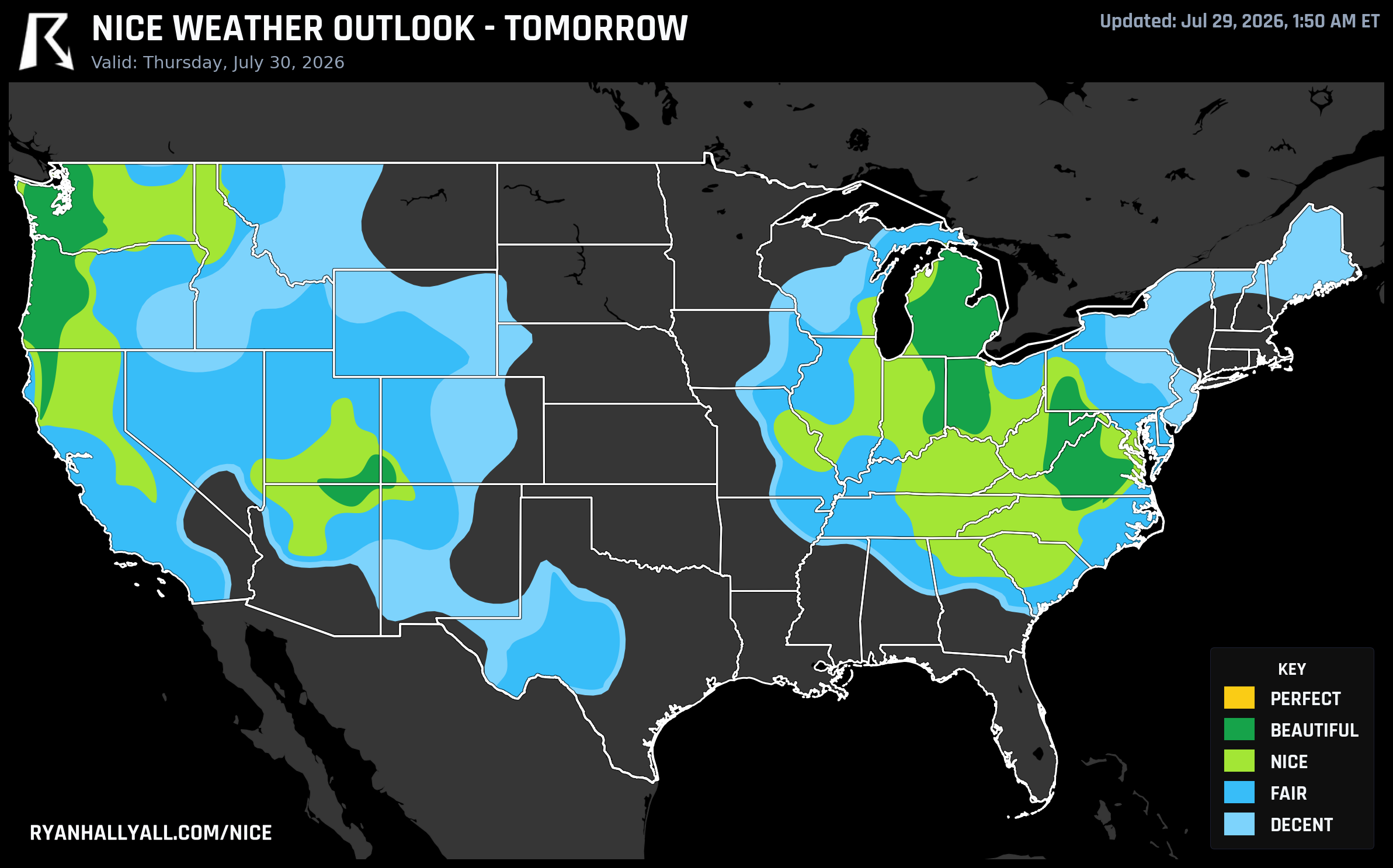
Tomorrow the whole picture shifts east and gets sharper. A dry Canadian high pushes into the Ohio Valley and Great Lakes behind this week's frontal mess, and Columbus, Toledo, Fort Wayne, and Grand Rapids all climb into Beautiful territory, with Columbus hitting a 92. The Ohio State Fair, already running under decent skies today, should feel noticeably better tomorrow with lower humidity and sunshine.
But the real prize is a cluster of small towns most people have never heard of. Along the I-5 corridor in Lewis and Thurston counties, Washington, places like Napavine, Grand Mound, McCleary, and Onalaska are projected to score 99.7 to 99.9, essentially the ceiling for the entire seven-day outlook. Centralia and Chehalis aren't far behind at 99.3 and 99.5. If you happen to live along that stretch of highway between Olympia and Vancouver, Washington, tomorrow is arguably the single best weather day anywhere in the country this week. It's a reminder that the biggest cities don't always win. Bigger metros like Seattle and Portland ride the same dry pattern tomorrow but land closer to the low 80s once wind and dewpoint get factored in at the city level.
The weekend still looks good, with one eye on the calendar
By Friday, Seattle and Baltimore lead a Beautiful-tier corridor that stretches into the Mid-Atlantic, and Seafair Weekend Festival kicks off in Seattle right into that window. Expect comfortable temperatures in the mid-80s, low humidity, and a light breeze rather than anything stormy. It's not quite the ceiling Thursday's I-5 towns get, but it's a very pleasant festival day.
That said, the broader pattern discussion is worth reading closely. WPC's extended outlook has a closed upper low sliding into southwestern Canada by early next week, which cools the Pacific Northwest even further, but it also amplifies a trough over the Midwest that keeps showers and heat swapping places through the Plains and Mid-South. CPC's week-2 hazards outlook goes further, flagging a renewed and expanding risk of extreme heat across California, the Southwest, and the Great Basin by August 5-6. In plain terms, this stretch of dry, mild air across the West is a window, not a new normal. If you've got outdoor plans in Oregon, Washington, or the Central Valley, this week and weekend are the time to use them.
For the full seven-day picture, city-by-city scores, and the daily maps behind all of this, check the Nice Weather outlook page.