Blog Article
NFL Preseason Finale Weather: Storms, Heat, and Aurora Odds
Eight NFL preseason games tonight face a marginal storm risk in Carolina, sticky Florida heat, and a real shot at aurora over Green Bay. Here's the forecast.

Nobody's Playing Their Starters Tonight, But the Atmosphere Showed Up Anyway
Alright, folks. Tonight's the last preseason Friday of the year, and it is an eight-game slate. Commanders at Ravens. Falcons at Dolphins. Texans at Panthers. Giants at Jets. Bucs at Jaguars. Cardinals at Packers. The Commanders already told everybody 41 players won't even suit up. That's basically the whole roster shrugging and saying "see y'all in September."
Here's the thing though. The atmosphere doesn't check the depth chart. It doesn't care if it's a meaningless preseason finale or the Super Bowl. So let's talk about what's actually going on over these stadiums tonight, because a couple of these games sit in weather that's worth knowing about before you fire up the grill.
Charlotte's Got Company Tonight
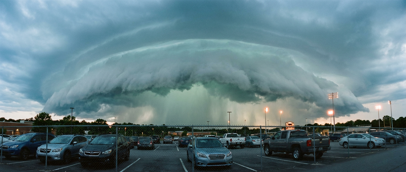
Texans at Panthers kicks off from Charlotte, and Charlotte happens to be sitting inside SPC's Marginal Risk area for tonight into Saturday morning. That zone stretches from north Georgia through the Carolinas and up into the Mid-Atlantic, and it also covers Washington, DC, which matters because the Commanders-Ravens crowd is driving in and out of that same corridor tonight.
Marginal Risk is the lowest rung on the SPC ladder, and it means exactly what it sounds like: isolated, not widespread. SPC has this pegged at a 5% chance for damaging wind and a 5% chance for severe hail if storms do fire. That's not a reason to cancel your tailgate. It is a reason to glance at the sky before first pitch, er, first snap, and know that an isolated strong storm rolling through during pregame is possible, not likely.
Worth remembering: this same general corridor got hammered by real severe weather just 24 hours ago. Severe Thunderstorm Watches went up across New Jersey, New York, and Pennsylvania yesterday, and a bowing complex out in Nebraska put down a measured 92 mph gust at Stapleton. Tonight is a much quieter animal by comparison. Marginal is marginal. But after a week like this one, with 90-plus mph wind gusts logged on four separate days across the Plains, it's fair to keep an eye on the radar app during timeouts.
The Rain Didn't Go Anywhere, It Just Calmed Down
WPC still has a Slight Risk of excessive rainfall painted across the coastal Carolinas into southeast Virginia and southern Georgia through Saturday morning. That's a step down from the flash flooding that swamped New Jersey and New York City on Wednesday, when a mesonet gauge in Gloucester County, NJ logged 5.24 inches and crews were doing water rescues in Staten Island and the Bronx. Tonight's setup is smaller in scope, but the ingredient list is familiar: a stalled front, precipitable water values pushing past 2 inches, and enough instability for training storms that can dump heavy rain in a hurry. If you're anywhere along that coastal strip this weekend, don't be shocked by a fast-moving downpour that drops more rain than the radar color would suggest.
Florida's Still Running the August Program
Down in Miami Gardens and Jacksonville, Falcons-Dolphins and Bucs-Jaguars kick off into what Florida does every August: heat and humidity that don't quit after sundown. Miami's average high this time of year is 91°F with a low of 77°F, and that low barely drops because the air stays loaded with moisture. Neither Florida game sits under an elevated SPC or WPC flag tonight, so this is standard-issue late-August Gulf swelter, not a specific alert. It'll just feel like it, especially for anyone standing in the upper deck without a breeze.
Speaking of the Gulf and tropics, three named systems are spinning right now. Karina is strengthening in the Eastern Pacific and forecast to become a major hurricane well offshore of southwestern Mexico, Lowell is a weaker tropical storm way out past Hawaii, and the remnants of Dolly are an open wave crossing toward the Lesser Antilles with impacts expected in Puerto Rico and the Virgin Islands by early next week. None of the three threaten the US mainland tonight, but late August is exactly when the tropics start waking up in earnest, and this is a pattern worth watching heading into September.
Look Up After the Whistle in Green Bay
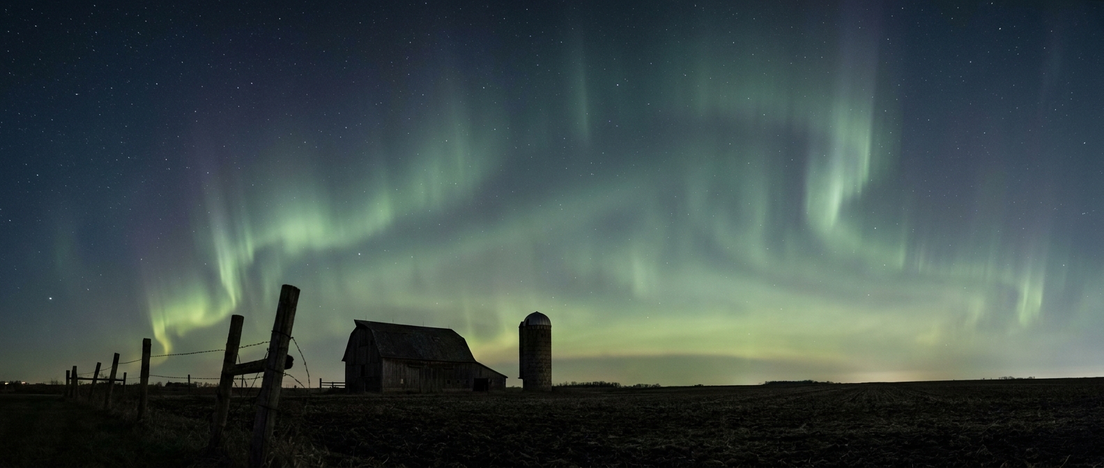
Here's the fun one. NOAA's Space Weather Prediction Center has G1 to G2, that's minor to moderate, geomagnetic storming likely tonight into Saturday, driven by a coronal hole high-speed stream and a couple of CMEs that left the sun a few days back. Confidence is only low to medium, but if the storming ramps up as forecast, folks up in Wisconsin watching Cardinals-Packers from Lambeau, or anyone north of there, have a real shot at catching some aurora once the lights go down after the game. No promises, this kind of activity is finicky and depends on exactly how the solar wind lines up when it arrives. But if you're already outside for a tailgate in Green Bay, it costs nothing to check the northern sky around 10 or 11 tonight.
The Takeaway
The rosters may be an afterthought tonight, but the atmosphere never phones it in. Charlotte and the DC-Baltimore corridor carry a low-end but real chance of an isolated strong storm. The coastal Carolinas and southern Georgia are still under a Slight excessive rainfall risk after a rough week of flooding up north. Florida's just being Florida. And if you're at Lambeau, keep one eye on the scoreboard and the other on the northern horizon after the final whistle blows.