Blog Article
Slight Risk Hits Upper Midwest as Norbert Stays Offshore
SPC posts a Slight Risk for hail, wind, and isolated tornadoes from Minneapolis to the Missouri Valley today, while Tropical Storm Norbert stays harmless offshore.
Norbert Spins Offshore While the Real Action Sets Up Over the Upper Midwest
Alright y'all, let's get you caught up. After a wild stretch that gave us 87 mph wind gusts in western Kansas, nearly 7 inches of rain in southern Ohio, and nickel-to-golf-ball hail in the Texas Panhandle, the pattern is finally shifting focus north. Here's what's actually on the table today.
Tropical Update: Norbert Spins, Lowell Fades Out
Out in the East Pacific, Tropical Storm Norbert is sitting about 975 miles southwest of the tip of Baja California with 58 mph winds, chugging west at 15 mph. It's dealing with some moderate wind shear that's kept it from getting its act together, and there's no coastal watch or warning anywhere near it. The National Hurricane Center's closest-approach data shows Norbert staying well south and west of Hawaii, with its nearest pass to the islands still five-plus days out and the storm expected to be down to around 55 mph by then. Bottom line: no U.S. impacts from Norbert right now.
Meanwhile, Post-Tropical Cyclone Lowell has officially wound down. NHC issued its final advisory on Lowell overnight, closing the book on a system that gave Kauai some rough surf and gusty winds earlier this week.
The one thing worth watching long-range: NHC has a broad area of disturbed weather well southeast of Hawaii that they're giving an 80% chance of development over the next seven days. It's disorganized right now and far from land, but we'll keep an eye on it since that's a notably high number for this stage.
Today's Severe Weather: Slight Risk From Minneapolis to Mid-Missouri
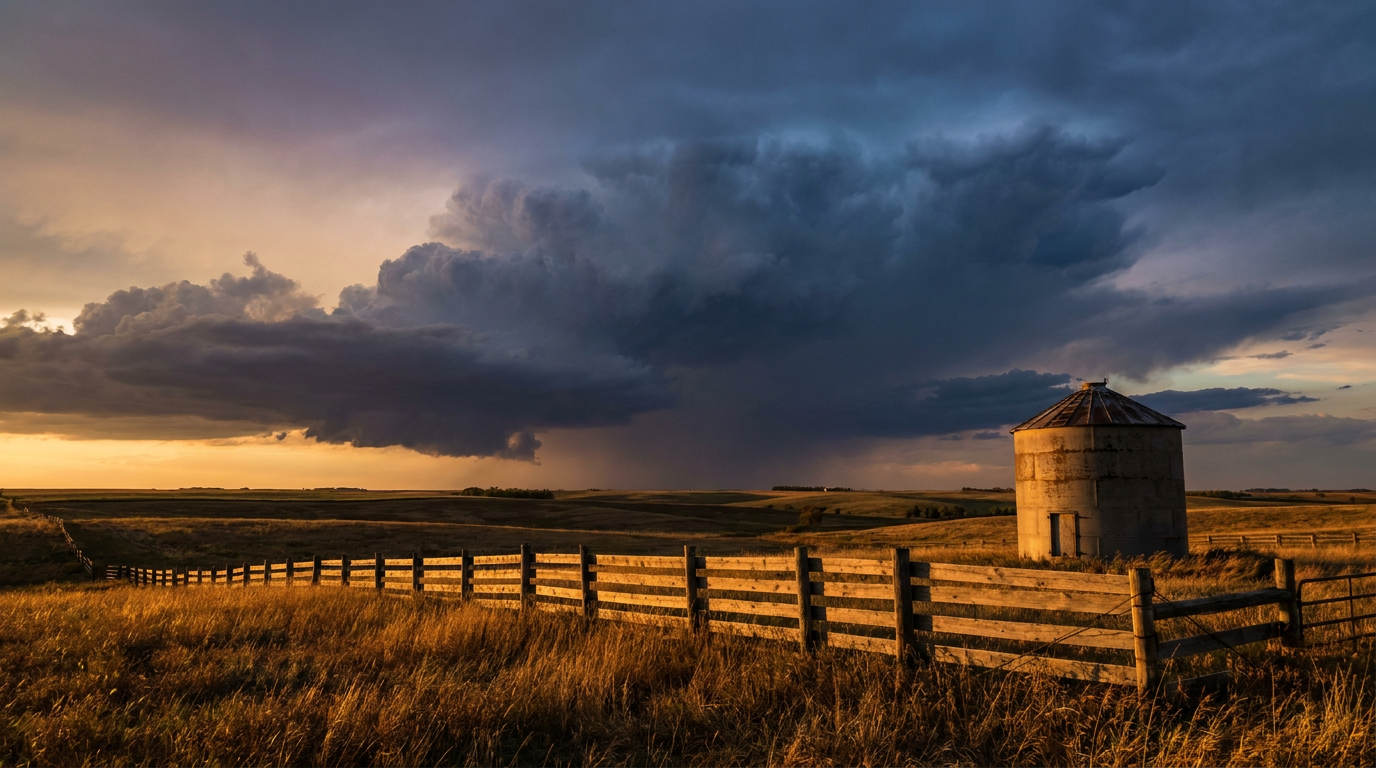
Here's the headline for the Lower 48. SPC has a Slight Risk up covering the Upper Mississippi Valley into the mid-Missouri Valley today, running through Minneapolis, Sioux Falls, and Duluth, with a conditional risk extending south into parts of the central Plains. A surface low, a triple point, a dryline, and a cold front are all converging over that same stretch of real estate, which is exactly the kind of setup that gets a meteorologist's attention.
The main hazards this afternoon into tonight:
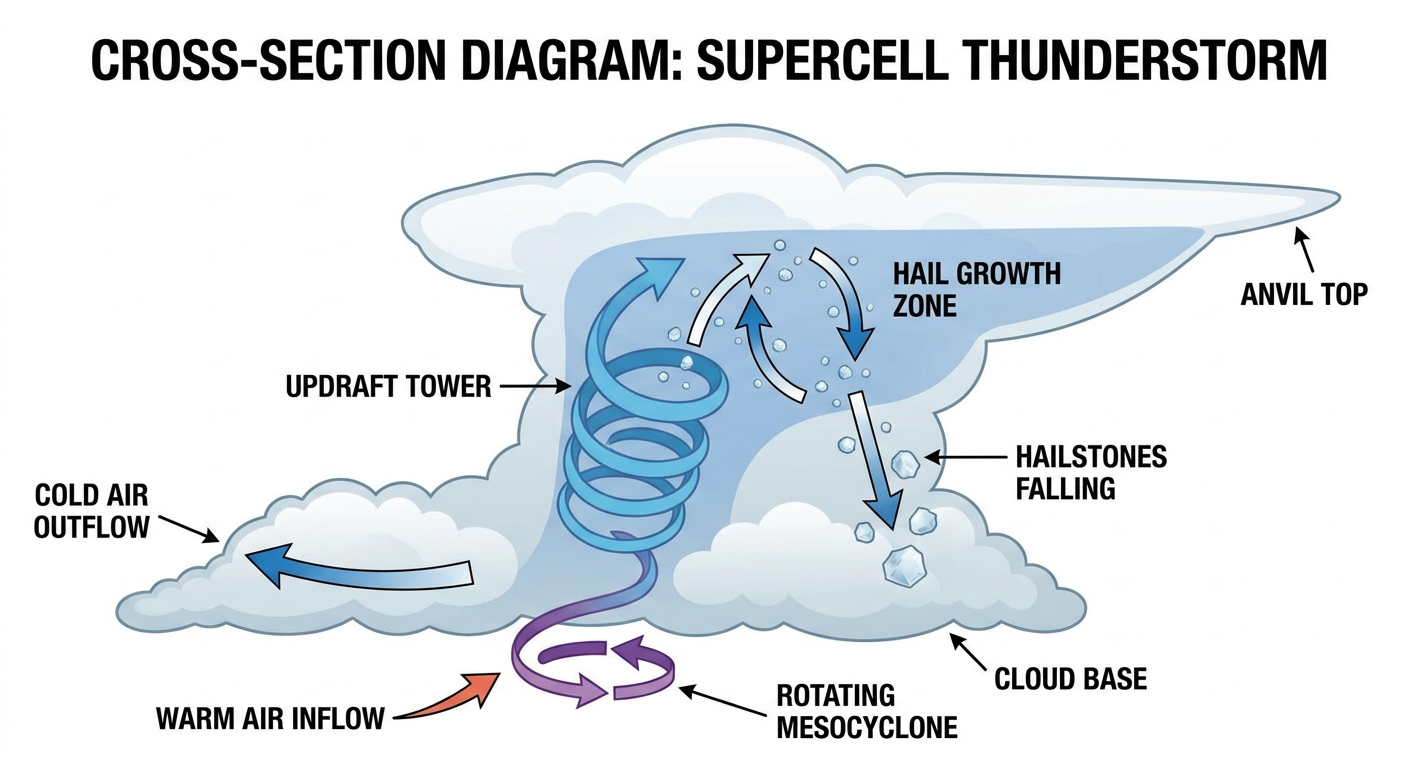
- Large hail, potentially over 2 inches in diameter in the hatched zone
- A few tornadoes possible, mainly with discrete supercells during peak heating
- Damaging wind gusts, with SPC putting a 30% probability (their highest tier) on numerous 60+ mph gusts in the more focused corridor
Storms should start as discrete supercells during the afternoon before the whole mess starts clustering up and potentially evolving into a nocturnal line capable of widespread wind damage. If you're in Sioux Falls, Minneapolis, or anywhere along that I-90/I-94 stretch, tonight's not the night to be caught outside once storms fire.
There's also a broad Marginal Risk draped across the Southeast today, covering Charlotte, Nashville, Memphis, Atlanta, and Raleigh. That's the lowest tier on SPC's scale, so we're talking isolated strong storms, not a widespread severe outbreak. Still worth keeping half an eye on the sky if you're at any of tonight's college openers in that region, like Richmond at NC State in Raleigh or Villanova at Louisville.
Saturday's Look Ahead: Risk Slides Into the Missouri Valley
By Saturday, SPC pulls the Marginal Risk south and west into southeastern Nebraska, southwestern Iowa, northeastern Kansas, and much of northwestern into central Missouri. That covers Kansas City, Topeka, and Columbia. A weak boundary paired with 2,000 to 3,000-plus J/kg of CAPE (that's a lot of fuel for storms, for the non-mets reading this) could support isolated supercells or clusters late Saturday afternoon into the evening, with large hail, damaging gusts, and a low-end tornado threat all in play. If you're headed to Lawrence for Missouri at Kansas, that game kicks off Friday night, ahead of Saturday's risk window, so you should be fine there. But if you've got Saturday plans anywhere in that Kansas City-to-Columbia corridor, keep a phone charged and an eye on the radar app once the sun starts dropping.
Rain Risk and Flash Flooding: Arizona, the Ohio Valley, and I-95
WPC has Slight Risk excessive rainfall areas popping up in a few spots over the next three days:
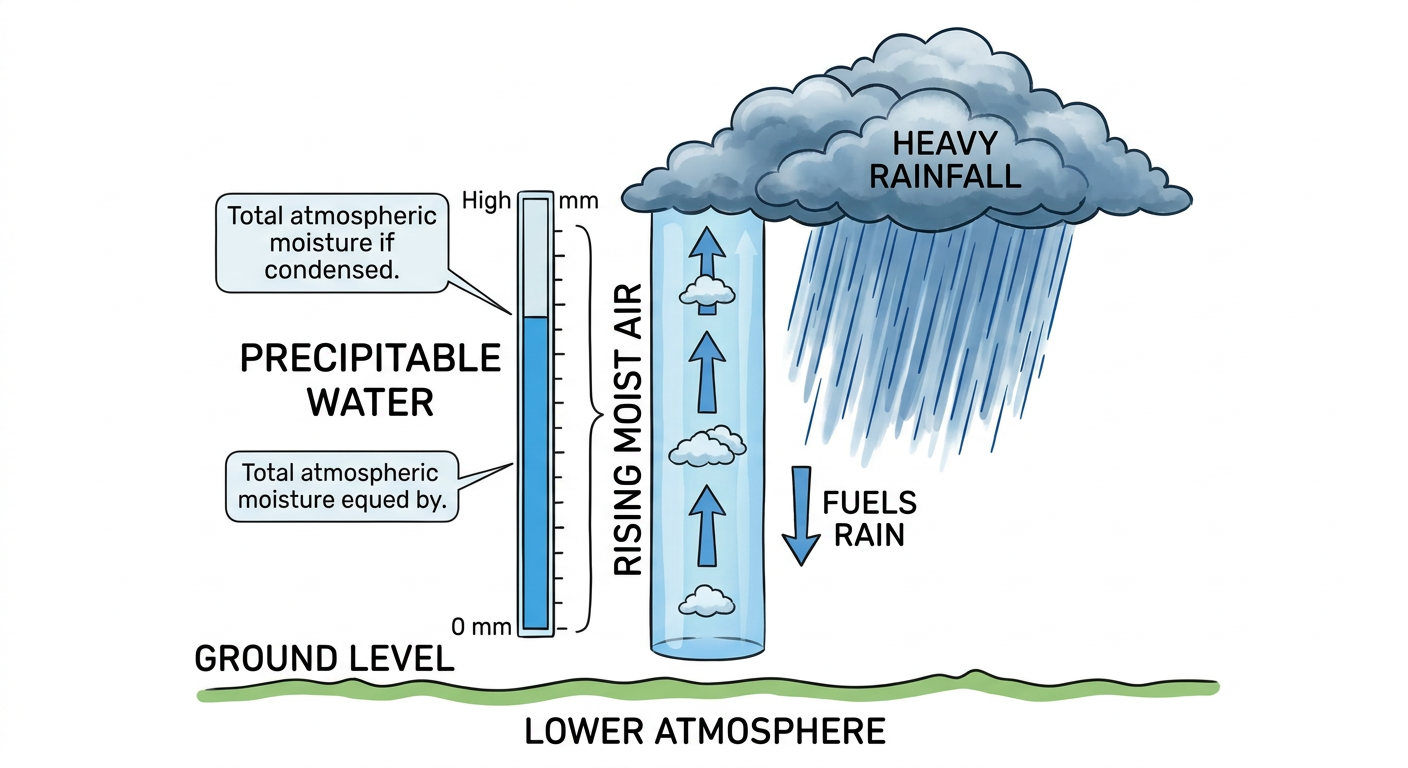
- Today, far southern Arizona and northern Minnesota, where precipitable water values over 1.5 inches in southern AZ could touch off flash flooding near burn scars and dry washes.
- Saturday, the Ohio Valley and Mid-Atlantic, including the I-95 corridor from Richmond through DC and Baltimore, as a warm front lifts north into deep moisture.
- Sunday, the Midwest, as a fast-moving shortwave trough drags a line of storms from the Dakotas southeast toward the Mississippi River.
None of these are moderate or high risk days, but after the week we just had (soil is still saturated from Iowa's 7.80 inch rainfall event and the nearly 7 inches that fell on Gallipolis, Ohio), it doesn't take much to get flash flooding started again in these areas.
Fire Weather: Critical Conditions in Nebraska and South Dakota
On the flip side of all that moisture, a surface low developing across the Northern Plains is dragging dry, windy air into eastern Wyoming, western Nebraska, and southwestern South Dakota today. SPC has that zone flagged for critical fire weather. If you're out that way, know that any spark has a much easier time getting away from you today.
Space Weather: Quiet to Unsettled, Nothing to Worry About
SWPC's outlook shows the geomagnetic field running quiet to unsettled through Sunday, with active periods possible today thanks to a coronal hole high-speed stream arriving. We already saw the peak of this cycle, a G1 (Minor) storm back on September 8. Today's activity should stay well below that. Solar flare activity remains low with just a slight chance of minor M-class flares. Nothing here should affect your weekend plans, though far-northern latitude folks might catch a faint aurora glow tonight if skies cooperate.
Weekend Outdoor Plans
Friday afternoon and evening actually look genuinely nice over the Great Lakes and Ohio Valley, dry air, calm winds, and plenty of sun. That's good news for tonight's Rice at Notre Dame kickoff and tomorrow's slate of home openers across Ohio and Indiana. Saturday's best outdoor weather sets up in the Northeast corridor and interior Southwest, while the central Plains and Midwest stay breezy and partly cloudy, capped by that afternoon severe threat we already covered. If you're headed to the Kansas State Fair in Hutchinson today, or catching festival lineups in Bristol, Madison, or Shippensburg this weekend, none of those sit inside today's severe or flood risk zones, so grab the sunscreen and go.
What We're Watching
- Overnight severe potential evolving into a QLCS across Minnesota and the Dakotas tonight
- Saturday's risk shift into the Kansas City/Columbia corridor
- Flash flood potential building along the I-95 corridor Saturday into Sunday
- The 80% development chance disturbance well southeast of Hawaii
- Critical fire weather holding across western Nebraska into South Dakota through sunset
Bottom Line
Norbert and Lowell are non-issues for the U.S. right now, so don't lose sleep over the tropics today. The weather that actually matters is the Slight Risk severe setup sliding from Minneapolis down through the mid-Missouri Valley this afternoon and evening, with large hail, a few tornadoes, and damaging wind gusts all possible before that risk shifts south into the Kansas City area for Saturday. If you're in either target zone, have a way to get warnings after dark tonight and again Saturday evening. Everybody else, especially folks near the Ohio Valley through I-95 this weekend, keep half an eye on rain totals since the ground out there is already soaked from this week's flooding.