Blog Article
Ohio Valley Flood Risk Rises Tuesday as Storms Track East
WPC issues a Moderate excessive rainfall risk for the Ohio Valley Tuesday as severe storms and flash flood threats persist across the Midwest and Southwest.

Ohio Valley's Flood Risk Ramps Up Tuesday While Slight Risk Storms Track Through the Midwest and Mid-Atlantic
Alright y'all, let's talk about water. Not the ocean kind, the falling-out-of-the-sky-too-fast kind.
The tropics are about as quiet as they've been all season. NHC has three areas of interest out there, all low-to-medium confidence, and nothing that's an imminent worry. So today the headline shifts inland, to a pattern that's been hammering the Midwest and Ohio Valley for days now.
The Main Event: A Moderate Rainfall Risk Builds for Tuesday
Here's the thing about yesterday. An MCS tracked from the Upper Midwest through the Ohio Valley and into the Southeast, and it left a mess behind it. Fort Wayne clocked a 67 mph gust. Flash flood warnings popped in Tennessee, Alabama, Pennsylvania, Illinois, and North Carolina, with water rescues in a couple of spots. That system is now history, but the setup that produced it hasn't gone anywhere.
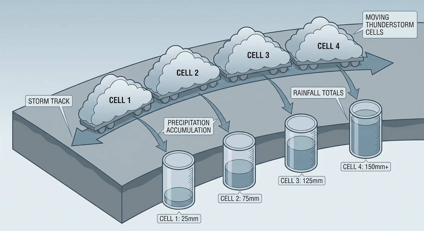
WPC has Tuesday (Day 2) pegged with a Moderate Risk of excessive rainfall centered on southern Ohio and western West Virginia. That's the highest rainfall risk category in the whole three-day outlook, and it's not by accident. The same quasi-stationary front that's been sitting across the northern Plains into the Ohio Valley is going to keep parking itself in roughly the same spot, and that means storms training, one cell after another rolling over the same patch of ground like boxcars on a track. HREF model guidance is putting 30 to 50 percent odds on more than 3 inches of rain in spots. When soils are already primed from a full week of heavy convection, that's exactly the recipe for flash flooding, not just puddled parking lots.
Monday itself carries a Slight Risk for rainfall across the Midwest, Ohio Valley, and southern Arizona, so this isn't a one-day problem. It's a stretch that runs Monday through at least Wednesday, with Tuesday being the sharpest point of it.
Today's Severe Threat: Slight Risk from Chicago to Baltimore
On top of the rain, SPC has a Slight Risk of severe thunderstorms up today across a corridor that includes Chicago, Columbus, Indianapolis, Baltimore, and Cleveland, affecting more than 43 million people. The setup: a belt of enhanced flow riding along that same stalled front, with damaging wind gusts the headline threat (15 percent probability, Level 2) and hail right behind it. Tornado chances are low, sitting at 2 percent, so this is a wind-and-hail day more than a tornado day, but any storm that goes severe out there could do real damage given how saturated the ground already is.
A quick note on history here, since a few folks have asked. Today's corridor happens to run right through the same stretch of northern Illinois into Indiana that took a historic derecho on this exact date back in 2020. That's a calendar coincidence and a geographic overlap, not a matching setup. Today's discussion doesn't show the kind of extreme instability or long-lived bow echo structure that made 2020 so destructive, so don't read more into that anniversary than it deserves.
Tuesday: The Threat Shifts and Sharpens
By Tuesday, SPC's Slight Risk area contracts a bit but shifts east into the Ohio Valley and central Appalachians, covering Chicago, Columbus, Indianapolis, Lexington, and Cincinnati, about 26.8 million people. This is the day to watch closest. MLCAPE values in the 2000 to 3500 J/kg range paired with 40 to 50 knot mid-level flow mean any storm that organizes could turn into a real wind producer. SPC's hatched area, the part of the map reserved for the nastiest potential, calls out gusts of 75 mph or more as possible. That's the kind of number that snaps healthy trees, not just weak limbs.
Cincinnati fans headed to the Bengals-Lions preseason game Thursday night are outside this window, but anyone with plans in the Ohio Valley corridor Tuesday afternoon or evening should keep half an eye on the sky.
Wednesday and Beyond: The Belt Keeps Moving
Day 3 (Wednesday) trims the severe risk down to the central and northern High Plains, while the rainfall Slight Risk holds over the Ohio Valley, Midwest, and Arizona. Beyond that, the Day 4-8 outlook keeps a moist axis parked from the central Plains into the lower Ohio Valley, meaning isolated severe storms remain possible most afternoons through the week. If you've got outdoor plans at the Illinois or Iowa State Fair (both kicking off Thursday), or you're headed to the Chicago Air and Water Show this coming weekend, keep checking back. This pattern isn't in a hurry to leave.
Monsoon Watch: Southern Arizona Stays in the Crosshairs
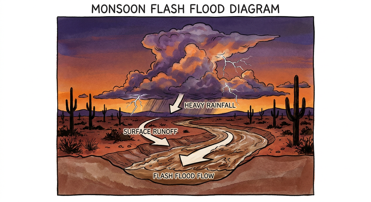
Don't sleep on the Southwest either. Southern Arizona, especially the I-19 corridor from Nogales up through Tucson, carries a multi-day flash flood threat as monsoon moisture peaks. Training thunderstorms over the same desert washes and burn scars can turn a dry arroyo into a dangerous flow of water in minutes, and that risk holds through Tuesday.
A Note on Space Weather
For the sky watchers out there, SWPC has a minor G1 geomagnetic storm possible tomorrow (August 11), with Kp reaching 5 as a coronal hole high-speed stream arrives. Nothing disruptive, but northern-latitude aurora chasers might get a decent show if skies stay clear.
What We're Watching
- WPC's Moderate Risk for excessive rainfall Tuesday over southern Ohio and western West Virginia, the highest-confidence flood signal in the whole outlook
- SPC's Slight Risk severe corridor shifting from Chicago-to-Baltimore today into the Ohio Valley and Appalachians tomorrow, with 75+ mph gusts possible in the hatched zone
- Antecedent soil saturation from this past week's rounds of heavy rain, raising the flash flood ceiling even for storms that wouldn't normally be a big deal
- Continued monsoon flash flood risk along the I-19 corridor in southern Arizona
- The Central Atlantic tropical wave (Medium risk, 60 percent chance of development by Day 7), worth a glance later this week even though it's not an immediate concern
Bottom Line
If you live anywhere from Chicago through the Ohio Valley and into the central Appalachians, Tuesday is your day to pay attention. That's when the rainfall risk peaks at Moderate and the severe wind threat sharpens right along with it. Know your flood-prone spots, don't drive through standing water, and have a way to get warnings if you're asleep when storms roll through overnight. Everybody else in today's Slight Risk zone (Chicago to Baltimore) should have a normal severe weather plan ready, mainly for wind and hail. And if you're in southern Arizona, stay out of washes and low-water crossings through midweek. This pattern's been camped out over the same general areas for days now, and it isn't packing up yet.