Blog Article
Enhanced Risk Storms Hit Omaha, Iowa; Severe Threat Shifts East for July 4th
An Enhanced Risk of damaging wind and large hail targets Nebraska and Iowa today, with the severe threat shifting to the Mid-Atlantic for Independence Day.
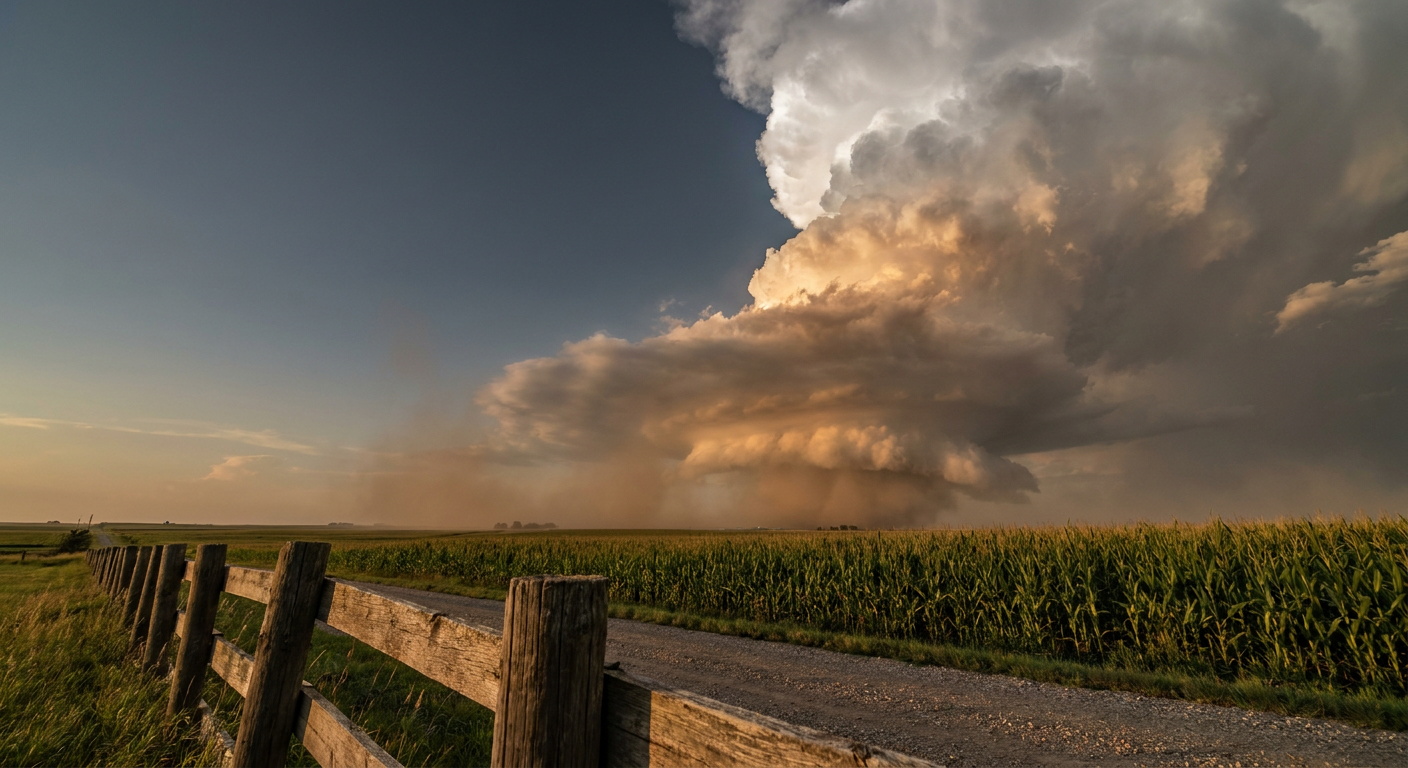
Omaha's Turn: An Enhanced Risk on the Plains While Storms Chase the Fourth East
Alright y'all, this week just will not quit. We've watched storms hammer the Northern Plains and Upper Midwest for days now. A 105 mph gust in Huron, South Dakota. Grapefruit-sized hail near Maynard, Iowa. Flash flooding that shut down stretches of I-90 and I-35. And here's the thing, today the machine cranks up again, just a little farther south.
The Storm Prediction Center has an Enhanced Risk (that's Level 3 out of 5) posted from central Nebraska into western Iowa. Omaha and Council Bluffs are sitting right in the middle of it. About 1.9 million people are inside that Enhanced zone, and a much bigger Slight Risk stretches east through Chicago, Detroit, and out to the I-95 cities.
Where the punch is today
Let me walk you through what SPC is actually worried about.
The headline threat is wind. Inside that Enhanced Risk, there's a 30 percent chance of damaging gusts within about 25 miles of any given point, and a hatched area where the strongest gusts could top 75 mph. That's the kind of wind that snaps healthy trees and knocks power out for whole neighborhoods. Large hail is in the mix too, with a hatched zone where stones could reach 2 inches, hen-egg size. There's even a low-end, 2 percent tornado threat, so an isolated spin-up isn't off the table if a storm gets its act together.
Here's why this setup fires. The flow aloft is going more zonal (that's meteorologist-speak for west-to-east, straighter ribbons of wind) as heights rise over the southern Rockies. A frontal boundary is draped through the region, daytime heating does the cooking, and there's a lot of fuel in place. WPC also has a Slight Risk of excessive rainfall over much of Iowa and eastern Nebraska, with precipitable water values near 1.5 to 2 inches and instability running 3,000 to 4,000 J/kg. Translation: the air is loaded with moisture and ready to pop.
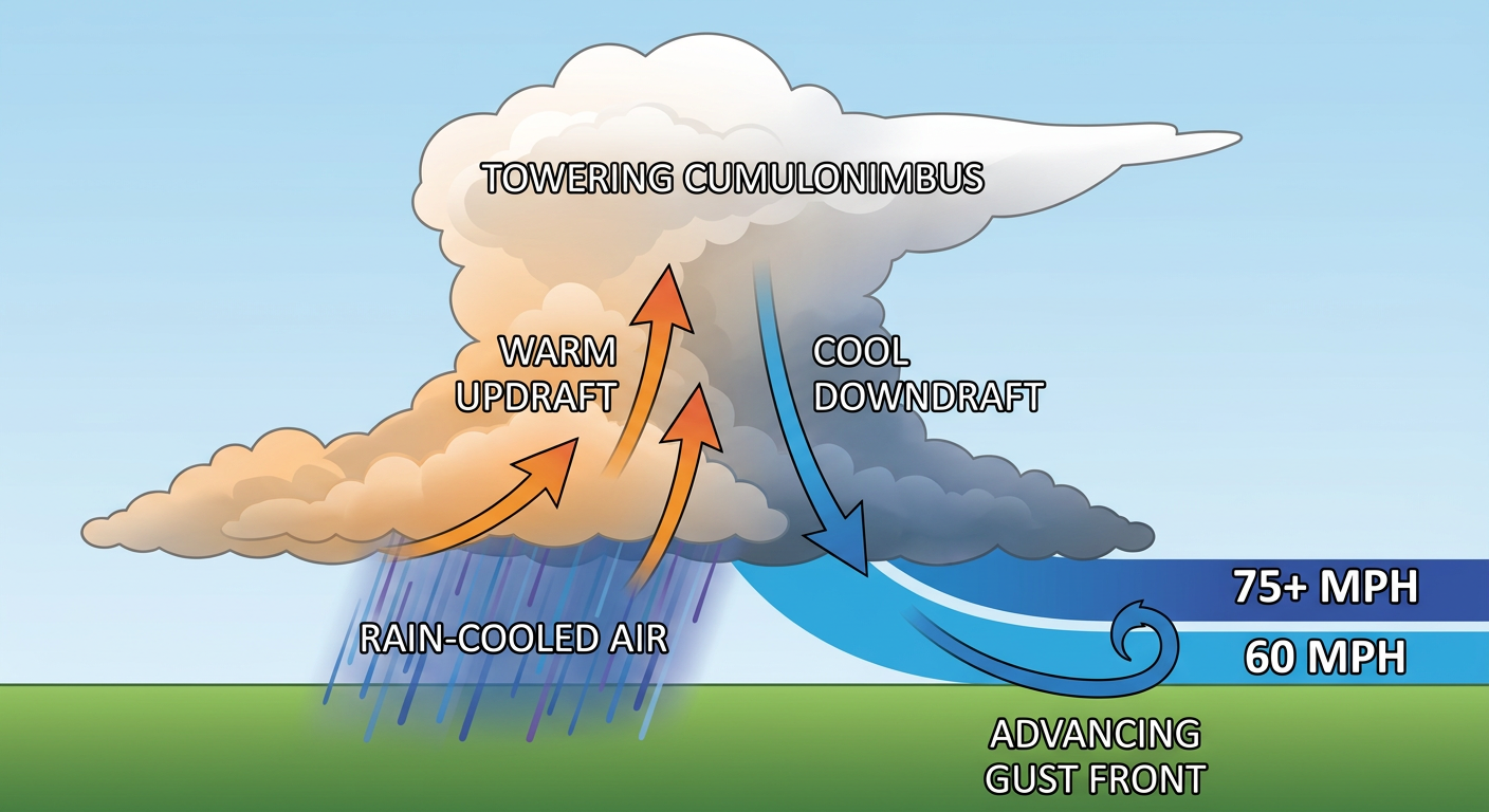
If you're in Omaha, Council Bluffs, Atlantic, Carroll, or Denison, keep a close eye on the sky through the afternoon and evening. The Cardinals and Cubs play in Chicago tonight, and that whole Slight Risk corridor from the Great Lakes east could see scattered storms roll through. Not a washout, but a "know where you'll take shelter" kind of evening.
The Fourth of July hand-off
We talked yesterday about the Mid-Atlantic and that big DC celebration. Here's the update. The severe threat is shifting east and south, and by tomorrow SPC has a Slight Risk in two separate zones.
One covers the Ohio Valley into the Mid-Atlantic, and that means New York, Philadelphia, Washington DC, and Baltimore are on the table. The setup there is classic July: strong heating of a soupy airmass, 3,000-plus J/kg of instability, and inverted-V profiles that favor downburst winds during the hottest part of the afternoon. About 50 million people sit inside that Saturday Slight Risk. The other zone is the central Great Plains, where large hail and severe gusts are possible into Saturday night, with a chance of supercells near Wichita.
Washington's normal high for early July is 89 degrees, and the airmass in place keeps temperatures near or above that with those muggy 60s and 70s dewpoints. That heat is the engine that powers the afternoon downbursts. If you've got flyovers, a parade, the Peachtree Road Race in Atlanta, or Nathan's in Brooklyn on your Saturday radar, the play is simple: enjoy the morning and midday, then watch the sky as the heat peaks in the afternoon. Storms this time of year usually fire late-day and move fast.
A bonus for the night owls
Switching gears to space weather, because it's worth a mention tonight. A CME (that's a coronal mass ejection, a big burp of solar material) left the sun back on June 30, and NOAA's Space Weather Prediction Center expects it to arrive today and into the Fourth. That's forecast to bring G1 to G2 level geomagnetic storming, which is minor to moderate.
What's that mean for you? If you're well north and you've got dark, clear skies away from city lights, there's an outside shot at some aurora tonight into tomorrow night. No promises, geomagnetic storms are fickle, but it's a fun reason to look up. It won't cause you any trouble beyond maybe some GPS wobble and radio noise.
What I'm watching
- Omaha and western Iowa this afternoon and evening: damaging wind is the top threat, with 75 mph gusts possible and large hail in the hatched zone
- Flash flooding across Iowa and eastern Nebraska: high moisture and slow-moving storms can drop heavy rain fast, especially after dark
- Saturday's Mid-Atlantic Slight Risk: downburst winds during peak afternoon heating, right over the holiday crowds in DC, Baltimore, Philly, and NYC
- Central Plains Saturday into Saturday night: hail and possible supercells near Wichita, plus an evening storm cluster near Kansas City around fireworks time
- Four Corners fire weather: critical conditions hang on for likely one more day in eastern Utah into western Colorado
- Aurora potential tonight: G1-G2 storming from the CME arrival, best odds well north with dark skies
Bottom line
If you're in eastern Nebraska or western Iowa today, have a way to get warnings and know where you'll shelter if a warning drops this afternoon or evening. Damaging wind is the main concern, and it can come up fast. For everybody heading into the Fourth across the Ohio Valley and East Coast, plan your outdoor celebrating for the morning and midday, then keep one eye on the sky as the afternoon heats up. Storms will be scattered and fast-moving, not an all-day rainout, but you'll want a plan to duck inside quick. And if you're up north tonight, give the northern sky a look.