Blog Article
Plains Severe Wind Risk Today, Storms Shift East This Weekend
SPC has a Slight Risk for damaging wind gusts across the Plains today, with the severe threat shifting to Iowa, Denver, and the Ohio Valley through the weekend.

Plains Get Another Round of Gusty Storms While the Northeast Finally Dries Out
Alright y'all, let's talk about what's cooking today. The Storm Prediction Center has a Slight Risk up for parts of the central and northern Plains, centered on places like Ainsworth, Albion, and Aurora, Nebraska. A broader Marginal Risk stretches from Sioux Falls down through Omaha and Kansas City, and get this, it even reaches all the way to Jacksonville and Tallahassee, Florida. Two very different parts of the country, same forecast package.
What's actually setting this up
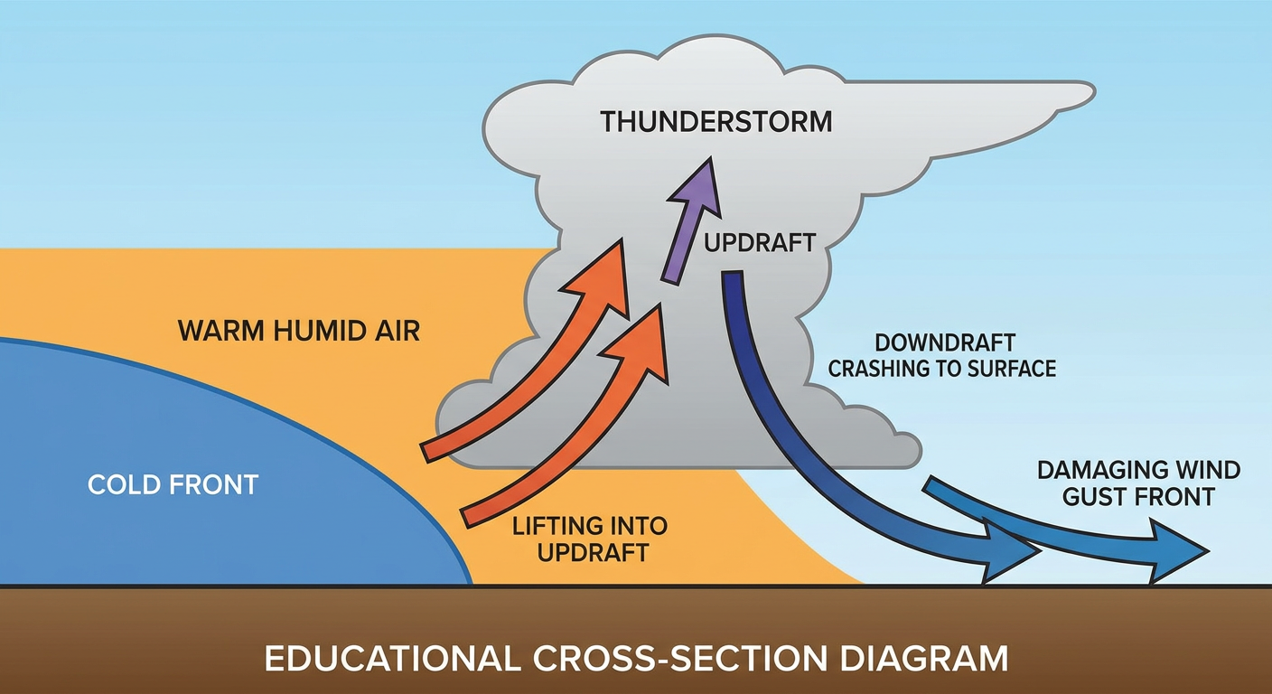
Here's the deal. A shortwave ridge is sliding east into the upper Mississippi Valley today, and it's dragging a shortwave trough and a cold front along behind it. Out ahead of that front, the atmosphere over Nebraska and the Dakotas has plenty of instability to work with, enough to support thunderstorms capable of producing severe wind gusts this afternoon and evening. SPC's own numbers put the wind threat at 15 percent in that Level 2 zone, meaning if storms do get going, 60 mph plus gusts are on the table. Hail chances are lower, sitting at that isolated Level 1 tier.
Down along the eastern Gulf Coast, it's a separate story but the same basic hazard. Isolated severe gusts are possible there too, riding along the edge of deep moisture and daytime heating. Nothing organized or widespread, just enough instability for a few storms to get feisty.
Where the threat goes this weekend
Friday, the focus shifts south and east a touch. SPC has Day 2 Marginal Risk running from Iowa down into the Ozark Plateau, and separately over the central and southern High Plains, which pulls in Denver, Colorado Springs, Springfield, Columbia, and Pueblo. There's even a conditional 2 percent tornado chance tucked into that Missouri corridor if storm modes stay discrete instead of clumping into a line. Large hail and damaging gusts are still the headline threats, especially for those transient supercells expected over eastern New Mexico and Colorado Friday evening.
By Saturday, the Marginal Risk slides into the Ohio and Tennessee Valleys, covering Nashville, Louisville, Lexington, Cincinnati, and Huntsville, with another patch over central and eastern New Mexico. That lines up with a mid-level trough working its way out of the Great Lakes into the Ozarks.
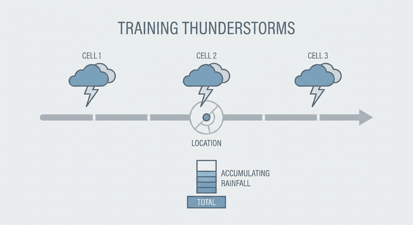
The rain side of this pattern deserves a mention too. WPC has a Slight Risk of excessive rainfall running Friday from the upper Midwest into the mid Mississippi Valley, thanks to training thunderstorms and PWAT values pushing over 2 inches. That risk then shifts into the Ohio and Tennessee Valleys on Saturday as Gulf moisture surges northward ahead of that same amplifying trough.
Still cleaning up from this week
Quick gut check on where we've been. Eastern New York is still drying out from Wednesday's flash flooding, the kind that closed roads in Coxsackie and Schodack and put over 7 inches of rain on the ground near Voorheesville. That system has moved offshore now, and the Northeast gets a real break today, no repeat of that nightmare in the forecast. Good news if you're anywhere near Albany or the Hudson Valley this morning.
Meanwhile out West, the heat keeps cranking. The latest guidance flags dangerous heat expanding into the Southwest, Intermountain West, and northern High Plains, with HeatRisk values running Major to Extreme in spots. Denver's climatological high this time of year sits at 90, and if that heat dome keeps building like the extended outlook suggests, some spots out there could be running well above that mark through early August.
What we're watching
- Damaging wind gusts today across Nebraska and the northern Plains, Slight Risk territory
- Isolated severe gusts along the eastern Gulf Coast, including Tallahassee and Jacksonville
- Friday's shift toward Iowa, the Ozark Plateau, and Denver, with a conditional tornado risk in Missouri
- Training thunderstorms bringing a Slight Risk of excessive rainfall to the upper Midwest Friday, then the Ohio and Tennessee Valleys Saturday
- Building heat across the Southwest and Intermountain West as the ridge strengthens into early August
Bottom Line
If you're in Nebraska, the Dakotas, or anywhere near Kansas City and Omaha today, keep half an eye on the sky this afternoon and evening. Nothing here screams outbreak, but a 60 mph gust can still snap a tree limb or knock out power just the same. Fans headed to the Royals-Twins game in Minneapolis or the Cubs-Cardinals matchup in St. Louis should just have a plan if the sky darkens. Gulf Coast folks near Jacksonville and Tallahassee, same advice, isolated storms could still pack a punch. And out West, if you're dealing with that building heat, this is a good week to check on elderly neighbors and keep the water bottle full. The Northeast, breathe easy today. You've earned it.