Blog Article
Central Plains Storms and PNW Fire Risk Forecast July 31
Severe storms and flash flooding target the Plains and Mississippi Valley this weekend while Extremely Critical fire weather builds in Washington's Columbia Basin.
Plains Storms Keep Rolling While Flash Flood Threat Shifts Into the Mississippi Valley
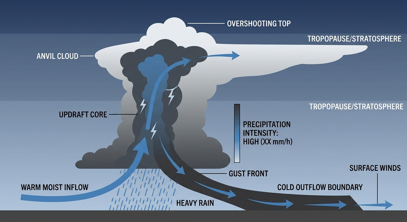
Alright y'all, let's talk about what's still cooking after last night. If you were anywhere near Nebraska or South Dakota yesterday evening, you know it got loud. An MCS rolled through and put down an 80 mph gust in Custer County, Nebraska, plus 4 to 6 inches of rain around Pierpont and Aberdeen, South Dakota, that stranded cars in the street. That system is the reason we're not done talking about the central Plains just yet.
Today's Setup: Slight Risk Holds Over Nebraska and South Dakota
SPC has a Slight Risk posted again today for parts of the central and northern Plains, centered on towns like Ainsworth, Albion, and Aurora, Nebraska. A broader Marginal Risk fans out from there, and get this, it actually stretches all the way to Jacksonville and Tallahassee, Florida, and up to Kansas City and Omaha. That's a wide footprint, but the ingredients aren't uniform. Out on the Plains, an amplifying shortwave trough is the driver, and it's pulling in enough instability and shear for damaging wind gusts and isolated large hail, with a small 2 percent chance of an isolated tornado. Down along the Gulf Coast and Florida Panhandle, the threat is more about isolated severe wind gusts riding in on daytime heating and Gulf moisture, similar to the tree-and-powerline damage Tallahassee saw yesterday.
WPC has also drawn a Slight Risk for excessive rainfall across the mid to upper Mississippi Valley today. Precipitable water values are sitting at 2 inches or higher, which is in the 99th percentile for this time of year. Translation: any storm that parks over the same spot for a while is going to be efficient at dumping rain fast. If you're in eastern South Dakota or southwestern Minnesota tonight, that's worth having your phone's weather alerts turned on for.
The Weekend: Threat Slides Southeast
By Saturday, SPC's Day 2 outlook shifts that Marginal Risk from Iowa southward into the Ozark Plateau, and separately over the central and southern High Plains near Denver, Colorado Springs, and Pueblo. A surface low developing from Iowa into Illinois will support some semi-discrete supercells, and Missouri carries a conditional tornado threat if storms can stay separated long enough to organize. If you're headed to the Hinterland Music Festival near Saint Charles, Iowa, keep an eye on the sky Saturday afternoon. Des Moines sits right in the bullseye for both the severe risk and a Slight excessive rainfall risk, with PWATs again pushing the 99th percentile.
Sunday, the Marginal severe risk moves again, this time into the Ohio and Tennessee Valleys, covering Nashville, Louisville, Lexington, and Cincinnati. Reds and Pirates fans at Great American Ball Park should have a decent Friday and Saturday, but Sunday's game could see some afternoon storm chances creep in.
On the rainfall side, WPC's Day 2 and Day 3 outlooks track that Slight Risk right along with the severe threat, moving from the Upper Midwest into the Ohio/Tennessee Valley Saturday, then into the Northeast and Mid-Atlantic by Sunday. That's the same general corridor that just got hammered with 6 to 7 inch rainfall totals in eastern New York and Massachusetts earlier this week, so soils up that way are already saturated. Any repeat heavy rain up there won't have much room to soak in.
Fire Weather Turns Extremely Critical in the Columbia Basin
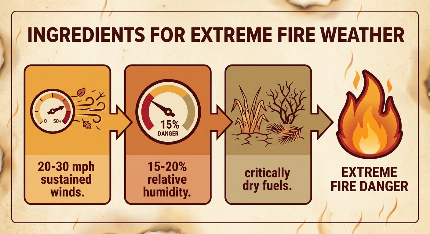
Here's the part of today's outlook that deserves real attention even though it's not severe thunderstorms. SPC has an Extremely Critical Fire Weather designation for Saturday across the Columbia Basin in central and southeastern Washington. We're talking sustained winds of 20 to 30 mph, gusts past 45 mph, relative humidity down to 15 to 20 percent, and energy release components above the 95th percentile. That's about as combustible as the atmosphere gets.
If you're headed to the Watershed Festival in George, Washington this weekend, that town sits right inside the Columbia Basin. Saturday's forecast isn't about rain gear, it's about dust, gusty wind, and awareness of any fire activity nearby. A Critical designation also extends into eastern Oregon, the Idaho Panhandle, and northwestern Montana. This is a ridge-driven setup, the same broad upper-level ridge over the Southwest that's kept places like Denver and Oklahoma City running well above their late-July averages (Denver's normal high this time of year is 90°F, OKC's is 94°F, and both have been living on the warm side of that ridge most of the month).
Where the Nice Weather Is
Not everywhere is dealing with something. Today's best conditions sit over the Pacific Northwest lowlands, west of that fire-risk zone in the Columbia Basin, and over the interior Northeast, both scoring in the BEAUTIFUL range with light wind, low humidity, and clean air. That's good news if you're at Seafair Weekend Festival in Seattle or Musikfest in Bethlehem, Pennsylvania today. Just know that fire risk builds fast once you cross the Cascades into the Columbia Basin.
What We're Watching
- Nebraska and South Dakota: Slight Risk for severe storms today, following last night's 80 mph gust and 4 to 6 inch rain totals
- Upper to mid Mississippi Valley: Slight Risk for excessive rainfall today, with PWATs near the 99th percentile
- Iowa into the Ozark Plateau: Marginal severe risk Saturday with a conditional tornado threat in Missouri
- Central/Southern High Plains near Denver and Pueblo: Marginal severe risk Saturday
- Ohio and Tennessee Valleys: Marginal severe risk Sunday, covering Nashville, Louisville, and Cincinnati
- Columbia Basin, Washington: Extremely Critical fire weather Saturday, with Critical conditions in eastern Oregon, the Idaho Panhandle, and northwest Montana
- Northeast and Mid-Atlantic: Slight excessive rainfall risk returns Sunday on already-saturated ground
Bottom Line
If you're in Nebraska, South Dakota, or the Florida Panhandle today, keep half an eye on the radar this afternoon and evening, especially if you're outdoors at a fair, festival, or ballgame. Heading into the weekend, shift your attention toward Iowa, the Ozarks, and eventually the Ohio Valley for storm chances, and toward the mid-Mississippi Valley and then the Northeast for the flash flood risk. And if your weekend plans put you anywhere in central or eastern Washington, especially George for Watershed Festival, treat Saturday's fire weather warning as the real deal. Dry grass, 30 mph wind, and single-digit humidity margins don't need much of a spark.