Blog Article
Polo's Remnants Bring Flood Risk to Plains, Nolo Nears Hawaii
Hurricane Polo's remnants fuel a Moderate flood risk from the Southwest to Oklahoma and Texas this week, while Category 3 Nolo passes near Kauai tonight.
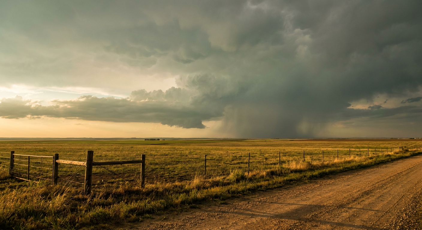
Polo's Remnants Are About to Soak the Southern Plains While Nolo Bears Down on Kauai
Alright y'all, a lot is happening at once this morning, so let's get into it. The headline story is what's left of Hurricane Polo. It came ashore near Loreto, Mexico, early this morning as roughly a Category 2 storm, and now it's about to spend the next several days feeding a genuinely dangerous flood setup across the Southwest and into the southern Plains. At the same time, Hurricane Nolo, a strong Category 3 way out in the Pacific, is making its closest approach to Kauai tonight. Two very different tropical stories, two very different parts of the country to watch.
When Old Hurricanes Don't Just Go Away
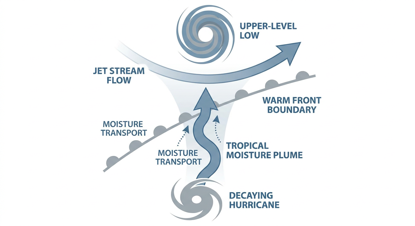
Here's the thing about Polo. Making landfall doesn't mean it's done. The core moisture from that system is getting pulled north out of Mexico, tracking roughly along the New Mexico/Texas border near El Paso today, and then getting absorbed into a strengthening upper-level low over the High Plains. By Wednesday, that low takes on a classic comma shape, with a warm front stretching all the way toward the Upper Great Lakes. Translation: this isn't a quick pass-through. It's a multi-day soak.
WPC has this pegged as a legitimate flood threat, not just a rain day. Here's how it lines up:
- Today (Tuesday): MODERATE risk of excessive rainfall from the Southwest into the Central High Plains, centered on the corridor near El Paso.
- Wednesday: MODERATE risk expands across the central and southern High Plains and into the southern Plains, with OKC, Wichita, Enid, and Stillwater all in the exposure zone.
- Thursday: MODERATE risk shifts into the southern Plains proper, covering San Antonio, Dallas, Austin, Fort Worth, and Laredo.
Our AI-assisted synthesis flags Wednesday as the most consequential day of the whole event, with 2 to 4 inches of additional rain, locally more, falling on ground that's going to already be saturated by the time it gets there. That's a flash flood setup, plain and simple, especially across northeastern New Mexico, southeastern Colorado, the Texas Panhandle, and western/central Oklahoma.
If you're in Albuquerque gearing up for the Balloon Fiesta that kicks off October 3rd, or heading to the Texas State Fair in Dallas this week, keep an eye on this. The fair should be fine early week, but Thursday's Marginal severe risk and lingering rain bands in the Dallas area are worth checking before you head out.
Severe Storms Riding Shotgun
Where there's this much tropical moisture running into a strong upper-level system, severe storms come along for the ride. SPC has it broken out day by day:
- Day 1 (today): Marginal risk from southern/eastern New Mexico into west Texas, covering El Paso, Lubbock, Amarillo, Midland, and Odessa. Isolated severe gusts and a couple of tornadoes are possible this afternoon into tonight.
- Day 2 (Wednesday): Slight risk across Abilene, Wichita Falls, San Angelo, Lawton, and Altus, with a broader Marginal risk stretching into Oklahoma City, Wichita, Enid, and Stillwater. Damaging wind gusts and hail are the main threats, with an isolated tornado or two not out of the question.
- Day 3 (Thursday): Marginal risk shifts into San Antonio, Dallas, Austin, Fort Worth, and Laredo as a cold front pushes southeastward across the southern Plains.
For late September, the air ahead of this system is running plenty warm and humid. Oklahoma City and Tulsa's normal high this time of year sits around 84°F, and Dallas and San Antonio typically run near 90 to 91°F. That kind of late-summer warmth combined with a strong upper-level jet is exactly the fuel this kind of severe setup needs.
Hawaii Watches Nolo Approach
Shifting way out into the Pacific, Hurricane Nolo is a strong Category 3 with 115 mph winds, sitting a few hundred miles southwest of Honolulu and moving north-northwest at 15 mph. Nolo's closest approach to Kauai is expected tonight, with the center passing roughly 300 miles south of the island. The RHY impact model has Kauai's south, north, and east shores at a "prepare" threat level, with Oahu's west and south shores at "aware."
The good news, if you can call it that: NHC's own guidance shows Nolo weakening some by the time it makes its closest pass, dropping to around 85 mph. Still, dangerous surf, gusty winds, and heavy rain bands are likely across the southeastern waters of the Papahanaumokuakea Marine National Monument tonight, and Kauai residents should not be caught off guard by a storm that's still a major hurricane as of this morning.
The Rest of the Tropics
It's a busy tropical map right now. Tropical Storm Rachel, currently 58 mph and sitting off the coast of Mexico, is forecast to become a hurricane within the next day or so as it tracks WNW, generally staying offshore and keeping coastal Mexico at an "aware" level for now. Out in the central Atlantic, Tropical Storms Fay and Hanna are both weak, disorganized, and far from any coastline that matters to US readers today. Two more invests, one in each basin, are being watched for possible development but aren't an immediate concern.
Elsewhere: Nice Weather and a Quiet Sun
Not everybody's dealing with rain and severe weather today. The nicest outdoor conditions land in a broken band from the Carolinas through the southern Appalachians and up into the northern Rockies and interior Pacific Northwest, where dry high pressure and dewpoints in the upper 40s to low 50s make for a genuinely beautiful day. If your outdoor plans sit outside the Southwest-to-Plains corridor we've been talking about, you're probably in good shape.
Up in space weather, it's a quiet stretch. SWPC expects mostly quiet geomagnetic conditions through October 1st, with just a slight chance of an M-class solar flare. The one item worth circling on your calendar is well down the road: a possible G1 minor geomagnetic storm around October 22nd, which could bring aurora chances to the northern tier. Nothing to worry about this week.
What We're Watching
- Whether the Plains low fully absorbs Polo's moisture as forecast, which would lock in the Wednesday/Thursday flood threat across Oklahoma and north Texas
- Flash flooding on already-saturated ground in northeastern New Mexico, southeastern Colorado, and the Texas Panhandle
- Any tornado reports embedded in the Wednesday severe risk across western Oklahoma and west-central Texas
- Nolo's exact track and intensity as it passes south of Kauai tonight
- Rachel's development into a hurricane over the next day or two
Bottom Line
If you're anywhere from El Paso to Oklahoma City to the Texas Hill Country, this is a multi-day rain event to take seriously, not a quick afternoon shower. Flash flooding is the number one hazard through Thursday, with severe storms and an isolated tornado threat layered on top Wednesday and Thursday. In Hawaii, Kauai residents should have their hurricane plan ready tonight as Nolo makes its closest pass, even with some expected weakening. Everybody else, enjoy that stretch of nice high pressure weather while it lasts.