Blog Article
March 02, 2026 Weather Recap: Major Ice Event & Extreme Heat
A complete recap of the March 02, 2026 weather events. Discover how a major ice storm impacted the East while a 130-degree temperature dipole split the US.
Ice, Earthquakes, and a 130-Degree Divide: Recapping March 2, 2026
Alright folks, let's take a look back at exactly what happened yesterday, March 2, 2026. If you were anywhere near the Ohio Valley or the Mid-Atlantic, you already know it was an absolute mess. We tracked a major winter system that completely changed its personality as it moved east, turning from a snowstorm into a dangerous ice event.
But that was just one piece of the puzzle. We also saw earth-rattling seismic activity and one of the most extreme temperature divides we have seen all year. Let's break down exactly what went down.
How the Day Unfolded
The day kicked off with a burst of heavy snow in the Midwest. Places like Hilliard, Ohio, picked up a quick 4.2 inches right out of the gate. It was enough to cause major headaches for the morning commute and force over 190 school districts to close their doors across the region.
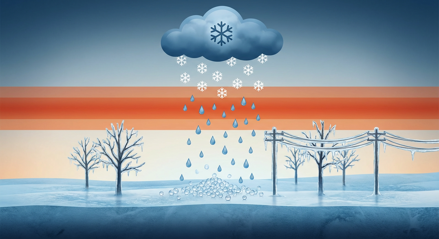
But here is the thing. As this system pushed into the Central Appalachians, a classic layer of warm air moved in aloft. We call this a "warm nose" in the weather world. As the snow fell into that warm layer, it melted into rain, and then immediately refroze as it hit the sub-freezing ground. This setup, driven by Cold Air Damming against the mountains, shifted the main threat from fluffy snow to a major ice storm.
Ground Truth: Forecast vs. Reality
When we look back at the data, the forecast actually nailed this one. We expected significant ice accretion in the West Virginia ridges, and that is exactly what happened. Snowshoe, West Virginia, saw a verified 0.40 inches of solid ice accumulation. That is enough to bring down tree limbs and cause serious power outages.
In total, the National Weather Service received 12 official storm reports for the day. If you were looking for a massive severe thunderstorm outbreak, you did not find it yesterday. Instead, almost all of our reports were for hazardous freezing rain across Pennsylvania, Maryland, and Virginia. We also had a few rogue reports out west, including dense freezing fog in Oberlin, Kansas, that dropped visibility to just a quarter of a mile, and a thunderstorm in Wyoming that dumped 0.75-inch hail right on Interstate 80.
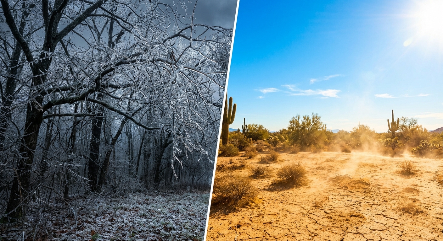
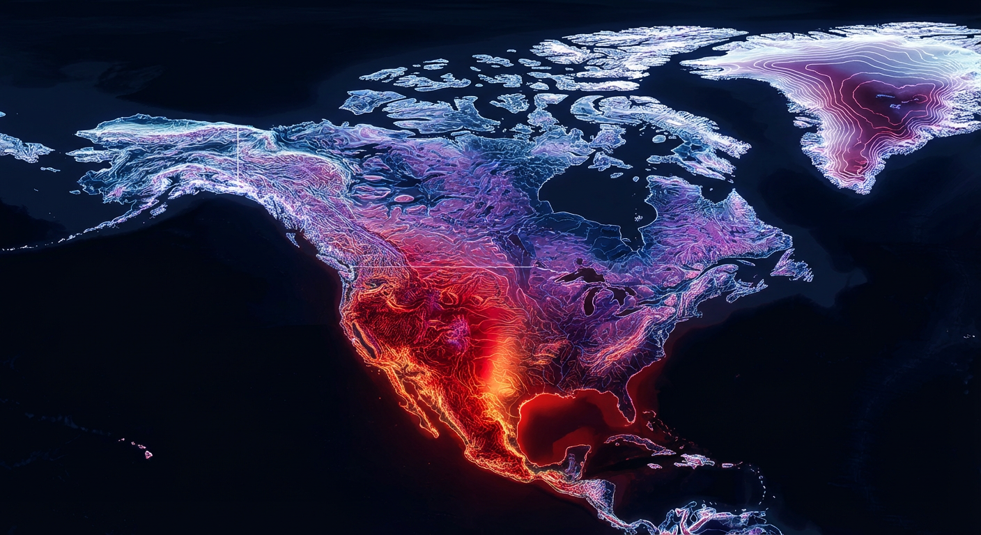
The Great 130-Degree Divide
Get this. While the East Coast was wrapped in an icy glaze, the Southwest was absolutely baking. We saw an incredible thermal dipole set up across North America.
Down in El Paso, Texas, the thermometer hit 90 degrees. That marked their fifth consecutive day of record-breaking heat. Meanwhile, up on the North Slope of Alaska, folks were shivering through life-threatening wind chills of 70 degrees below zero. That is a 130-degree temperature difference happening at the exact same time. It truly shows how dynamic our atmosphere can be.
And just to keep things interesting, the earth decided to move, too. We recorded a magnitude 4.1 earthquake right in the middle of the country near Cowles, Nebraska, and a larger magnitude 5.5 quake out by the Aleutian Islands in Alaska.
What Meteorologists Learned
This event was a perfect textbook example of Cold Air Damming. When cold air gets wedged against the eastern side of the Appalachian Mountains, it is incredibly stubborn to scour out. The models handled this shallow layer of freezing air very well, which allowed forecasters to issue Winter Storm Warnings with plenty of lead time. It proves that when we understand the terrain, we can nail the ice forecast.
What is Coming Next
Y'all need to pay attention if you live in the Southern Plains. The weather is not calming down. Today and tomorrow, we are watching a potent cold front crossing the Rockies. By Wednesday, this is going to clash with all that warm, moist air in the South.
The Storm Prediction Center has already outlined a Slight Risk for severe storms across North-Central Texas up into the Ozarks. We are talking about the potential for large hail, damaging winds up to 70 mph, and even an isolated tornado or two. Plus, heavy rain is going to raise the flash flooding risk from Texas all the way up into the Ohio Valley.
The Bottom Line
- The Ice Verified: The forecast of 0.40 inches of ice in the West Virginia mountains was spot on, causing significant travel and infrastructure impacts.
- School Closures: The transition from snow to ice shut down over 190 school districts across the Midwest and Ohio Valley.
- Extreme Contrasts: We lived through a 130-degree temperature split between Alaska's brutal cold and Texas's record heat.
- Stay Alert: The quiet severe weather pattern is ending. Texas, Oklahoma, and Arkansas need to be ready for strong thunderstorms and heavy rain by Wednesday.
Stay safe, keep your weather radios handy, and I will keep you updated right here as this next system develops.