Blog Article
March 06, 2026 Weather Recap: Tornado Outbreak & Blizzard
Read the full March 06, 2026 weather recap. We break down the devastating tornado outbreak in Michigan and Oklahoma, plus the major winter storm in Colorado.
Yesterday Was A Monster, Y'all
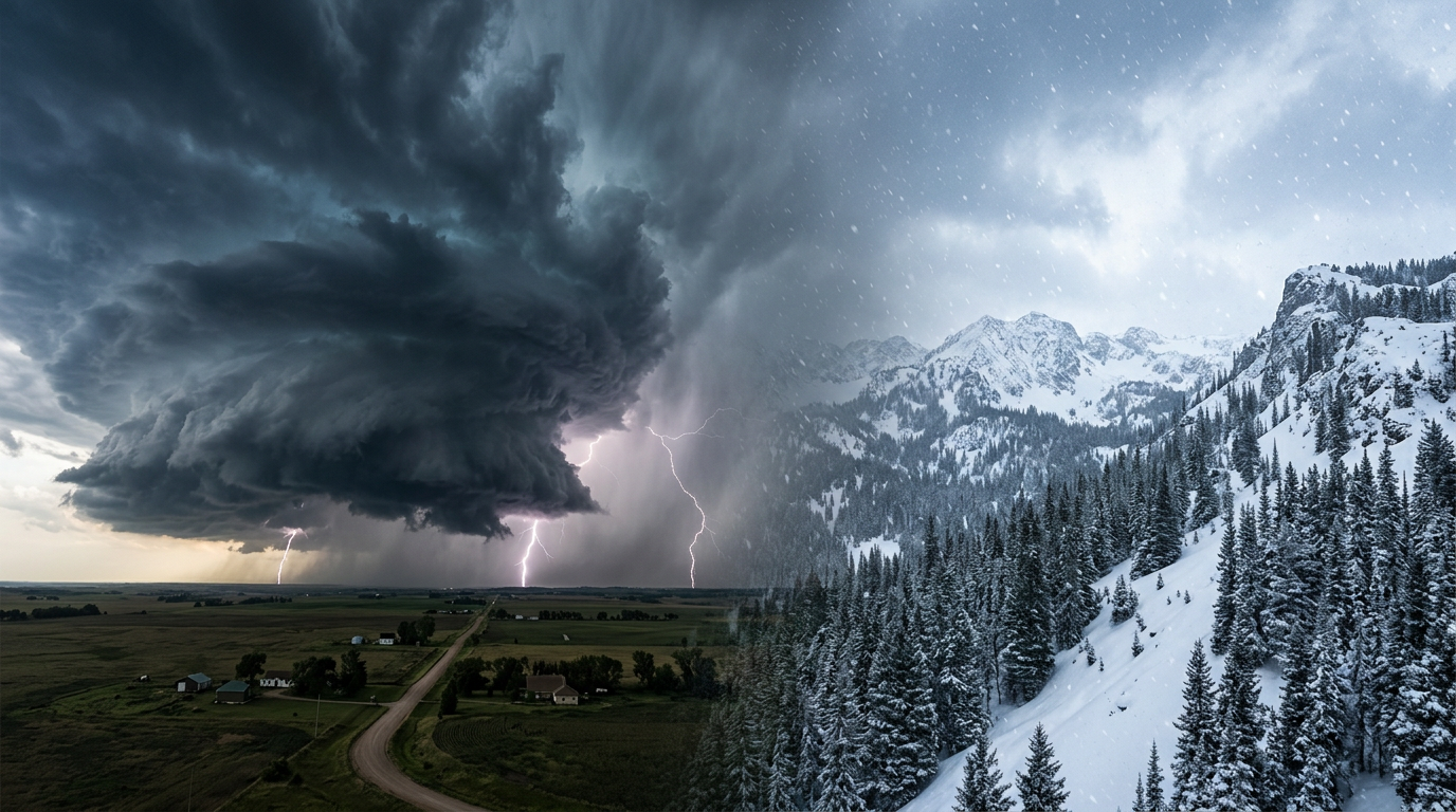
Alright folks, let us take a deep breath. March 06, 2026, is a day a lot of us are going to remember for a very long time. We knew a massive system was coming, but seeing it unfold in real time is always a different beast. From paralyzing ice in the Northeast to heartbreaking tornado damage in the Plains and Midwest, this storm threw absolutely everything it had at us.
Here is the thing. The most striking and devastating moments of the day came out of Southern Michigan and Northeast Oklahoma. We had Particularly Dangerous Situation (PDS) Tornado Warnings flying, and the radar confirmed our worst fears.
How The Day Unfolded
The morning started off treacherous in the colder sectors. We saw significant icing up in New England and New York. I am talking about major multi-vehicle pileups on I-95 and I-495, plus a mail truck crash in Buffalo. Over in Minnesota, the Duluth Lift Bridge had to be shut down after accumulating up to three inches of solid ice.
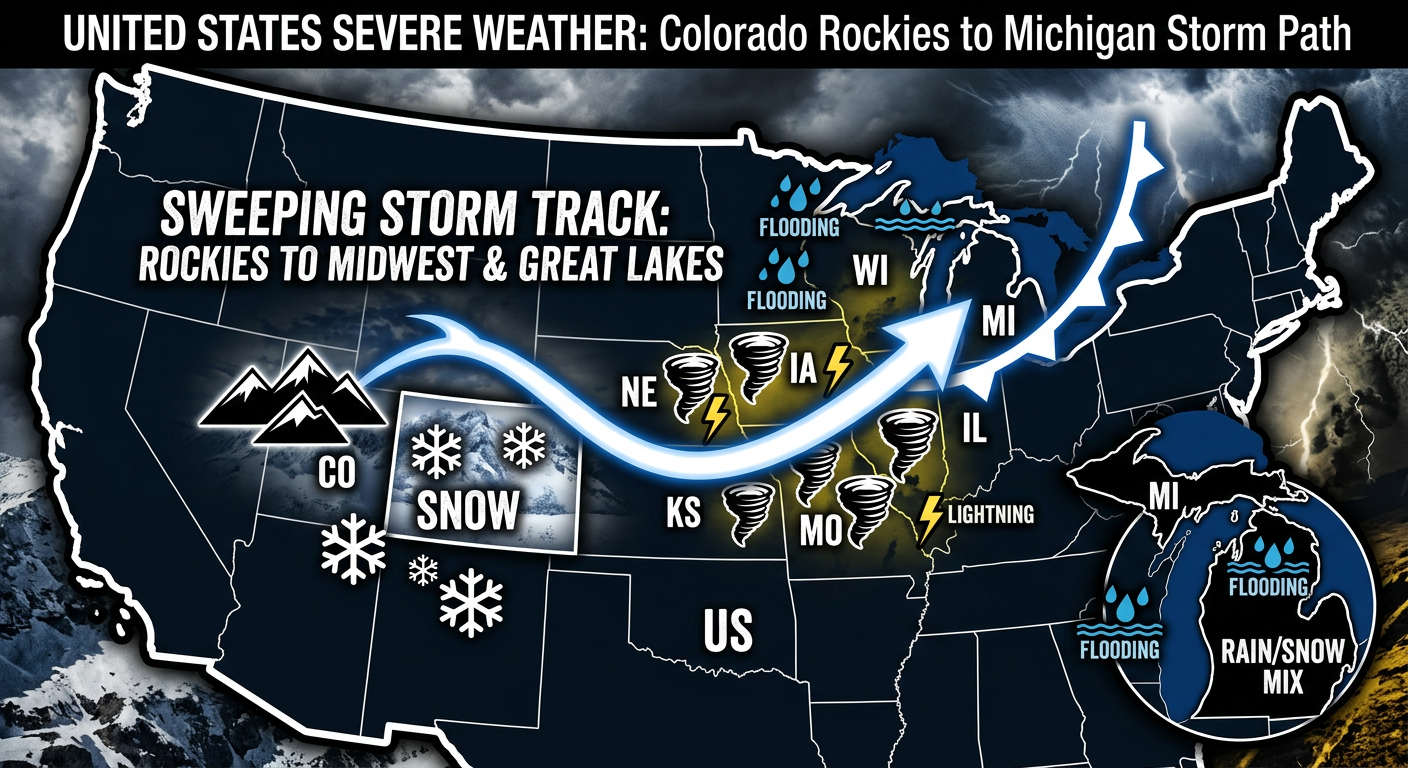
Meanwhile, out in the Colorado Front Range, a relentless winter storm was burying the mountains. The Niwot Snotel sensor near Ward, Colorado, measured 15.6 inches of snow. It got so bad that search and rescue teams in Boulder County had to transition to a 'vehicle relay' system just to navigate the saturated, snow-choked mountain roads.
Then, as we got into the afternoon and evening hours, the atmosphere in the warm sector absolutely exploded. A series of tornadic supercells fired up. In Bristow, Oklahoma, emergency responders confirmed demolished homes and flipped mobile trailers.
But the most intense atmospheric signature of the day happened in Three Rivers, Michigan. Radar detected a massive 51 dBZ debris ball. That is an incredibly high reflectivity value for debris, y'all. The tornado destroyed the roof of a local Menards and an ambulance bay. Tragically, we also have confirmed fatalities and structural devastation in the Three Rivers and Union City areas.
By late night, the storms grew into a massive squall line. We registered a 70 mph wind gust in Lamar Heights, Missouri. The heavy rain also triggered flash flooding. In Lansing, Michigan, a child had to be rescued from a submerged vehicle when water completely overtopped US-127.
The Ground Truth: Forecast vs. Reality
So, what actually happened compared to what we expected? The Storm Prediction Center had highlighted these risk areas, and the transition from a winter hazard to a severe weather outbreak went largely as modeled. However, the sheer intensity of the Michigan tornadoes was a harsh reality check.
Here are the key stats we have confirmed so far from yesterday:
- 10 total preliminary severe weather reports logged in our immediate system with many more likely as damage surveys are completed.
- 15.6 inches of confirmed snow at Niwot Snotel in Colorado.
- 3.0 inches of ice accretion on the Duluth Lift Bridge.
- 70 mph wind gust measured in Lamar Heights, Missouri.
- A rare 51 dBZ debris ball detected during the Three Rivers tornado.
Get this, while all of this severe weather was happening, we actually had a Magnitude 5.7 earthquake in Alaska and a 4.9 quake in Louisiana. Mother Nature was just incredibly restless yesterday.
What Meteorologists Can Learn
If there is one big takeaway for weather nerds and professionals alike, it is the textbook example of upscale growth. The way those discrete supercells in Oklahoma and Michigan eventually merged into a massive, forward-surging wind and flood machine overnight shows exactly how energy transfers in these high-shear environments. The National Weather Intensity Score peaked at a staggering 120.02 during this transition.
What Is Coming Next
We do not get much time to rest. The severe threat is shifting to the East Coast today. We are looking at a Marginal Risk for the Carolinas and Southeast Virginia, mainly for isolated strong gusts and hail.
Out West, a potent new system is entering the Pacific Northwest. The Weather Prediction Center is forecasting a high chance of heavy snow for the Washington Cascades. On top of that, we have critical fire weather conditions developing in Northeast New Mexico and the Texas Panhandle due to high winds and low humidity. Oh, and the Northern Plains? Y'all are about to see temperatures 25 to 30 degrees above average.
The Bottom Line
March 06, 2026, delivered a devastating combination of winter weather, violent tornadoes, and dangerous flooding. Our hearts go out to the folks in Michigan and Oklahoma who lost loved ones and homes. As we move into the rest of the weekend, please keep your weather radios on and stay weather aware, especially if you are in the path of the next system. Stay safe out there, y'all.