Blog Article
March 10, 2026 Weather Recap: Storms, Flooding & Ice
Read our complete March 10, 2026 weather recap. We break down the 70 mph winds and flooding in Illinois, the ice in Michigan, and what is coming next.
March 10, 2026 Weather Recap: The Day the Midwest Got Squeezed
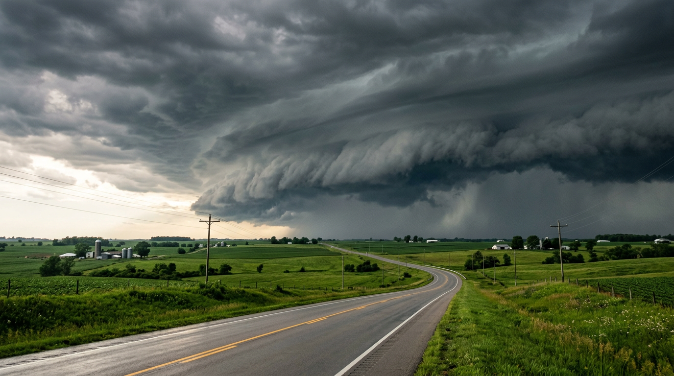
Alright folks, let's look back at the wild weather we saw yesterday. March 10, 2026, was one of those classic transition days where the atmosphere just could not make up its mind. We ended up with exactly 25 confirmed severe weather reports, and they ranged from cars trapped in flooded viaducts to a sneaky ice storm that coated trees up north.
Here is the thing about spring weather in the Midwest. It can throw everything at you all at once. Let's break down exactly what happened.
The Most Dramatic Moments
If you were in central or southern Illinois yesterday, you probably heard the wind howling or the rain pounding. The standout moment for me was seeing the reports out of Dundas, Illinois, where a personal weather station clocked a massive 70 mph wind gust. That is near hurricane force, y'all.
Down in Fairfield, Illinois, the winds were strong enough to snap a tree and blow it right into a trailer on Ash Street. That same squall line knocked out power for folks in the eastern part of town.
But the wind was not the only problem. Get this, the rain came down so fast and hard in the Decatur area that multiple viaducts flooded out completely. We had confirmed reports of at least five cars stalling out in the deep water between Decatur and Tolono.

How the Day Unfolded
The day started with a lot of heavy moisture streaming northward. By late morning, the rain and thunderstorms really started to fire up and mature across Illinois.
- 11:15 AM: The skies opened up over Macon County. Within minutes, the viaducts in Decatur were underwater. Two cars stalled out immediately, and another three got stuck just south of town shortly after.
- 11:24 AM: The squall line intensified as it moved east. This is when that 70 mph wind gust slammed into Dundas.
- 11:31 AM: The damaging winds reached Fairfield, taking down trees and powerlines.
- 12:28 PM: While Illinois was dealing with severe storms, folks up in Waters, Michigan, were measuring solid ice. Early reports suggested a minor glaze, but the final measurement came in at a slippery 0.34 inches of freezing rain.
Forecast vs. Reality: Ground Truth
So, how did the forecast hold up? For the most part, meteorologists had a good handle on the storm track. We knew a dynamic system was going to sweep through the region. However, the localized flash flooding in central Illinois escalated a bit faster than some models predicted. The ground was already saturated, and those viaducts filled up in the blink of an eye.
Up in Michigan, the ice overperformed just a bit. Initial morning observations hinted at about 0.13 inches of ice, but as the freezing rain kept falling, it bumped up to over a third of an inch. That is more than enough to cause serious travel headaches and weigh down power lines.

What We Can Learn
If there is one lesson to take away from March 10, it is to never underestimate low-lying roads during a heavy downpour. It is incredibly easy to misjudge the depth of water in a flooded viaduct. Those drivers in Decatur and Tolono found out the hard way. Turn around, do not drown is not just a catchy phrase. It is a strict rule to live by.
What is Coming Next
The storm system that caused yesterday's mess is not done yet. Today, March 11, it is pushing east, bringing a Slight Risk for severe thunderstorms to the Ohio Valley, the Tennessee Valley, and the Mid-Atlantic.
But the really wild stuff is happening out West. We are looking at a massive, record-breaking heat wave building in Southern California, with temperatures soaring into the 90s. That is about 25 degrees above normal for this time of year. Combine that building ridge with a dry cold front moving through the Plains, and we have Critical Fire Weather popping up in the Texas Panhandle, eastern New Mexico, and western Oklahoma. Humidity is dropping to 15 percent, and winds are gusting to 35 mph.
The Bottom Line
Yesterday was a perfect example of the clash of seasons. We had 70 mph thunderstorm gusts in Illinois and over a third of an inch of solid ice in Michigan. As we push deeper into March, you have to stay weather aware. The patterns are shifting fast, bringing severe storms to the East, dangerous heat to the Southwest, and critical fire risks to the Plains. Keep your weather radios handy and stay safe out there, y'all.