Blog Article
March 12, 2026 Weather Recap: Tornadoes and 109 MPH Winds
Read the complete March 12, 2026 weather recap. From tornadoes in Georgia to 109 mph winds in Wyoming and a blizzard in Minnesota, see what happened.
A Coast-to-Coast Weather Rollercoaster
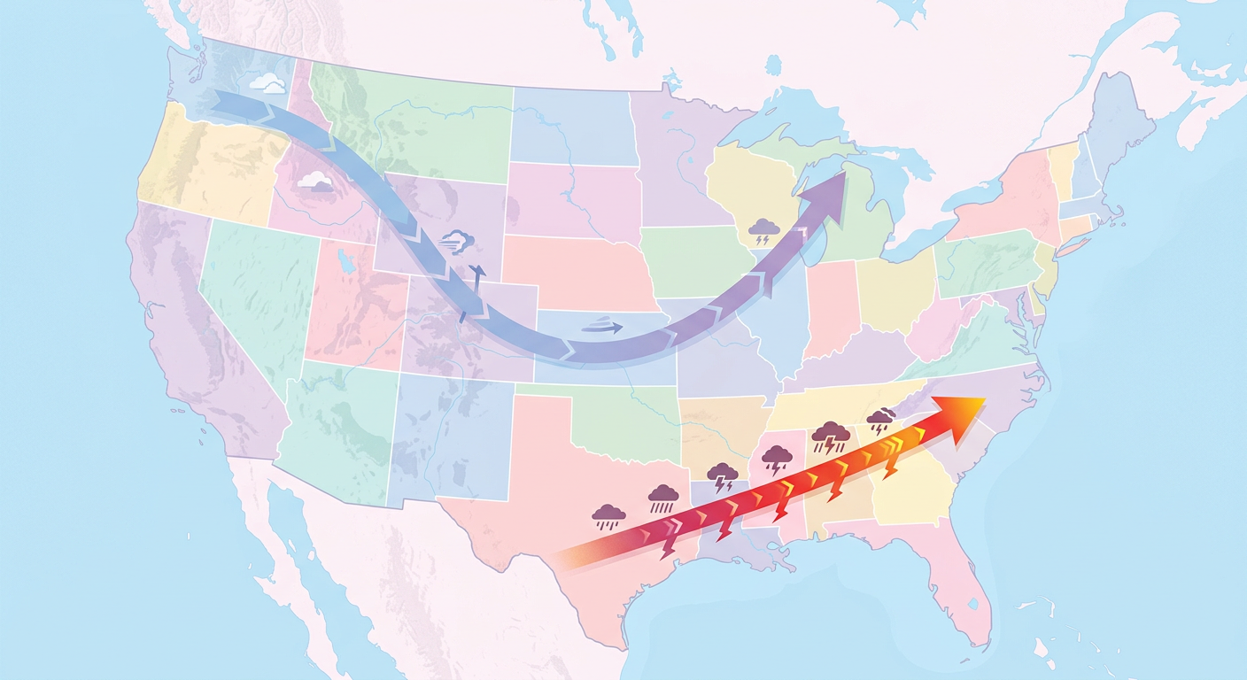
Alright folks, yesterday was an absolute powerhouse of a weather day. March 12, 2026, delivered a little bit of everything across the United States. We had 35 total severe weather reports, but please do not let that low number fool you. The impacts from this system were massive and widely felt.
We saw simultaneous Blizzard, Tornado, and Flash Flood warnings active across the country within the exact same 24-hour cycle. You do not see that every day.
How the Day Unfolded
The most dramatic moments of the day actually happened on two completely different fronts. Down south, the morning kicked off with dangerous discrete tornadic cells. We had a radar-confirmed tornado in St. Tammany Parish, Louisiana, right around 2:31 AM UTC. As the morning progressed, those isolated cells merged into a nasty, high-velocity squall line. That line absolutely raced across the Southeast through Georgia and the Carolinas at speeds up to 65 mph. By late morning, we had a confirmed ground-contact tornado in Houston County, Georgia, right at the intersection of Highway 96 and Highway 41.
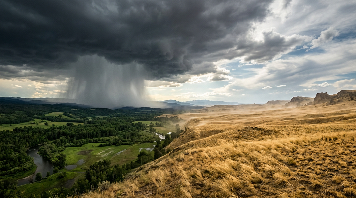
But get this. While the Deep South was dealing with severe storms, the Western United States was getting completely battered by a historic pressure gradient. We are talking about non-convective wind gusts that rivaled hurricane force. A 109 mph wind gust was recorded near Centennial, Wyoming. Hilger, Montana, clocked in at 104 mph.
These winds caused absolute havoc. Multiple semi-trucks were blown over on I-80 in Wyoming and I-29 in South Dakota. We saw structural damage in Cheyenne, including roof failures and a wind-induced fire at a local VFW. The power grid took a massive hit too. Fremont County, Wyoming, and Shoshone County, Idaho, reported 99 to 100 percent power outages for tracked customers.
Ground Truth vs. The Forecast
Here is the thing, meteorologists saw the big picture coming. The transition of those Gulf Coast storms from discrete cells to a linear squall line with 70 mph wind potential played out exactly as expected.
However, the sheer intensity of the non-convective winds in the Rockies was a bit of a surprise in its localized ferocity. Catching 109 mph gusts on multiple mesonet stations is rare, and the resulting near-total power blackouts in rural counties show just how vulnerable infrastructure can be to these extreme gradient wind events.
As the day wound down, the primary low-pressure system matured and transitioned into a full-blown blizzard over the Upper Midwest. Duluth, Minnesota, and the Red River Valley saw snowfall rates of 1 to 2 inches per hour with visibility dropping near zero.
Key Stats to Remember
- 35 total severe weather reports logged throughout the event.
- Confirmed Tornadoes: Radar-confirmed in St. Tammany Parish, LA, and a ground-contact tornado in Houston County, GA.
- 109 mph wind gust recorded near Centennial, WY.
- 18 inches of snow dropped in 24 hours at Ski Bluewood, WA.
- Significant Icing: Millinocket, ME, saw 0.36 inches of freezing rain and 3 inches of sleet.
- Tropical Trouble: Flash flooding and landslides hit Oahu, Hawaii, flooding local schools.
What We Can Learn
What meteorologists can take away from this event is the importance of messaging non-convective threats. A 109 mph wind gust will destroy a building just as easily as a low-end tornado, but it does not come with a big red polygon on the TV screen. We have to continue finding better ways to communicate the danger of gradient winds to the general public.

What is Coming Next
Y'all need to stay weather aware because we are not done yet. That winter storm is continuing to wrap up across the Northern Plains and Great Lakes today. Meanwhile, a massive heatwave is building in the West, bringing temperatures 15 to 22 degrees above normal and creating Critical Fire Weather conditions in New Mexico and West Texas.
Looking ahead to Sunday and Monday, another very strong system is coming together. We are tracking a slight to enhanced risk of severe weather from Arkansas up into Indiana on Sunday, which will shift toward the Carolinas and the Mid-Atlantic by Monday.
The Bottom Line
March 12 was a perfectly orchestrated collision of atmospheric extremes. Whether it was tornadoes in Georgia, hurricane-force winds in Wyoming, or a blizzard in Minnesota, this system tested our infrastructure from coast to coast. Take the weekend to clean up, check on your neighbors, and prepare your severe weather plans for the next round of storms coming Sunday.