Blog Article
March 16, 2026 Weather Recap: Blizzard & Severe Storms
Read our complete March 16, 2026 weather recap. We break down the historic 35-inch Great Lakes blizzard, the Alabama tornado, and extreme wind events.
The March 16, 2026 Weather Recap
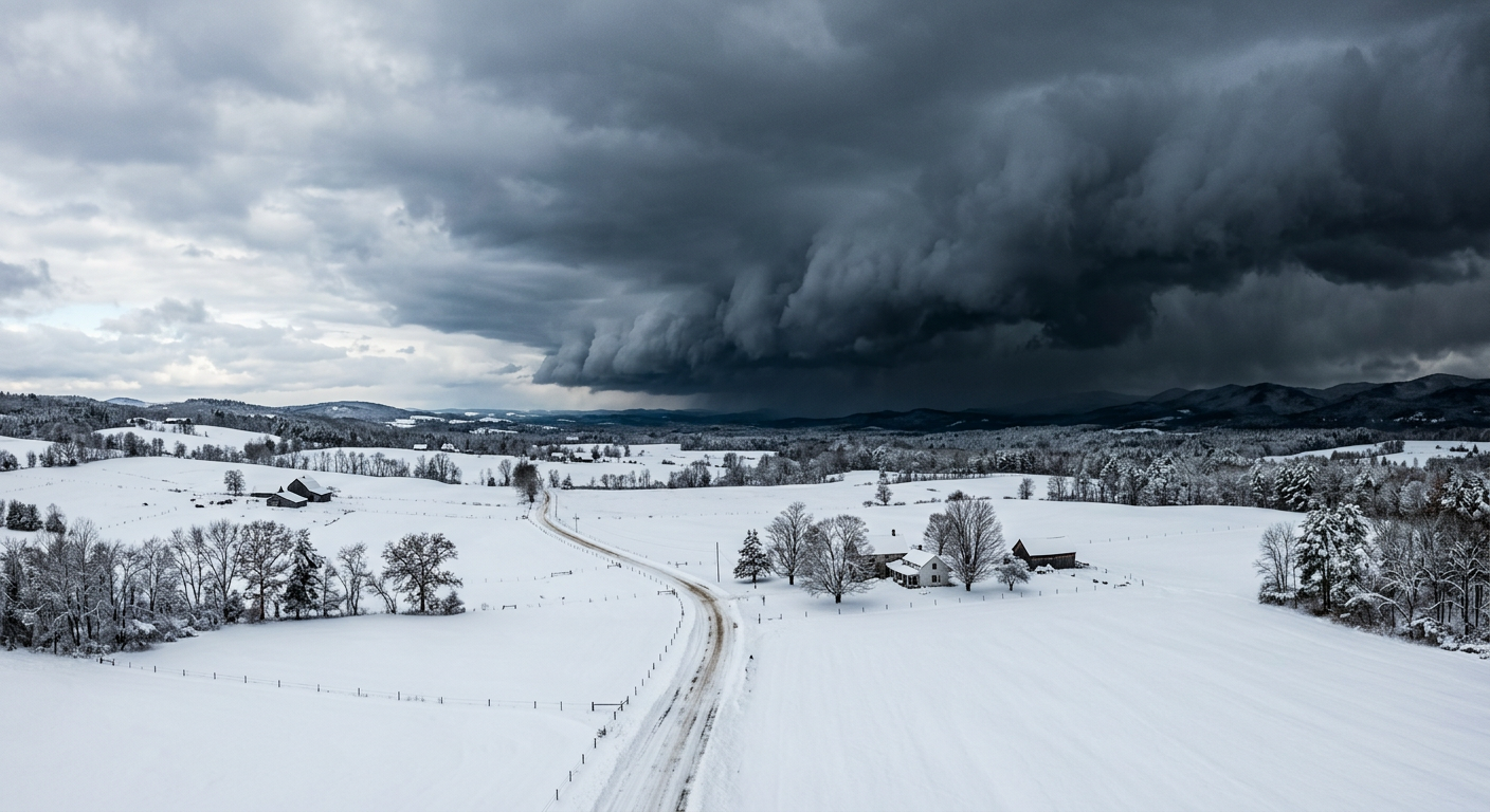
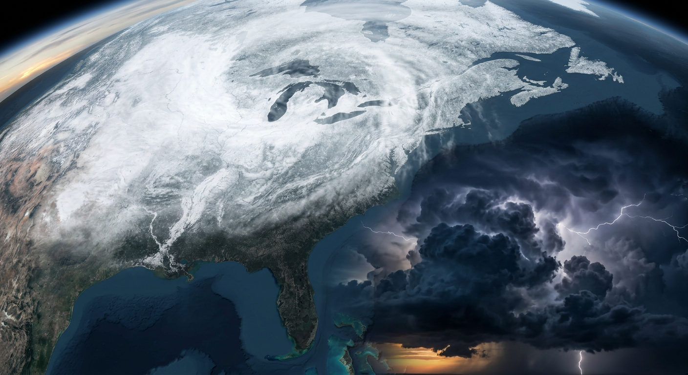
Alright folks, we need to talk about what just happened. Yesterday, March 16, 2026, brought us one of those massive, sprawling storm systems that meteorologists will be studying for a long time. We had a historic blizzard burying the Great Lakes and a violent squall line tearing through the South.
We knew this system was going to be an absolute monster, but seeing the ground truth is always a sobering experience. Let's walk through exactly how this day unfolded.
How The Day Escalated
The entire day saw a steady escalation in hazard intensity. Things really started peaking between 14:00Z and 19:00Z. Up north, the blizzard reached its maximum accumulation rates. Down south, a severe squall line reached the densely populated I-95 corridor. As we moved into the late afternoon and evening, the tornadic threats transitioned into significant straight-line winds and flash flooding.
Ground Truth: Impacts and Records
Here is the thing about a storm of this size. The impacts are incredibly widespread and unfortunately very severe. Early reports show just how hard some of these areas were hit.
- Historic Snowfall: Spalding, Michigan recorded a jaw-dropping 35.0 inches of snow, setting a record storm total. Nearby Negaunee, Michigan measured 33.7 inches. Sturgeon Bay, Wisconsin wasn't far behind with 33.2 inches.
- Southern Tornadoes: We had a confirmed tornado on the ground causing structural damage along Highway 64 in Lexington, Alabama.
- Extreme Winds: The squall line overperformed in a big way. We saw 117 mph radar-indicated wind velocities impacting the Louisville and Fort Knox, Kentucky area. A trained spotter in Tompkinsville, Maryland also estimated an 81 mph wind gust.
- Power Grid Failures: The heavy snow and wind took a massive toll. In Roscommon County, Michigan, over 88% of customers lost power due to storm damage.
Tragically, the extreme conditions turned deadly. In Denmark, Wisconsin, blizzard-induced zero visibility led to a fatal milk truck rollover. In Howard, Wisconsin, the active blizzard conditions contributed to a structural fire and roof collapse at an assisted living facility. Our thoughts are with everyone affected by these terrible events.
And get this. While all of this was happening down here on Earth, we actually observed an M3-class solar flare and Coronal Mass Ejection at the exact same time. The atmosphere and space were both putting on a wild show yesterday.
What We Can Learn
When we look at a March 16, 2026 severe weather recap, the big takeaway for meteorologists is how accurately the models handled the timing of that 14:00Z to 19:00Z peak. The blizzard verified exactly as the highest-end forecasts suggested. However, the sheer intensity of the straight-line winds in the Ohio Valley, specifically those 117 mph radar velocities near Louisville, shows how a highly dynamic springtime environment can push squall lines to absolute extremes.
What Is Coming Next
Now that this massive storm is exiting New England, the weather pattern is shifting dramatically.
If you live in the deep South, you are waking up to record cold this morning, which will shift into the Southeast by Wednesday. Out West, it is a completely different story. An anomalously early heatwave is building and expanding across the western United States, bringing summer-like heat to the Desert Southwest.
We are also tracking a critical fire weather risk today for Northwest Texas into Southwest Oklahoma due to very dry conditions and gusty winds. Meanwhile, an atmospheric river is slamming into Washington state, bringing 2 to 3 inches of rain and a marginal risk of excessive rainfall and river flooding over the next few days.
The Bottom Line
Y'all, yesterday was a stark reminder of how volatile the transition from winter to spring can be. We saw two completely different seasons playing out at their most extreme levels on the exact same day. If you are in the wake of the blizzard, please be careful with the cleanup. If you are in the South, stay alert as we transition from severe weather cleanup to freezing temperatures.
Stay safe out there, keep your weather radios handy, and we will keep tracking what comes next.