Blog Article
May 07, 2026 Weather Recap: MS Tornado & Late-Season Freeze
A complete recap of the May 07, 2026 weather events, including an EF1 tornado in Mississippi, widespread wind damage, and a massive late-season freeze.

May 07, 2026 Recap: Deep South Tornadoes and a Massive Late-Season Freeze
Y'all, yesterday was a prime example of how wild the spring transition can be. We had a little bit of everything on May 07, 2026. While the northern half of the country was shivering, the Deep South was dealing with some serious severe weather.
Here is a look at how the day unfolded and what the data shows us this morning.
The Deep South Severe Threat
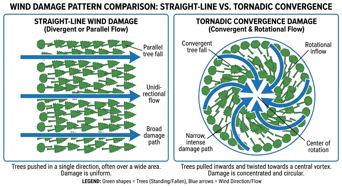
The day started with high-intensity convective activity across the Deep South. The atmosphere was primed, and we saw a confirmed tornado report near Prentiss, Mississippi, with observed debris and power flashes.
The NWS Storm Survey team got out there and confirmed an EF1 tornado about seven miles north-northwest of Kokomo. It packed maximum winds of 88 mph and was on the ground for just over three miles in Marion County.
As the day progressed, that severe threat transitioned into an organized squall line that pushed through Mississippi, Alabama, Florida, and Georgia. The wind damage reports piled up fast. We had an emergency manager report a house destroyed by fallen trees in Columbia, Mississippi. Down in Vernon, Florida, law enforcement reported numerous downed trees and roof damage to a building.
Forecast vs. Reality
In our previous forecast, we talked about the Weather Prediction Center highlighting southern Mississippi and southeastern Louisiana for an excessive rainfall threat. That verified exactly as expected. We saw three to six inches of rain fall over Mississippi, which led to significant flash flooding right over US Highway 49.
We also spent a lot of time yesterday talking about the severe threat setting up for the Southern Plains. That was a forecast for today, and it is still very much on track.
The Cold Side of the Storm
Get this. While Florida was sweating out record heat at 97 degrees, 76 million people up north were under frost and freeze alerts. That is a massive footprint for a late-season freeze in May.
Out in the Colorado Rockies, the cold air produced some serious winter weather. Observers measured a solid 16.0 inches of late-season snow near Gould, Colorado. It is a great reminder that elevation and late-season moisture can still produce heavy snow right up to the edge of summer.

What is Coming Next
The weather pattern is not slowing down. Today, the Storm Prediction Center has a Level 2 Slight Risk right back over the Southern Plains. We are looking at a threat for large hail and damaging winds from southeast Kansas down through central Oklahoma and north Texas. If you live in Oklahoma City, Tulsa, or Wichita Falls, you need to have a way to get warnings today.
The Weather Prediction Center also has another Slight Risk for excessive rainfall over the Lower Mississippi Valley today, so the flooding threat is not over for the Gulf Coast.
Bottom Line
- The Deep South took a hit: An EF1 tornado in Mississippi and widespread straight-line wind damage across the Southeast proved how fast these spring squall lines can organize.
- The forecast verified: The excessive rainfall risk for Mississippi turned into actual flash flooding on major highways.
- Spring is a season of extremes: We recorded 97-degree heat in Florida on the same day 76 million people prepped for a freeze and Colorado picked up 16 inches of snow.
Spring weather does not care what the calendar says. You have to stay ready for anything from tornadoes to blizzards right now. We will keep watching the data and keep you updated on the Southern Plains threat today.