Blog Article
May 30, 2026 Severe Weather Recap: Tornadoes & Flooding
A complete recap of the May 30, 2026 severe weather event, including Nebraska tornadoes, 84 mph winds, and major flash flooding in Jackson, Tennessee.

Y'all, yesterday was a busy one. We saw a steady escalation in the weather as the day went on. Things started with serious morning flash floods in the Southeast and transitioned into a major wind, hail, and tornado event in the Central Plains by the afternoon and evening.
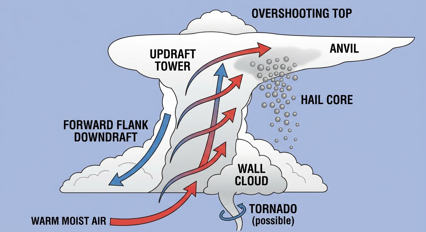
The Plains Tornadoes and Giant Hail
Let's talk about Nebraska and Colorado first. We had nine tornado reports yesterday. Emergency managers reported an ongoing tornado with debris crossing Interstate 80 about 10 miles south-southeast of Bushnell, Nebraska. Storm chasers also caught a funnel with a dust swirl on the ground near Clarkville, Colorado, and another tornado northwest of Wauneta.
The hail was no joke, either. We saw measured three-and-a-half-inch hail just north of Wellfleet, Nebraska. That is about the size of a tea saucer, which is significantly above the typical severe thresholds for that region. Out near Lodgepole, a Mesonet station clocked an 84 mph thunderstorm wind gust.
Southeast Flooding
The water issues in the Southeast were just as serious. In downtown Jackson, Tennessee, we saw three and a half feet of water inundation. That is unusually high for an urban flash flood event there, and it required water rescues. Over at the Horse Creek Recreation Area, emergency evacuations had to be conducted due to the rising water.
Over in North Carolina, emergency management reported home inundations in Stallings and Hemby Bridge after two to four inches of rain fell in a short amount of time.
Forecast vs. Reality
In our previous update, we talked about the early reports of the 84 mph wind gust in Lodgepole and the tornado crossing I-80. We also highlighted the severe water issues in Jackson. As the final data came in, those early reports held up perfectly. The atmosphere did exactly what the data suggested it would do, transitioning from a heavy rain threat in the east to a dynamic severe threat in the Plains.
What Comes Next
Looking ahead to today and Monday, the active pattern continues.
- Today: The Storm Prediction Center has a Marginal Risk for severe storms from the Dakotas down into the Ozarks. The main threats are isolated damaging winds and hail.
- Monday: This is the day we are really watching. There is a Slight Risk, a level 2 out of 5, for the Central Plains. We are looking at a 15 percent chance for scattered damaging winds and severe hail.
- Rainfall: The Weather Prediction Center has a Slight Risk for excessive rainfall today in the Northern Rockies and parts of the Southeast.
Bottom Line
If you live in the Central Plains, use today's quieter weather to prepare for Monday's severe threat. Secure your loose outdoor items and make sure you have multiple ways to get warnings. For folks in the Southeast, the ground is already saturated from yesterday's storms. It will not take much more rain to cause flash flooding, so please do not drive through water covering the roadways.