Blog Article
June 04, 2026 Severe Weather Recap: KS Tornado & Floods
A complete weather recap of June 04, 2026. Review the confirmed Kansas tornado, 71 mph winds in South Dakota, and life-threatening flash floods in Texas.
A Wild Thursday Across the Plains
Y'all, yesterday was one of those days where the atmosphere threw the whole kitchen sink at us. We had severe thunderstorms, life-threatening flash floods, a G4 geomagnetic storm, and even a 5.7 magnitude earthquake off the Oregon coast. It was a busy 24 hours.
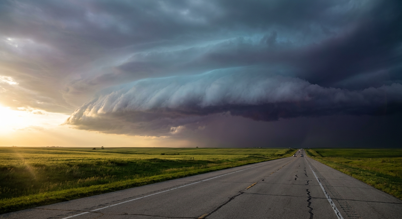
The day escalated exactly how we thought it would. As the afternoon heated up, those scattered storms organized into a messy line across the central United States.
Ground Truth: Tornadoes and Wind
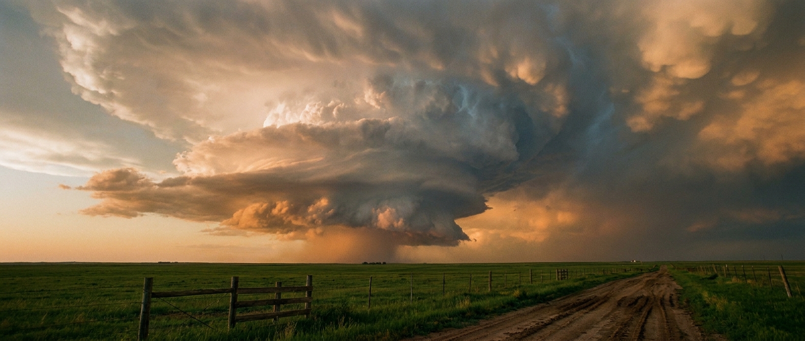
We had a confirmed tornado reported near Cawker City and Glen Elder, Kansas. A storm chaser caught it on video spinning over Waconda Lake for about 8 minutes. The good news is we have no reports of damage from that one. We also had a brief landspout pop up near Gillette, Wyoming, which a local emergency manager caught on camera.
The wind was the real problem yesterday. We warned you about the massive wind threat setting up, and the data backed it up. A mesonet site near Wolsey, South Dakota, clocked a 71 mph gust. Down in Kansas, severe thunderstorm winds snapped power poles near the Wichita Eisenhower airport. That mess closed down Interstate 235 in both directions and knocked out power to more than 7,000 customers. Emergency managers also reported large tree limbs down in Mulvane and Clay Center.
The Water Threat Materializes
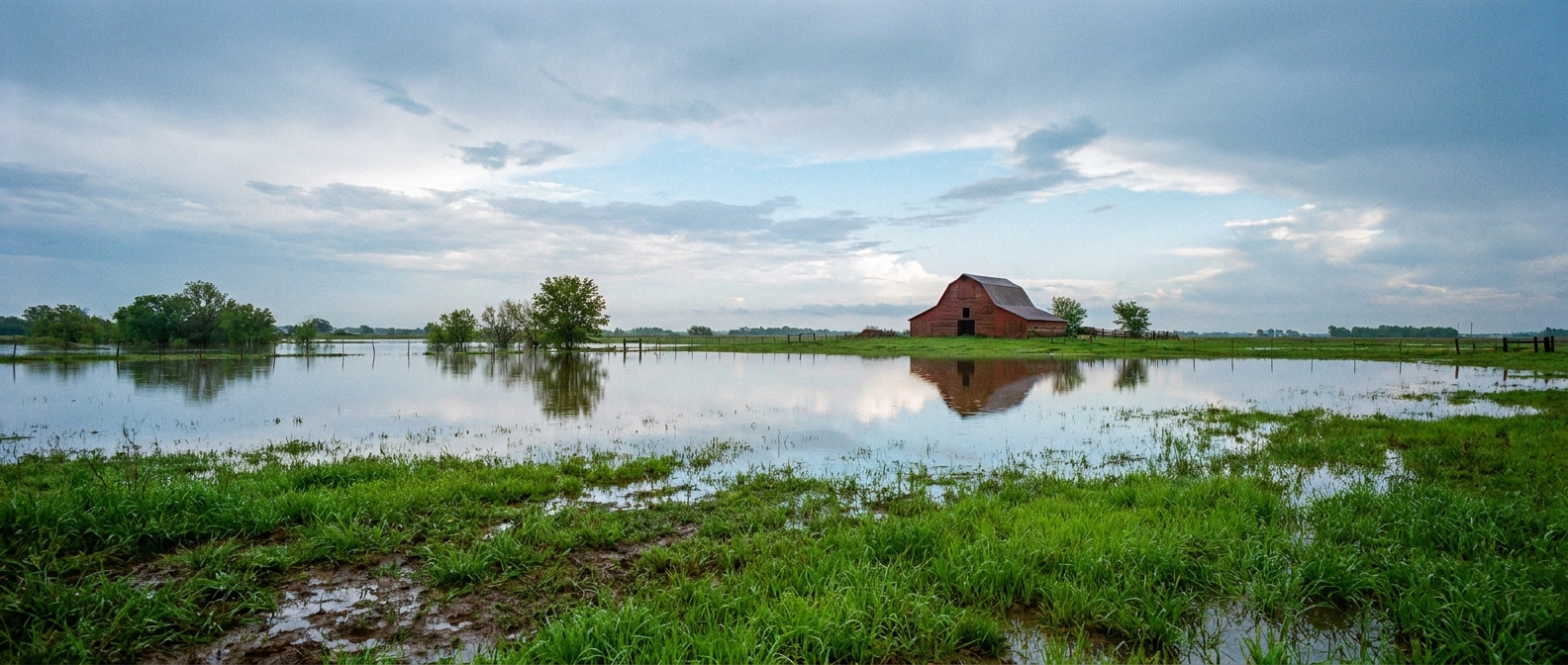
We also talked yesterday about the flash flood threat, and the rain was relentless. A trained spotter near Delphos, Kansas, measured a flat 5.0 inches of rain in 24 hours. All that water has to go somewhere. The Solomon River at Minneapolis, Kansas, is now forecast to approach a historical record level of 32.1 feet.
Down in Texas, Gaines County dealt with life-threatening flash flooding that covered State Highway 83. When the ground is this saturated, it does not take much to turn a road into a river.
Forecast vs. Reality
Looking back at our forecast, the models had a great handle on this setup. We predicted flash flooding, strong winds, and the solar storm. We specifically called out the potential for 5 inches of rain in Kansas, and that is exactly what fell. The atmosphere did exactly what it said it was going to do. Warning lead times were solid, and folks took the severe thunderstorm warnings seriously.
What Comes Next
The severe threat is not over. Today, June 5, the Storm Prediction Center has a Slight Risk up for the Central Plains and Mid-Mississippi Valley. If storms form in that hatched area, we could see wind gusts over 75 mph and hail the size of hen eggs. Tomorrow, that threat shifts east toward the Ohio Valley and Northeast.
Oh, and the Eastern Pacific tropics are awake. Tropical Storm Amanda is spinning out there with 46 mph winds, and we are watching two other disturbances behind it.
Bottom Line
The ground in the central US is soaked. Any new storms today will drop water on places that simply cannot hold it. The transition from spring to summer is in full swing, and these mesoscale convective systems are going to keep rolling. Have multiple ways to get warnings, especially if you live near a swollen river or creek.